The right side delivers a nearly continuous mountain show: San Gabriel peaks on departure, the Sierra Nevada and Cascade volcanoes (Shasta, Lassen, Hood, St. Helens, Adams) along the cruise track up the I-5 corridor, and a dramatic close-up of Mount Rainier on final approach into SEA. The left side stays mostly over flat valley farmland and low coast-range hills with far fewer standout features.
Flown ONT to SEA? Did we get it right?
Flight Path
Ontario to Seattle is 957 miles (1,540 km), a flight of about 2 hours 25 minutes.
Sacramento Valley farmland, Mount Shasta and Lassen Peak on the eastern horizon, Cascade Range volcanic chain including Mount Hood, Mount St. Helens, and Mount Adams as the flight tracks north toward Washington
Great circle distance and headings ›


Phase by phase
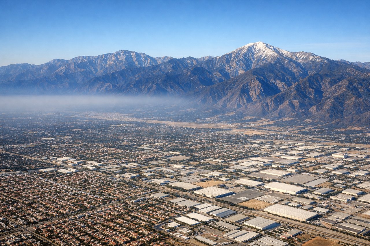
Takeoff from ONT
RIGHTAs the aircraft climbs out of ONT and banks north toward the Central Valley corridor, the San Gabriel Mountains and Cajon Pass dominate the right side, with the high desert opening up beyond. The left side mostly shows the flat, hazy Inland Empire and San Gabriel Valley sprawl with no major landmarks.
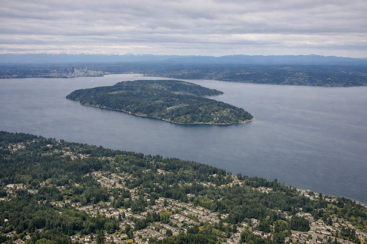
Landing at SEA
RIGHTOn the descent into SEA from the south, the approach path runs close enough to give right-side passengers a strong view of Mount Rainier's massive glaciated summit rising over the southern Puget Sound lowlands. The left side instead faces mostly flat suburban terrain and distant, less distinct Olympic foothills.
Will your flight be in sunlight?
Pick a date and time in the Sun Map to watch the sun move across your whole flight.
About This Route
Which side of the plane should I sit on flying from Ontario International (ONT) to Seattle Tacoma International (SEA)?
Sit on the Right side of the plane for the best views on flights from Ontario to Seattle. The right side delivers a nearly continuous mountain show: San Gabriel peaks on departure, the Sierra Nevada and Cascade volcanoes (Shasta, Lassen, Hood, St. Helens, Adams) along the cruise track up the I-5 corridor, and a dramatic close-up of Mount Rainier on final approach into SEA. The left side stays mostly over flat valley farmland and low coast-range hills with far fewer standout features.
What can I see during takeoff from Ontario International in Ontario?
During takeoff from Ontario International (ONT), sit on the Right side for the best views. As the aircraft climbs out of ONT and banks north toward the Central Valley corridor, the San Gabriel Mountains and Cajon Pass dominate the right side, with the high desert opening up beyond. The left side mostly shows the flat, hazy Inland Empire and San Gabriel Valley sprawl with no major landmarks. Notable sights include: San Gabriel Mountains, Cajon Pass, Mojave Desert edge, Tehachapi Mountains.
What can I see when landing at Seattle Tacoma International in Seattle?
When landing at Seattle Tacoma International (SEA), sit on the Right side for the best views. On the descent into SEA from the south, the approach path runs close enough to give right-side passengers a strong view of Mount Rainier's massive glaciated summit rising over the southern Puget Sound lowlands. The left side instead faces mostly flat suburban terrain and distant, less distinct Olympic foothills. Notable sights include: Mount Rainier, southern Puget Sound, Tacoma foothills, Cascade foothills.
How long is the flight from Ontario to Seattle?
The flight from Ontario International (ONT) to Seattle Tacoma International (SEA) takes about 2 hours 25 minutes. The shortest flight path between them is 957 miles (1,540 km); winds and air traffic control usually add a few percent.
What does the Ontario to Seattle flight path pass over?
Sacramento Valley farmland, Mount Shasta and Lassen Peak on the eastern horizon, Cascade Range volcanic chain including Mount Hood, Mount St. Helens, and Mount Adams as the flight tracks north toward Washington