The left side delivers the dramatic Chicago departure view — one of the most iconic urban aerial panoramas in the US — and along the flight path south through Texas, the left side also picks up views of San Antonio's urban sprawl and the Hill Country terrain. The right side at landing is good but the Corpus Christi approach view is relatively brief and low-key compared to the Chicago departure.
Flown ORD to CRP? Did we get it right?
Flight Path
Chicago to Corpus Christi is 1,121 miles (1,803 km), a flight of about 2 hours 55 minutes.
The route tracks south-southwest over Illinois farmland, crosses the Missouri Ozarks plateau edge, then enters the flat Texas coastal plain. Over central Texas you pass west of Austin and San Antonio — the Edwards Plateau escarpment (Balcones Escarpment) is visible as a subtle terrain break. The final 150 miles are dead-flat Gulf Coastal Plain with scattered ranch land, the Nueces River drainage, and increasing coastal wetlands approaching Corpus Christi.
Great circle distance and headings ›

Phase by phase
Takeoff from ORD
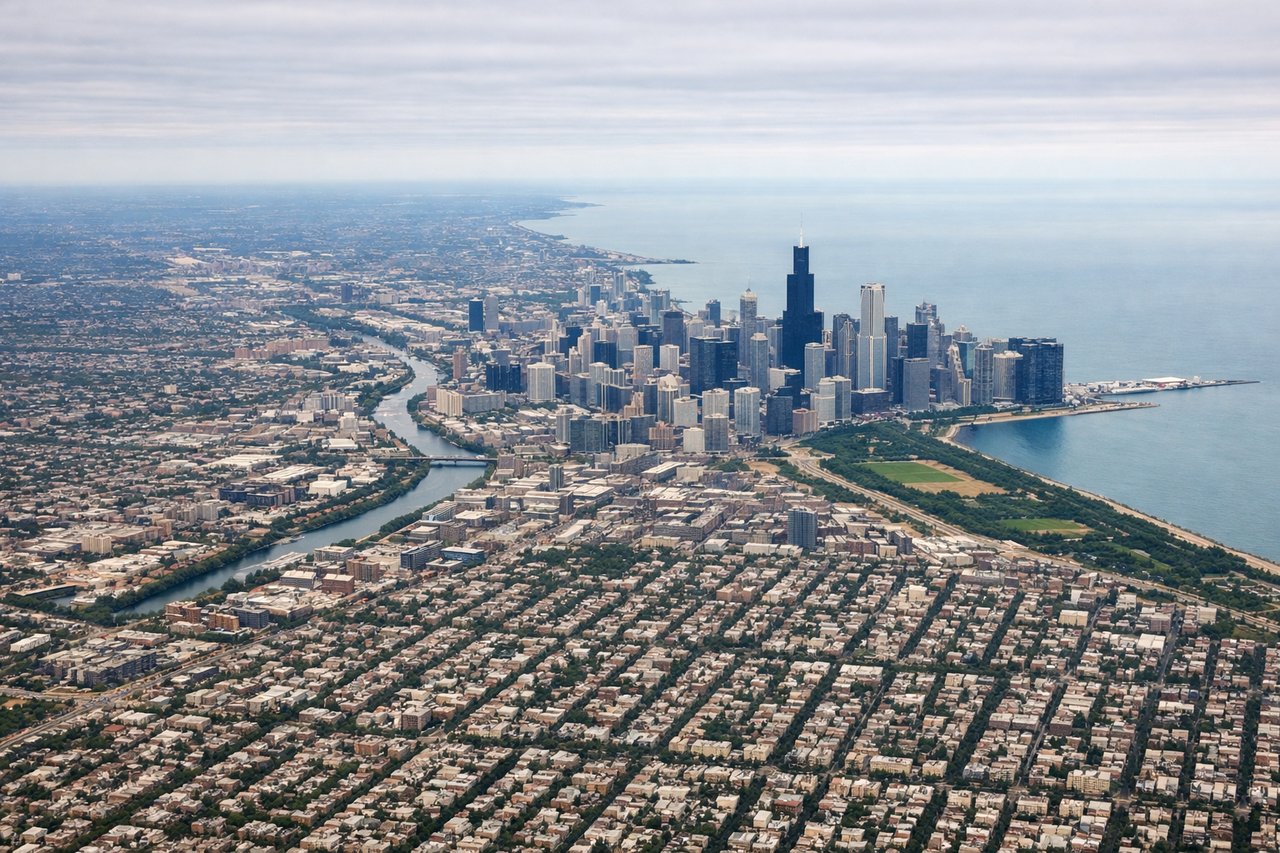
LEFTORD's most common southbound departures (runways 10L/10C heading east then turning south) put the left side facing the Chicago skyline and Lake Michigan shoreline. You get a clear view of the downtown Loop, Grant Park, and the lakefront as the aircraft banks south.
Landing at CRP
RIGHTCRP typically uses runway 13 or 18 for southerly approaches, meaning the aircraft arrives from the north or northeast. The right side faces west and southwest, giving views of Corpus Christi Bay, the city waterfront, and the distinctive Harbor Bridge as you descend over the coastal plain.
Will your flight be in sunlight?
Pick a date and time in the Sun Map to watch the sun move across your whole flight.
About This Route
Which side of the plane should I sit on flying from Chicago Ohare International (ORD) to Corpus Christi International (CRP)?
Sit on the Left side of the plane for the best views on flights from Chicago to Corpus Christi. The left side delivers the dramatic Chicago departure view — one of the most iconic urban aerial panoramas in the US — and along the flight path south through Texas, the left side also picks up views of San Antonio's urban sprawl and the Hill Country terrain. The right side at landing is good but the Corpus Christi approach view is relatively brief and low-key compared to the Chicago departure.
What can I see during takeoff from Chicago Ohare International in Chicago?
During takeoff from Chicago Ohare International (ORD), sit on the Left side for the best views. ORD's most common southbound departures (runways 10L/10C heading east then turning south) put the left side facing the Chicago skyline and Lake Michigan shoreline. You get a clear view of the downtown Loop, Grant Park, and the lakefront as the aircraft banks south. Notable sights include: Chicago Loop skyline, Lake Michigan shoreline, Grant Park and Museum Campus, Midway Airport to the south.
What can I see when landing at Corpus Christi International in Corpus Christi?
When landing at Corpus Christi International (CRP), sit on the Right side for the best views. CRP typically uses runway 13 or 18 for southerly approaches, meaning the aircraft arrives from the north or northeast. The right side faces west and southwest, giving views of Corpus Christi Bay, the city waterfront, and the distinctive Harbor Bridge as you descend over the coastal plain. Notable sights include: Corpus Christi Bay, Harbor Bridge, Nueces Bay, Padre Island National Seashore visible to the southeast.
How long is the flight from Chicago to Corpus Christi?
The flight from Chicago Ohare International (ORD) to Corpus Christi International (CRP) takes about 2 hours 55 minutes. The shortest flight path between them is 1,121 miles (1,803 km); winds and air traffic control usually add a few percent.
What does the Chicago to Corpus Christi flight path pass over?
The route tracks south-southwest over Illinois farmland, crosses the Missouri Ozarks plateau edge, then enters the flat Texas coastal plain. Over central Texas you pass west of Austin and San Antonio — the Edwards Plateau escarpment (Balcones Escarpment) is visible as a subtle terrain break. The final 150 miles are dead-flat Gulf Coastal Plain with scattered ranch land, the Nueces River drainage, and increasing coastal wetlands approaching Corpus Christi.