Chicago to Guadalajara is 1,733 miles (2,789 km), a flight of about 3 hours 45 minutes.
The right side scores higher due to superior scenic variety across the full flight: Chicago's lakefront and urban departure, followed by the dramatic Sierra Madre Occidental mountains and Guadalajara's urban landscape on approach. The left side offers only flat terrain and agricultural plains for most of the flight with minimal distinctive features.
Flight Path
The flight path crosses the Great Plains of Texas and northern Mexico, passing over the flat agricultural landscape of central Texas, the Rio Grande valley near the Texas-Mexico border, and the high plateau (Altiplano) of northern Mexico before descending toward Guadalajara. Notable geographic features include the Rio Grande river valley, the transition from Texas plains to Mexican plateau, and the approach to the Sierra Madre Occidental mountain system west of Guadalajara.
Great circle distance and headings ›

Phase by phase
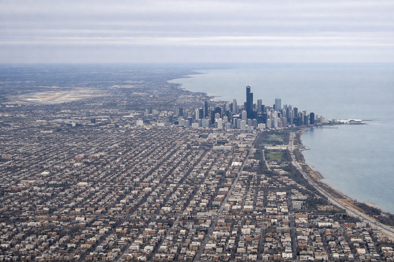
Takeoff from ORD
RIGHTRight-side departures from ORD typically climb westbound over the Chicago metropolitan area and Lake Michigan shoreline, offering views of the city grid, harbor infrastructure, and the transition from urban to agricultural landscape. Left-side departures see primarily inland flat terrain and suburban sprawl with minimal distinctive features.
Landing at GDL
RIGHTRight-side approaches to GDL descending from the northeast typically offer views of the Sierra Madre Occidental foothills, the Guadalajara metropolitan area sprawl, and the approach over the Bajío plateau terrain. Left-side approaches see primarily flat agricultural plateau with fewer distinctive visual features until final descent.
Landmarks on this routeAll landmarks →
Will your flight be in sunlight?
Pick a date and time in the Sun Map to watch the sun move across your whole flight.
About This Route
Which side of the plane should I sit on flying from Chicago Ohare International (ORD) to Don Miguel Y Hidalgo International (GDL)?
Sit on the Right side of the plane for the best views on flights from Chicago to Guadalajara. The right side scores higher due to superior scenic variety across the full flight: Chicago's lakefront and urban departure, followed by the dramatic Sierra Madre Occidental mountains and Guadalajara's urban landscape on approach. The left side offers only flat terrain and agricultural plains for most of the flight with minimal distinctive features.
What can I see during takeoff from Chicago Ohare International in Chicago?
During takeoff from Chicago Ohare International (ORD), sit on the Right side for the best views. Right-side departures from ORD typically climb westbound over the Chicago metropolitan area and Lake Michigan shoreline, offering views of the city grid, harbor infrastructure, and the transition from urban to agricultural landscape. Left-side departures see primarily inland flat terrain and suburban sprawl with minimal distinctive features. Notable sights include: Lake Michigan shoreline, Chicago downtown skyline and harbor, suburban grid pattern extending westward, early views of Illinois farmland.
What can I see when landing at Don Miguel Y Hidalgo International in Guadalajara?
When landing at Don Miguel Y Hidalgo International (GDL), sit on the Right side for the best views. Right-side approaches to GDL descending from the northeast typically offer views of the Sierra Madre Occidental foothills, the Guadalajara metropolitan area sprawl, and the approach over the Bajío plateau terrain. Left-side approaches see primarily flat agricultural plateau with fewer distinctive visual features until final descent. Notable sights include: Sierra Madre Occidental mountain ridges to the east, Guadalajara city sprawl and urban development, Bajío plateau agricultural fields, approach over Jalisco highlands.
How long is the flight from Chicago to Guadalajara?
The flight from Chicago Ohare International (ORD) to Don Miguel Y Hidalgo International (GDL) takes about 3 hours 45 minutes. The shortest flight path between them is 1,733 miles (2,789 km); winds and air traffic control usually add a few percent.
What does the Chicago to Guadalajara flight path pass over?
The flight path crosses the Great Plains of Texas and northern Mexico, passing over the flat agricultural landscape of central Texas, the Rio Grande valley near the Texas-Mexico border, and the high plateau (Altiplano) of northern Mexico before descending toward Guadalajara. Notable geographic features include the Rio Grande river valley, the transition from Texas plains to Mexican plateau, and the approach to the Sierra Madre Occidental mountain system west of Guadalajara.