Chicago to Malargue is 5,477 miles (8,814 km), a flight of about 10 hours.
While left offers good Chicago departure views, right dominates the flight's most dramatic scenery—the Andes Mountains during the long southern approach occupy nearly half the flight duration and provide unmatched visual impact.
Flight Path
The flight path crosses the Gulf of Mexico (visible as open water with scattered clouds), then passes over the Yucatan Peninsula and Central America. Over South America, the Amazon Basin appears as dense green forest canopy with river systems visible as dark linear features. The flight then transitions to the Brazilian Plateau and eventually the Andes foothills. The most notable midpoint feature is the Amazon River system—visible as a massive dendritic network of waterways around 6,000-8,000 feet altitude. Secondary features include the Andes cordillera becoming progressively more prominent as the aircraft descends toward Argentina, with the transition from tropical to arid landscape clearly visible. The Paraná River basin may be visible depending on exact routing. Right side seats will see the Andes increasingly dominate from roughly 3-4 hours before landing.
Great circle distance and headings ›
.jpeg?width=600)


Phase by phase
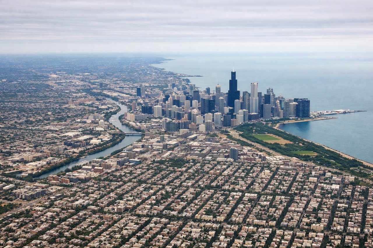
Takeoff from ORD
LEFTLeft side offers views of Lake Michigan immediately after departure, with the Chicago skyline receding behind. The lake dominates the early climb-out phase and provides clear water-to-land contrast.
Landing at LGS
RIGHTRight side provides the best views during approach to Malargue. The Andes Mountains dominate the descent, with the high peaks of the Central Andes visible on the right, and the approach path follows terrain that reveals the dramatic elevation changes.
Landmarks on this routeAll landmarks →
Will your flight be in sunlight?
Pick a date and time in the Sun Map to watch the sun move across your whole flight.
About This Route
Which side of the plane should I sit on flying from Chicago Ohare International (ORD) to Malargue (LGS)?
Sit on the Right side of the plane for the best views on flights from Chicago to Malargue. While left offers good Chicago departure views, right dominates the flight's most dramatic scenery—the Andes Mountains during the long southern approach occupy nearly half the flight duration and provide unmatched visual impact.
What can I see during takeoff from Chicago Ohare International in Chicago?
During takeoff from Chicago Ohare International (ORD), sit on the Left side for the best views. Left side offers views of Lake Michigan immediately after departure, with the Chicago skyline receding behind. The lake dominates the early climb-out phase and provides clear water-to-land contrast. Notable sights include: Lake Michigan, Chicago downtown skyline, Indiana shoreline, Calumet River industrial area.
What can I see when landing at Malargue in Malargue?
When landing at Malargue (LGS), sit on the Right side for the best views. Right side provides the best views during approach to Malargue. The Andes Mountains dominate the descent, with the high peaks of the Central Andes visible on the right, and the approach path follows terrain that reveals the dramatic elevation changes. Notable sights include: Central Andes peaks (6,000+ meters), Atuel River valley, Malargue basin, pre-Andean foothills.
How long is the flight from Chicago to Malargue?
The flight from Chicago Ohare International (ORD) to Malargue (LGS) takes about 10 hours. The shortest flight path between them is 5,477 miles (8,814 km); winds and air traffic control usually add a few percent.
What does the Chicago to Malargue flight path pass over?
The flight path crosses the Gulf of Mexico (visible as open water with scattered clouds), then passes over the Yucatan Peninsula and Central America. Over South America, the Amazon Basin appears as dense green forest canopy with river systems visible as dark linear features. The flight then transitions to the Brazilian Plateau and eventually the Andes foothills. The most notable midpoint feature is the Amazon River system—visible as a massive dendritic network of waterways around 6,000-8,000 feet altitude. Secondary features include the Andes cordillera becoming progressively more prominent as the aircraft descends toward Argentina, with the transition from tropical to arid landscape clearly visible. The Paraná River basin may be visible depending on exact routing. Right side seats will see the Andes increasingly dominate from roughly 3-4 hours before landing.