Chicago to Moorea is 5,689 miles (9,155 km), a flight of about 11 hours 5 minutes.
The left side delivers the iconic Chicago departure view with the skyline and Lake Michigan, which is the most dramatic moment of the flight. The landing view on the right is spectacular, but the overall left-side advantage from departure tips the balance — and over the Pacific the views are largely open ocean regardless of side.
Flight Path
The great circle route tracks southwest over the Midwest, crosses the California coast near Los Angeles, then heads south-southwest across the open Pacific. Notable features include the Sierra Nevada visible during the California crossing, the Channel Islands off the Southern California coast, and then roughly 4,000 miles of open Pacific Ocean. The route passes well north of the Hawaiian Islands chain (visible only as distant specks if at all), crosses the Tropic of Cancer and Equator over open water, and approaches French Polynesia from the northeast, with Tahiti's volcanic profile and the Society Islands becoming visible in the final descent.
Great circle distance and headings ›

.jpg?width=600)
Phase by phase
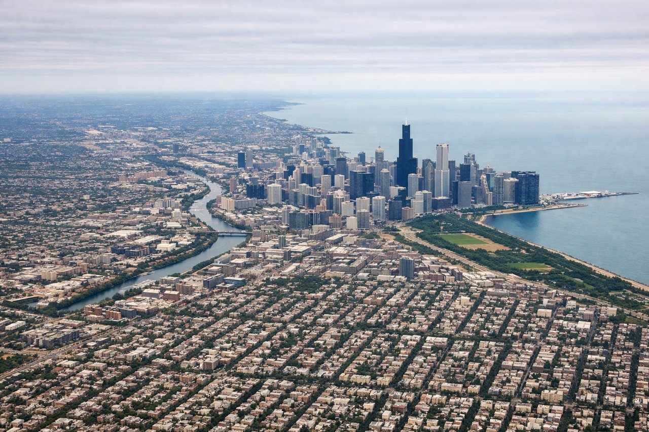
Takeoff from ORD
LEFTORD departures heading southwest or west on runways 10L/10C/10R put the Chicago skyline and Lake Michigan on the left side. You get a clear view of the downtown Loop, Grant Park, and the lakefront as the aircraft banks south and west. The lake stretches north toward Wisconsin on the left horizon.
Landing at MOZ
RIGHTTemae Airport (MOZ) has a single runway oriented roughly east-west (07/25). Arrivals typically come in from the east over the lagoon, meaning the right side faces north toward Moorea's dramatic interior peaks — Mount Rotui and the twin bays of Cook's Bay and Opunohu Bay. The left side faces south toward open ocean.
Landmarks on this routeAll landmarks →
Will your flight be in sunlight?
Pick a date and time in the Sun Map to watch the sun move across your whole flight.
About This Route
Which side of the plane should I sit on flying from Chicago Ohare International (ORD) to Temae (MOZ)?
Sit on the Left side of the plane for the best views on flights from Chicago to Moorea. The left side delivers the iconic Chicago departure view with the skyline and Lake Michigan, which is the most dramatic moment of the flight. The landing view on the right is spectacular, but the overall left-side advantage from departure tips the balance — and over the Pacific the views are largely open ocean regardless of side.
What can I see during takeoff from Chicago Ohare International in Chicago?
During takeoff from Chicago Ohare International (ORD), sit on the Left side for the best views. ORD departures heading southwest or west on runways 10L/10C/10R put the Chicago skyline and Lake Michigan on the left side. You get a clear view of the downtown Loop, Grant Park, and the lakefront as the aircraft banks south and west. The lake stretches north toward Wisconsin on the left horizon. Notable sights include: Chicago Loop skyline, Lake Michigan shoreline, Grant Park/Museum Campus, Midway Airport (visible to the south).
What can I see when landing at Temae in Moorea?
When landing at Temae (MOZ), sit on the Right side for the best views. Temae Airport (MOZ) has a single runway oriented roughly east-west (07/25). Arrivals typically come in from the east over the lagoon, meaning the right side faces north toward Moorea's dramatic interior peaks — Mount Rotui and the twin bays of Cook's Bay and Opunohu Bay. The left side faces south toward open ocean. Notable sights include: Mount Rotui (899m), Cook's Bay, Opunohu Bay, Moorea's coral reef and lagoon.
How long is the flight from Chicago to Moorea?
The flight from Chicago Ohare International (ORD) to Temae (MOZ) takes about 11 hours 5 minutes. The shortest flight path between them is 5,689 miles (9,155 km); winds and air traffic control usually add a few percent.
What does the Chicago to Moorea flight path pass over?
The great circle route tracks southwest over the Midwest, crosses the California coast near Los Angeles, then heads south-southwest across the open Pacific. Notable features include the Sierra Nevada visible during the California crossing, the Channel Islands off the Southern California coast, and then roughly 4,000 miles of open Pacific Ocean. The route passes well north of the Hawaiian Islands chain (visible only as distant specks if at all), crosses the Tropic of Cancer and Equator over open water, and approaches French Polynesia from the northeast, with Tahiti's volcanic profile and the Society Islands becoming visible in the final descent.