Chicago to Rapid City is 781 miles (1,256 km), a flight of about 2 hours 15 minutes.
The left side wins both ends of the flight. During the cruise across South Dakota, the left side also faces south toward the Missouri River breaks and the gradual rise of the high plains, while the right side sees mostly featureless northern prairie. The Black Hills arrival on the left is the visual highlight of the entire route.
Flight Path
The flight crosses the Mississippi River near the Quad Cities (Iowa-Illinois border), then tracks across the Iowa and South Dakota plains. The Missouri River crossing near Chamberlain, SD is visible as a wide meandering river cutting through eroded bluffs. The terrain gradually rises from about 700 feet elevation in Iowa to over 3,000 feet approaching the Black Hills. The landscape transitions from Midwest farmland to open mixed-grass prairie roughly over central Iowa.
Great circle distance and headings ›


Phase by phase
Takeoff from ORD
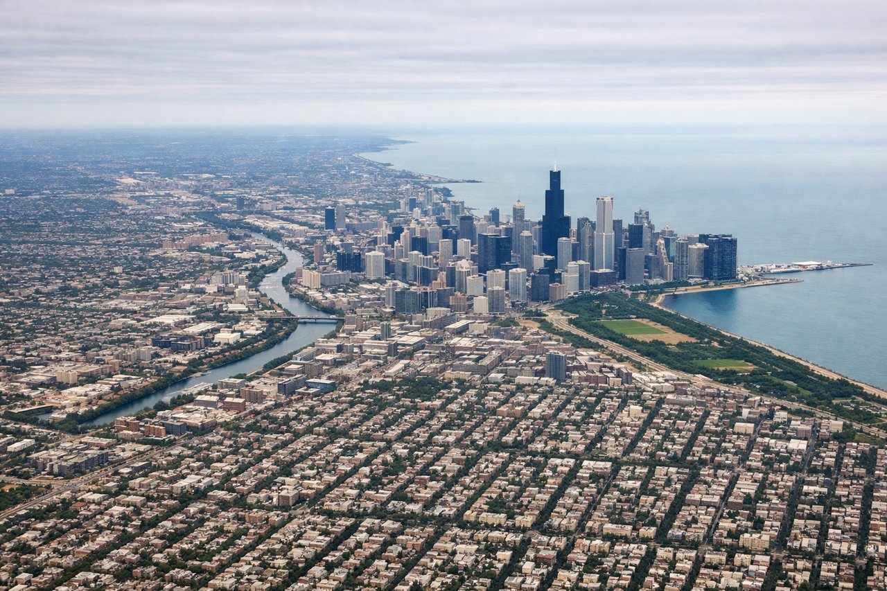
LEFTO'Hare's primary westbound departures on runways 10L/10R/9L head west-northwest, putting the Chicago skyline and Lake Michigan behind and to the left (south). The left side gets a clear view back over the city grid, the lakefront, and the downtown towers as you climb out heading toward the western suburbs.
Landing at RCA
LEFTEllsworth AFB sits just southeast of Rapid City, and approaches typically come in from the east on runway 13/31 or from the north. On a westbound arrival, the left side faces south and southwest, giving a direct view of the Black Hills rising abruptly from the plains — the most dramatic terrain feature of the entire flight.
Landmarks on this routeAll landmarks →
Will your flight be in sunlight?
Pick a date and time in the Sun Map to watch the sun move across your whole flight.
About This Route
Which side of the plane should I sit on flying from Chicago Ohare International (ORD) to Ellsworth Afb (RCA)?
Sit on the Left side of the plane for the best views on flights from Chicago to Rapid City. The left side wins both ends of the flight. During the cruise across South Dakota, the left side also faces south toward the Missouri River breaks and the gradual rise of the high plains, while the right side sees mostly featureless northern prairie. The Black Hills arrival on the left is the visual highlight of the entire route.
What can I see during takeoff from Chicago Ohare International in Chicago?
During takeoff from Chicago Ohare International (ORD), sit on the Left side for the best views. O'Hare's primary westbound departures on runways 10L/10R/9L head west-northwest, putting the Chicago skyline and Lake Michigan behind and to the left (south). The left side gets a clear view back over the city grid, the lakefront, and the downtown towers as you climb out heading toward the western suburbs. Notable sights include: Chicago downtown skyline, Lake Michigan shoreline, Chicago River corridor, suburban grid of Oak Park and Elmhurst.
What can I see when landing at Ellsworth Afb in Rapid City?
When landing at Ellsworth Afb (RCA), sit on the Left side for the best views. Ellsworth AFB sits just southeast of Rapid City, and approaches typically come in from the east on runway 13/31 or from the north. On a westbound arrival, the left side faces south and southwest, giving a direct view of the Black Hills rising abruptly from the plains — the most dramatic terrain feature of the entire flight. Notable sights include: Black Hills uplift, Rapid City urban area, Cheyenne River valley, open Great Plains grasslands.
How long is the flight from Chicago to Rapid City?
The flight from Chicago Ohare International (ORD) to Ellsworth Afb (RCA) takes about 2 hours 15 minutes. The shortest flight path between them is 781 miles (1,256 km); winds and air traffic control usually add a few percent.
What does the Chicago to Rapid City flight path pass over?
The flight crosses the Mississippi River near the Quad Cities (Iowa-Illinois border), then tracks across the Iowa and South Dakota plains. The Missouri River crossing near Chamberlain, SD is visible as a wide meandering river cutting through eroded bluffs. The terrain gradually rises from about 700 feet elevation in Iowa to over 3,000 feet approaching the Black Hills. The landscape transitions from Midwest farmland to open mixed-grass prairie roughly over central Iowa.