Norfolk to Chicago is 703 miles (1,131 km), a flight of about 2 hours 5 minutes.
While the landing offers strong Lake Michigan views on the left, the takeoff from Norfolk provides more dramatic and varied scenery with the Hampton Roads waterway system and Atlantic coastline. Right-side seats capture the most visually distinctive features of this route.
Flight Path
The flight path crosses the Appalachian foothills (visible as low ridges and valleys in West Virginia and eastern Kentucky), the Ohio River valley near Cincinnati, and the relatively flat terrain of Indiana and Illinois. The Appalachian features are most visible around the 2-hour mark, appearing as subtle elevation changes and river valleys rather than dramatic peaks. The Ohio River is occasionally visible as a meandering waterway. Most of the latter half of the flight crosses agricultural plains with scattered cities (Columbus, Indianapolis) appearing as urban grids below.
Great circle distance and headings ›.jpeg?width=600)

Phase by phase
Takeoff from ORF
RIGHTRight-side seats offer views of the Hampton Roads waterway system and the Atlantic coastline as the aircraft climbs northwestward. You'll see the confluence of the James, Nansemond, and Elizabeth Rivers, plus the distinctive outline of the Virginia Peninsula.
Landing at MDW
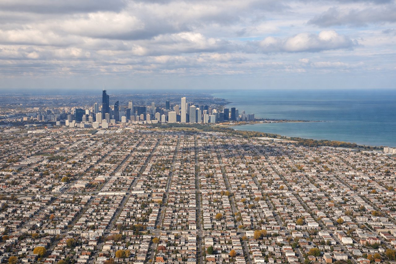
LEFTLeft-side seats provide excellent views of Lake Michigan and Chicago's downtown skyline during the descent and approach to Midway. You'll see the lake's eastern shoreline and the city's grid pattern spreading inland from the waterfront.
Landmarks on this routeAll landmarks →
Will your flight be in sunlight?
Pick a date and time in the Sun Map to watch the sun move across your whole flight.
About This Route
Which side of the plane should I sit on flying from Norfolk International (ORF) to Chicago Midway International (MDW)?
Sit on the Right side of the plane for the best views on flights from Norfolk to Chicago. While the landing offers strong Lake Michigan views on the left, the takeoff from Norfolk provides more dramatic and varied scenery with the Hampton Roads waterway system and Atlantic coastline. Right-side seats capture the most visually distinctive features of this route.
What can I see during takeoff from Norfolk International in Norfolk?
During takeoff from Norfolk International (ORF), sit on the Right side for the best views. Right-side seats offer views of the Hampton Roads waterway system and the Atlantic coastline as the aircraft climbs northwestward. You'll see the confluence of the James, Nansemond, and Elizabeth Rivers, plus the distinctive outline of the Virginia Peninsula. Notable sights include: Hampton Roads (major naval anchorage and shipping channels), James River estuary, Atlantic Ocean coastline, Chesapeake Bay entrance.
What can I see when landing at Chicago Midway International in Chicago?
When landing at Chicago Midway International (MDW), sit on the Left side for the best views. Left-side seats provide excellent views of Lake Michigan and Chicago's downtown skyline during the descent and approach to Midway. You'll see the lake's eastern shoreline and the city's grid pattern spreading inland from the waterfront. Notable sights include: Lake Michigan (western shoreline), Chicago downtown skyline and Loop district, Chicago River, Midway Airport runways and surrounding neighborhoods.
How long is the flight from Norfolk to Chicago?
The flight from Norfolk International (ORF) to Chicago Midway International (MDW) takes about 2 hours 5 minutes. The shortest flight path between them is 703 miles (1,131 km); winds and air traffic control usually add a few percent.
What does the Norfolk to Chicago flight path pass over?
The flight path crosses the Appalachian foothills (visible as low ridges and valleys in West Virginia and eastern Kentucky), the Ohio River valley near Cincinnati, and the relatively flat terrain of Indiana and Illinois. The Appalachian features are most visible around the 2-hour mark, appearing as subtle elevation changes and river valleys rather than dramatic peaks. The Ohio River is occasionally visible as a meandering waterway. Most of the latter half of the flight crosses agricultural plains with scattered cities (Columbus, Indianapolis) appearing as urban grids below.