Pucallpa to Lima is 305 miles (491 km), a flight of about 1 hour 10 minutes.
While takeoff favors the right for river views, the landing approach on the left offers more dramatic and sustained visual interest—the Andes-to-coast transition, Lima's urban geography, and the Pacific are all genuinely impressive from altitude. The landing experience outweighs the takeoff.
Flight Path
The flight path crosses the Andes mountain range roughly 40-50 minutes into the flight. You'll pass over the central Peruvian highlands, including the Mantaro River valley and high-altitude plateaus around 10,000-12,000 feet elevation. The terrain transitions from jungle-covered foothills to bare, rocky peaks and ridges, then descends toward the coastal plain. Cloud cover over the mountains is common, but on clear days the ridge lines and deep valleys are striking.
Great circle distance and headings ›Phase by phase
Takeoff from PCL
RIGHTPucallpa typically departs to the east or northeast. Right-side seats face toward the Ucayali River valley and the forested terrain that dominates the approach to the Andes. You'll see the river's meanders and the transition from lowland jungle to slightly elevated terrain as you climb.
Landing at LIM
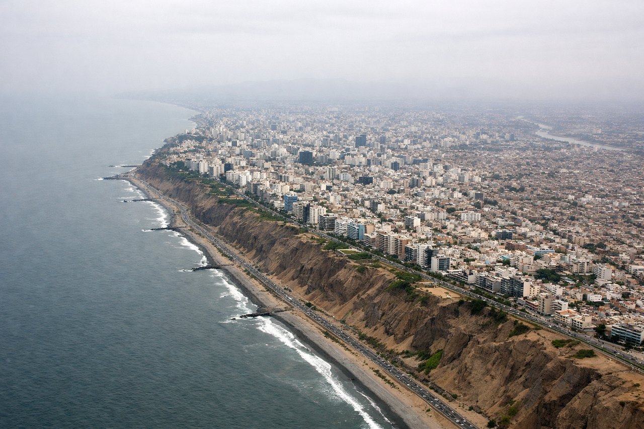
LEFTLima's Jorge Chavez International typically lands from the south or southeast on runways 01L/01R or 03L/03R. Left-side seats will face the Pacific Ocean and the coastal approach, showing the dramatic transition from the Andes foothills down to the coastal plain and the city's sprawl along the coast.
Landmarks on this routeAll landmarks →
Will your flight be in sunlight?
Pick a date and time in the Sun Map to watch the sun move across your whole flight.
About This Route
Which side of the plane should I sit on flying from Cap Fap David Avenzur Rengifo (PCL) to Jorge Chávez International Airport (LIM)?
Sit on the Left side of the plane for the best views on flights from Pucallpa to Lima. While takeoff favors the right for river views, the landing approach on the left offers more dramatic and sustained visual interest—the Andes-to-coast transition, Lima's urban geography, and the Pacific are all genuinely impressive from altitude. The landing experience outweighs the takeoff.
What can I see during takeoff from Cap Fap David Avenzur Rengifo in Pucallpa?
During takeoff from Cap Fap David Avenzur Rengifo (PCL), sit on the Right side for the best views. Pucallpa typically departs to the east or northeast. Right-side seats face toward the Ucayali River valley and the forested terrain that dominates the approach to the Andes. You'll see the river's meanders and the transition from lowland jungle to slightly elevated terrain as you climb. Notable sights include: Ucayali River (visible as a brown serpentine waterway below), surrounding rainforest canopy, distant ridgelines of the eastern Andes foothills beginning to appear on the horizon.
What can I see when landing at Jorge Chávez International Airport in Lima?
When landing at Jorge Chávez International Airport (LIM), sit on the Left side for the best views. Lima's Jorge Chavez International typically lands from the south or southeast on runways 01L/01R or 03L/03R. Left-side seats will face the Pacific Ocean and the coastal approach, showing the dramatic transition from the Andes foothills down to the coastal plain and the city's sprawl along the coast. Notable sights include: Pacific Ocean (sharp blue-gray line on the western horizon), Lima's urban sprawl and districts (Miraflores, San Isidro visible as dense grid patterns), Andes mountains receding inland to the east, Callao port area with container terminals visible as geometric patterns.
How long is the flight from Pucallpa to Lima?
The flight from Cap Fap David Avenzur Rengifo (PCL) to Jorge Chávez International Airport (LIM) takes about 1 hour 10 minutes. The shortest flight path between them is 305 miles (491 km); winds and air traffic control usually add a few percent.
What does the Pucallpa to Lima flight path pass over?
The flight path crosses the Andes mountain range roughly 40-50 minutes into the flight. You'll pass over the central Peruvian highlands, including the Mantaro River valley and high-altitude plateaus around 10,000-12,000 feet elevation. The terrain transitions from jungle-covered foothills to bare, rocky peaks and ridges, then descends toward the coastal plain. Cloud cover over the mountains is common, but on clear days the ridge lines and deep valleys are striking.