Padang to Jakarta is 574 miles (924 km), a flight of about 1 hour 15 minutes.
The right side scores higher (3.0 vs 2.5) because it delivers scenic value across both the departure and arrival phases. Takeoff offers the dramatic Barisan Mountains, a genuine volcanic landscape feature. Landing provides the urban and maritime spectacle of Jakarta's sprawling cityscape and the Thousand Islands archipelago. The left side, while offering some coastal views during departure and ocean scenery during cruise, lacks the concentrated landmark density and visual drama of the right side. This is a short regional flight (approximately 1 hour 15 minutes), so the full-flight experience depends heavily on departure and arrival quality—both favor the right side.
Flight Path
The flight path crosses central Sumatra at low altitude, passing over the Barisan Mountains' central section and transitioning from West Sumatra's volcanic terrain to the Strait of Malacca region. The Sunda Strait and northern Java coast become visible during descent. No major lakes or rivers are prominently visible from cruise altitude on this short route; the primary geographic feature is the continuous mountain spine of the Barisan range running north-south beneath the flight path.
Great circle distance and headings ›Phase by phase
Takeoff from PDG
RIGHTRight side captures the dramatic Barisan Mountains immediately after departure from Padang. Whether departing runway 33 (northwest over ocean) or runway 15 (southeast toward hills), the right side offers the best view of the volcanic spine that defines West Sumatra's geography. The mountains rise steeply from the coastal plain and are visible within minutes of climb-out.
Landing at CGK
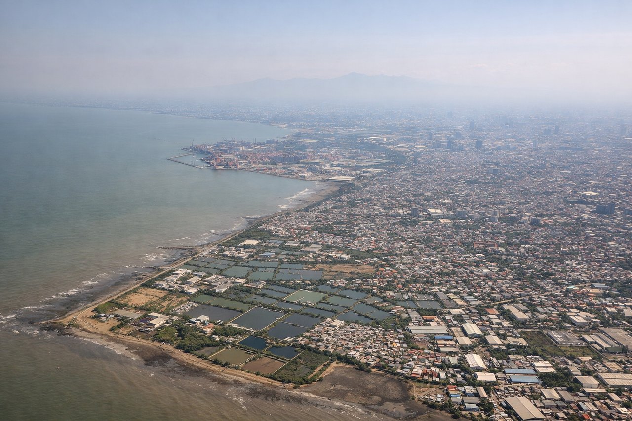
RIGHTRight side provides superior approach scenery into Jakarta. As the aircraft descends on final approach (typically from the north or northeast), the right side reveals Jakarta's sprawling urban landscape, the Java Sea coastline, and the Thousand Islands (Kepulauan Seribu) archipelago. The city's harbor, industrial zones, and dense urban grid are clearly visible during descent and final approach.
Will your flight be in sunlight?
Pick a date and time in the Sun Map to watch the sun move across your whole flight.
About This Route
Which side of the plane should I sit on flying from Minangkabau International Airport (PDG) to Soekarno Hatta International (CGK)?
Sit on the Right side of the plane for the best views on flights from Padang to Jakarta. The right side scores higher (3.0 vs 2.5) because it delivers scenic value across both the departure and arrival phases. Takeoff offers the dramatic Barisan Mountains, a genuine volcanic landscape feature. Landing provides the urban and maritime spectacle of Jakarta's sprawling cityscape and the Thousand Islands archipelago. The left side, while offering some coastal views during departure and ocean scenery during cruise, lacks the concentrated landmark density and visual drama of the right side. This is a short regional flight (approximately 1 hour 15 minutes), so the full-flight experience depends heavily on departure and arrival quality—both favor the right side.
What can I see during takeoff from Minangkabau International Airport in Padang?
During takeoff from Minangkabau International Airport (PDG), sit on the Right side for the best views. Right side captures the dramatic Barisan Mountains immediately after departure from Padang. Whether departing runway 33 (northwest over ocean) or runway 15 (southeast toward hills), the right side offers the best view of the volcanic spine that defines West Sumatra's geography. The mountains rise steeply from the coastal plain and are visible within minutes of climb-out. Notable sights include: Barisan Mountains (volcanic ridge running north-south), Padang coastal plain, Indian Ocean coastline, foothills of the Bukit Barisan range.
What can I see when landing at Soekarno Hatta International in Jakarta?
When landing at Soekarno Hatta International (CGK), sit on the Right side for the best views. Right side provides superior approach scenery into Jakarta. As the aircraft descends on final approach (typically from the north or northeast), the right side reveals Jakarta's sprawling urban landscape, the Java Sea coastline, and the Thousand Islands (Kepulauan Seribu) archipelago. The city's harbor, industrial zones, and dense urban grid are clearly visible during descent and final approach. Notable sights include: Jakarta skyline and central business district, Java Sea coastline, Kepulauan Seribu (Thousand Islands) archipelago, Jakarta harbor and port facilities.
How long is the flight from Padang to Jakarta?
The flight from Minangkabau International Airport (PDG) to Soekarno Hatta International (CGK) takes about 1 hour 15 minutes. The shortest flight path between them is 574 miles (924 km); winds and air traffic control usually add a few percent.
What does the Padang to Jakarta flight path pass over?
The flight path crosses central Sumatra at low altitude, passing over the Barisan Mountains' central section and transitioning from West Sumatra's volcanic terrain to the Strait of Malacca region. The Sunda Strait and northern Java coast become visible during descent. No major lakes or rivers are prominently visible from cruise altitude on this short route; the primary geographic feature is the continuous mountain spine of the Barisan range running north-south beneath the flight path.