Puerto Maldonado to Lima is 534 miles (859 km), a flight of about 1 hour 15 minutes.
While takeoff favors the right for jungle and river views, the landing approach on the left provides more dramatic and sustained views of the Andes-to-coast transition, urban Lima's geography, and the Pacific. The landing experience outweighs the brief takeoff advantage.
Flight Path
The flight path crosses the eastern Peruvian lowlands, transitioning from rainforest to increasingly cleared agricultural areas and small settlements. Around the midpoint, the Andes become more prominent on the left (south), with the cordillera's main ridge visible as a continuous mountain wall. The terrain gradually rises from jungle elevation (around 500 feet at PEM) to crossing passes above 10,000 feet before descending toward Lima's coastal plain. The Urubamba River valley may be visible to the south during the climb phase, marking the boundary between lowland and highland Peru.
Great circle distance and headings ›Phase by phase
Takeoff from PEM
RIGHTPEM typically departs to the east or northeast. Right-side seats capture the Madre de Dios River valley and the transition from rainforest to the Andean foothills as you climb out. The river's meandering course is distinctive and clearly visible during initial climb.
Landing at LIM
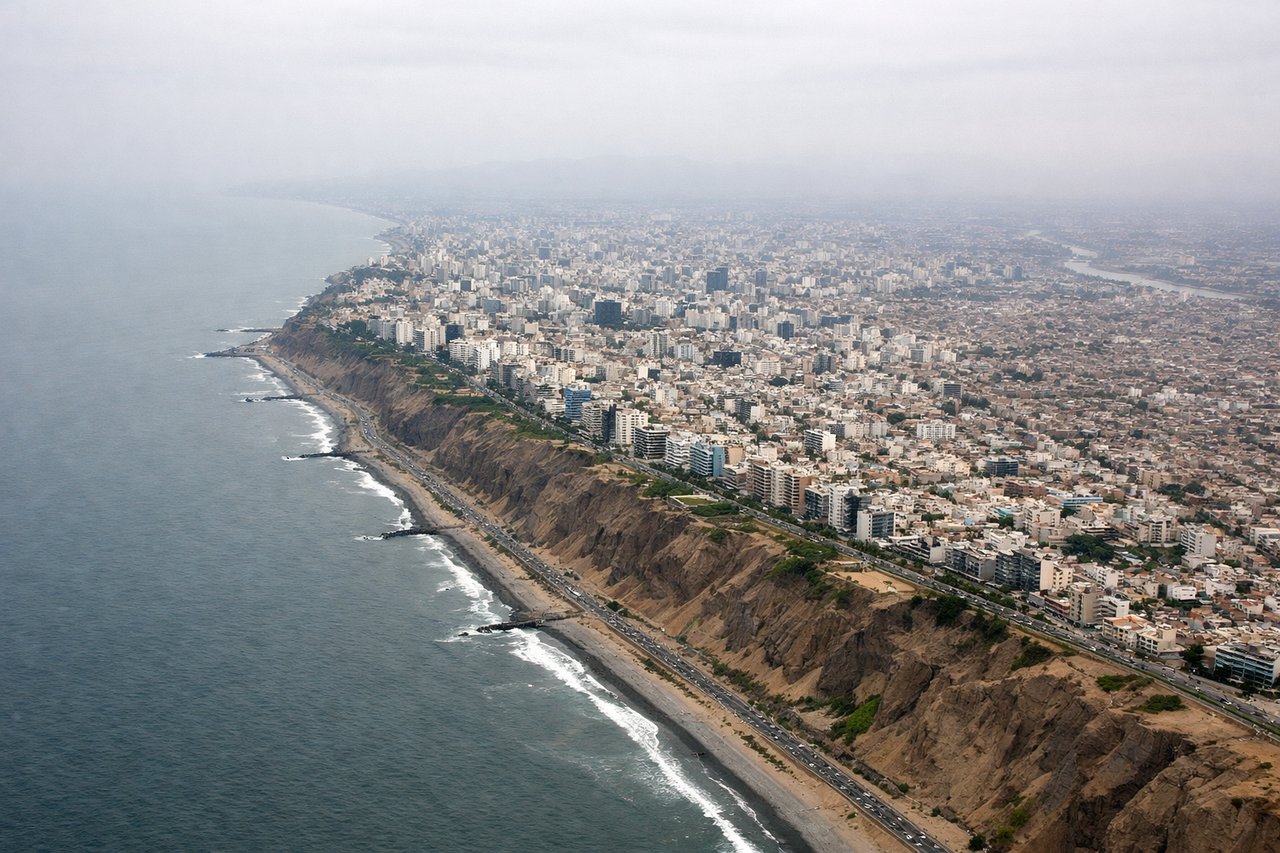
LEFTApproaching LIM from the east typically uses westbound runways (1L/1R). Left-side seats offer views of the Andes descending toward the coastal plain, the Rimac River valley cutting through Lima's urban sprawl, and the Pacific Ocean appearing as you descend below 5,000 feet.
Will your flight be in sunlight?
Pick a date and time in the Sun Map to watch the sun move across your whole flight.
About This Route
Which side of the plane should I sit on flying from Padre Aldamiz (PEM) to Jorge Chávez International Airport (LIM)?
Sit on the Left side of the plane for the best views on flights from Puerto Maldonado to Lima. While takeoff favors the right for jungle and river views, the landing approach on the left provides more dramatic and sustained views of the Andes-to-coast transition, urban Lima's geography, and the Pacific. The landing experience outweighs the brief takeoff advantage.
What can I see during takeoff from Padre Aldamiz in Puerto Maldonado?
During takeoff from Padre Aldamiz (PEM), sit on the Right side for the best views. PEM typically departs to the east or northeast. Right-side seats capture the Madre de Dios River valley and the transition from rainforest to the Andean foothills as you climb out. The river's meandering course is distinctive and clearly visible during initial climb. Notable sights include: Madre de Dios River (winding through jungle immediately below), Puerto Maldonado town grid (small but visible directly beneath), eastern rainforest canopy stretching to the horizon, distant Andean ridge line forming the eastern horizon.
What can I see when landing at Jorge Chávez International Airport in Lima?
When landing at Jorge Chávez International Airport (LIM), sit on the Left side for the best views. Approaching LIM from the east typically uses westbound runways (1L/1R). Left-side seats offer views of the Andes descending toward the coastal plain, the Rimac River valley cutting through Lima's urban sprawl, and the Pacific Ocean appearing as you descend below 5,000 feet. Notable sights include: Rimac River valley (visible as a linear feature through urban Lima), Andes mountain range (receding to the southeast), Lima's urban grid and districts (San Isidro, Miraflores visible as distinct zones), Pacific Ocean coastline with Callao port.
How long is the flight from Puerto Maldonado to Lima?
The flight from Padre Aldamiz (PEM) to Jorge Chávez International Airport (LIM) takes about 1 hour 15 minutes. The shortest flight path between them is 534 miles (859 km); winds and air traffic control usually add a few percent.
What does the Puerto Maldonado to Lima flight path pass over?
The flight path crosses the eastern Peruvian lowlands, transitioning from rainforest to increasingly cleared agricultural areas and small settlements. Around the midpoint, the Andes become more prominent on the left (south), with the cordillera's main ridge visible as a continuous mountain wall. The terrain gradually rises from jungle elevation (around 500 feet at PEM) to crossing passes above 10,000 feet before descending toward Lima's coastal plain. The Urubamba River valley may be visible to the south during the climb phase, marking the boundary between lowland and highland Peru.