The right side offers the only real variety on this route: a glimpse of Perth's coastline at takeoff, occasional views of the Great Australian Bight's dramatic limestone cliffs during the Nullarbor crossing, and the Brindabella Ranges near Canberra on landing. The left side stays over featureless outback and tablelands for nearly the entire flight.
Flight Path
Nullarbor Plain, Great Australian Bight coastal cliffs, Eyre Peninsula fringes visible to the south
Great circle distance and headings ›Phase by phase
Takeoff from PER
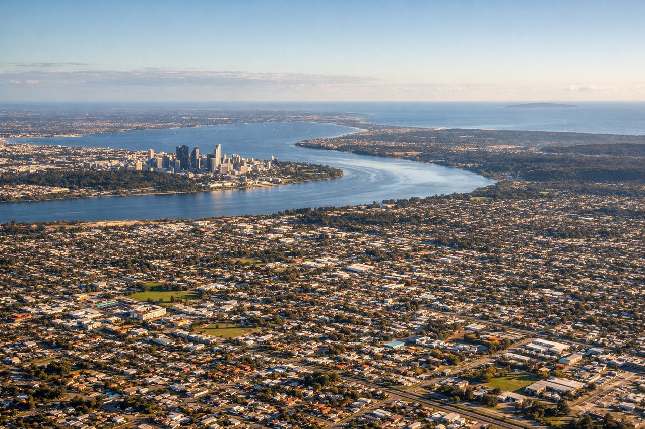
RIGHTDeparting PER on runway 21 or 03, the aircraft tracks south then turns east, briefly keeping the Indian Ocean and Perth's coastal suburbs visible on the right before the turn inland. The left side only shows the flat outer suburbs and scrubland stretching toward the Darling Range foothills, which are low and unremarkable.
Landing at CBR
RIGHTOn approach into CBR, aircraft typically track in from the north or south along the Molonglo Valley, and the Brindabella Ranges and the Australian Alps foothills rise clearly to the south and west, best seen from the right side during the final turn. The left side mostly shows the flatter Monaro tablelands with less relief.
Will your flight be in sunlight?
See exactly which side of the plane gets sun and shade at your departure time.
About This Route
Which side of the plane should I sit on flying from Perth International (PER) to Canberra (CBR)?
Sit on the Right side of the plane for the best views on flights from Perth to Canberra. The right side offers the only real variety on this route: a glimpse of Perth's coastline at takeoff, occasional views of the Great Australian Bight's dramatic limestone cliffs during the Nullarbor crossing, and the Brindabella Ranges near Canberra on landing. The left side stays over featureless outback and tablelands for nearly the entire flight.
What can I see during takeoff from Perth International in Perth?
During takeoff from Perth International (PER), sit on the Right side for the best views. Departing PER on runway 21 or 03, the aircraft tracks south then turns east, briefly keeping the Indian Ocean and Perth's coastal suburbs visible on the right before the turn inland. The left side only shows the flat outer suburbs and scrubland stretching toward the Darling Range foothills, which are low and unremarkable. Notable sights include: Indian Ocean coastline, Swan River mouth, Fremantle Harbour, Perth CBD skyline.
What can I see when landing at Canberra in Canberra?
When landing at Canberra (CBR), sit on the Right side for the best views. On approach into CBR, aircraft typically track in from the north or south along the Molonglo Valley, and the Brindabella Ranges and the Australian Alps foothills rise clearly to the south and west, best seen from the right side during the final turn. The left side mostly shows the flatter Monaro tablelands with less relief. Notable sights include: Brindabella Ranges, Lake Burley Griffin, Australian Alps foothills, Canberra's Parliamentary Triangle.
How long is the flight from Perth to Canberra?
The flight from Perth International (PER) to Canberra (CBR) takes 4h 05m.
What does the Perth to Canberra flight path pass over?
Nullarbor Plain, Great Australian Bight coastal cliffs, Eyre Peninsula fringes visible to the south