The left side scores higher due to the superior takeoff experience from Philadelphia—the Delaware River estuary, urban waterfront, and Appalachian transition provide more visual variety and landmark density than the right side's flat farmland departure. Although the right side's Boise landing is scenic, the left side's overall journey from a major coastal city through the Appalachian corridor to the high desert interior offers greater scenic diversity across the full flight.
Flown PHL to BOI? Did we get it right?
Flight Path
Philadelphia to Boise is 2,107 miles (3,391 km), a flight of about 5 hours 15 minutes.
Appalachian Mountains (Pennsylvania, West Virginia, Kentucky ridges), Ohio River valley, Mississippi River valley near St. Louis, Great Plains of Missouri and Kansas, Rocky Mountain foothills approaching Colorado, high desert plateau of Wyoming and Idaho
Great circle distance and headings ›


Phase by phase
Takeoff from PHL
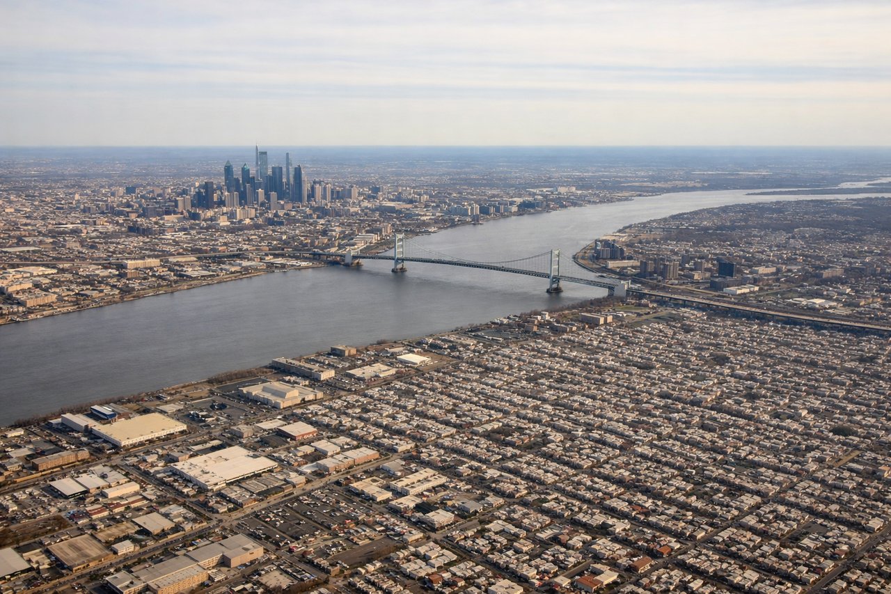
LEFTLeft side captures the Delaware River estuary, Philadelphia's urban waterfront, and the transition from coastal lowlands toward the Appalachian foothills. Right side faces inland toward flat Pennsylvania farmland with minimal visual interest during climb-out.
Landing at BOI
RIGHTRight side offers the dramatic approach to Boise with the Boise Foothills and the Owyhee Mountains visible during descent. The Boise River valley and the city's setting against the high desert landscape create visual interest. Left side faces the open high desert plateau with minimal terrain variation.
Will your flight be in sunlight?
Pick a date and time in the Sun Map to watch the sun move across your whole flight.
About This Route
Which side of the plane should I sit on flying from Philadelphia International (PHL) to Boise Air Terminal (BOI)?
Sit on the Left side of the plane for the best views on flights from Philadelphia to Boise. The left side scores higher due to the superior takeoff experience from Philadelphia—the Delaware River estuary, urban waterfront, and Appalachian transition provide more visual variety and landmark density than the right side's flat farmland departure. Although the right side's Boise landing is scenic, the left side's overall journey from a major coastal city through the Appalachian corridor to the high desert interior offers greater scenic diversity across the full flight.
What can I see during takeoff from Philadelphia International in Philadelphia?
During takeoff from Philadelphia International (PHL), sit on the Left side for the best views. Left side captures the Delaware River estuary, Philadelphia's urban waterfront, and the transition from coastal lowlands toward the Appalachian foothills. Right side faces inland toward flat Pennsylvania farmland with minimal visual interest during climb-out. Notable sights include: Delaware River and Philadelphia waterfront, Schuylkill River confluence, Appalachian ridge line emerging to the northwest.
What can I see when landing at Boise Air Terminal in Boise?
When landing at Boise Air Terminal (BOI), sit on the Right side for the best views. Right side offers the dramatic approach to Boise with the Boise Foothills and the Owyhee Mountains visible during descent. The Boise River valley and the city's setting against the high desert landscape create visual interest. Left side faces the open high desert plateau with minimal terrain variation. Notable sights include: Boise Foothills, Boise River valley, Owyhee Mountains to the south, Boise city grid.
How long is the flight from Philadelphia to Boise?
The flight from Philadelphia International (PHL) to Boise Air Terminal (BOI) takes about 5 hours 15 minutes. The shortest flight path between them is 2,107 miles (3,391 km); winds and air traffic control usually add a few percent.
What does the Philadelphia to Boise flight path pass over?
Appalachian Mountains (Pennsylvania, West Virginia, Kentucky ridges), Ohio River valley, Mississippi River valley near St. Louis, Great Plains of Missouri and Kansas, Rocky Mountain foothills approaching Colorado, high desert plateau of Wyoming and Idaho