The landing view into the Himalayas is the dominant visual reward on this route. While the PHL departure offers local interest, the approach to BWA with the Mahabharat Range and Terai plain is geographically more dramatic and memorable.
Flight Path
This route typically routes via a European or Middle Eastern hub (Frankfurt, Istanbul, or Doha are common). The direct great-circle path crosses the Atlantic, Western Europe, Eastern Europe/Caucasus region, the Caspian Sea area, Central Asia (Turkmenistan/Uzbekistan steppes), the Hindu Kush mountains (visible on clear days during the Afghan/Pakistan crossing), and finally descends into the Nepal Terai. The most visually striking midpoint feature is the Hindu Kush range and the transition from the arid Central Asian plateau into the increasingly green foothills of the Himalayas as you approach Nepal.
Great circle distance and headings ›.jpg?width=600)
.jpeg?width=600)


.jpg?width=600)
Phase by phase
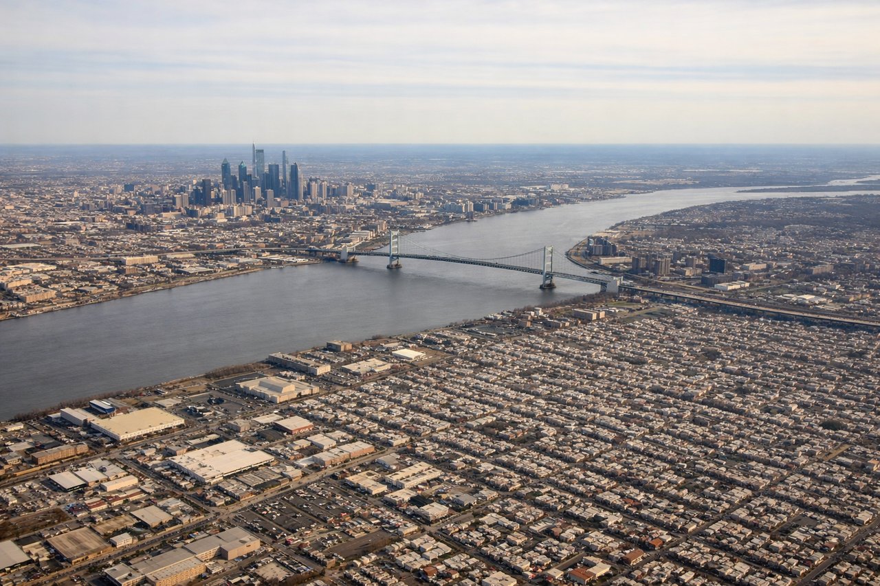
Takeoff from PHL
LEFTPHL typically departs eastbound (Runways 09L/09R). Left seats face north initially, giving views of the Delaware River, Northeast Philadelphia urban sprawl, and the Schuylkill River valley as you climb. Right seats see industrial areas and less distinctive terrain.
Landing at BWA
RIGHTApproaching BWA from the west (standard arrival), right seats face south and southeast toward the Himalayas. You'll see the Mahabharat Range and foothills rising dramatically as you descend into the Terai plain. Left seats see the flat agricultural plain and less dramatic terrain.
Landmarks on this routeAll landmarks →
Will your flight be in sunlight?
See exactly which side of the plane gets sun and shade at your departure time.
About This Route
Which side of the plane should I sit on flying from Philadelphia International (PHL) to Bhairahawa (BWA)?
Sit on the Right side of the plane for the best views on flights from Philadelphia to Bhairawa. The landing view into the Himalayas is the dominant visual reward on this route. While the PHL departure offers local interest, the approach to BWA with the Mahabharat Range and Terai plain is geographically more dramatic and memorable.
What can I see during takeoff from Philadelphia International in Philadelphia?
During takeoff from Philadelphia International (PHL), sit on the Left side for the best views. PHL typically departs eastbound (Runways 09L/09R). Left seats face north initially, giving views of the Delaware River, Northeast Philadelphia urban sprawl, and the Schuylkill River valley as you climb. Right seats see industrial areas and less distinctive terrain. Notable sights include: Delaware River (immediate left, snaking northeast), Schuylkill River (visible inland to the northwest), Northeast Philadelphia grid pattern, Ben Franklin Bridge approach corridor.
What can I see when landing at Bhairahawa in Bhairawa?
When landing at Bhairahawa (BWA), sit on the Right side for the best views. Approaching BWA from the west (standard arrival), right seats face south and southeast toward the Himalayas. You'll see the Mahabharat Range and foothills rising dramatically as you descend into the Terai plain. Left seats see the flat agricultural plain and less dramatic terrain. Notable sights include: Mahabharat Range (southern foothills of the Himalayas, rising steeply), Terai plain (flat agricultural lowland), Rapti River valley (visible as a linear feature cutting through the plain), Bhairahawa town and surrounding settlements.
How long is the flight from Philadelphia to Bhairawa?
The flight from Philadelphia International (PHL) to Bhairahawa (BWA) takes Approximately 16-17 hours (including typical routing via Europe or Middle East hub).
What does the Philadelphia to Bhairawa flight path pass over?
This route typically routes via a European or Middle Eastern hub (Frankfurt, Istanbul, or Doha are common). The direct great-circle path crosses the Atlantic, Western Europe, Eastern Europe/Caucasus region, the Caspian Sea area, Central Asia (Turkmenistan/Uzbekistan steppes), the Hindu Kush mountains (visible on clear days during the Afghan/Pakistan crossing), and finally descends into the Nepal Terai. The most visually striking midpoint feature is the Hindu Kush range and the transition from the arid Central Asian plateau into the increasingly green foothills of the Himalayas as you approach Nepal.