While takeoff offers pleasant river and agricultural views on the right, the landing approach on the left provides more dramatic urban and water scenery—Lake Michigan and the Chicago skyline are more visually striking than Peoria's departure landscape.
Flown PIA to ORD? Did we get it right?
Flight Path
Peoria to Chicago is 130 miles (209 km), a flight of about 50 minutes.
The flight path crosses central Illinois farmland, passing east of Bloomington-Normal. At cruise altitude (around 25,000 feet), passengers may see the Illinois River continuing northeast, scattered small towns and lakes, and the gradual transition from agricultural plains to suburban development as the aircraft approaches the Chicago metropolitan area. The Des Plaines River valley becomes visible in the final descent phase.
Great circle distance and headings ›Phase by phase
Takeoff from PIA
RIGHTRight-side seats offer views of the Illinois River valley and the transition from Peoria's urban core to agricultural plains. The climb-out path typically heads northeast, giving right-side passengers a clear view of the river's meandering course and the surrounding farmland.
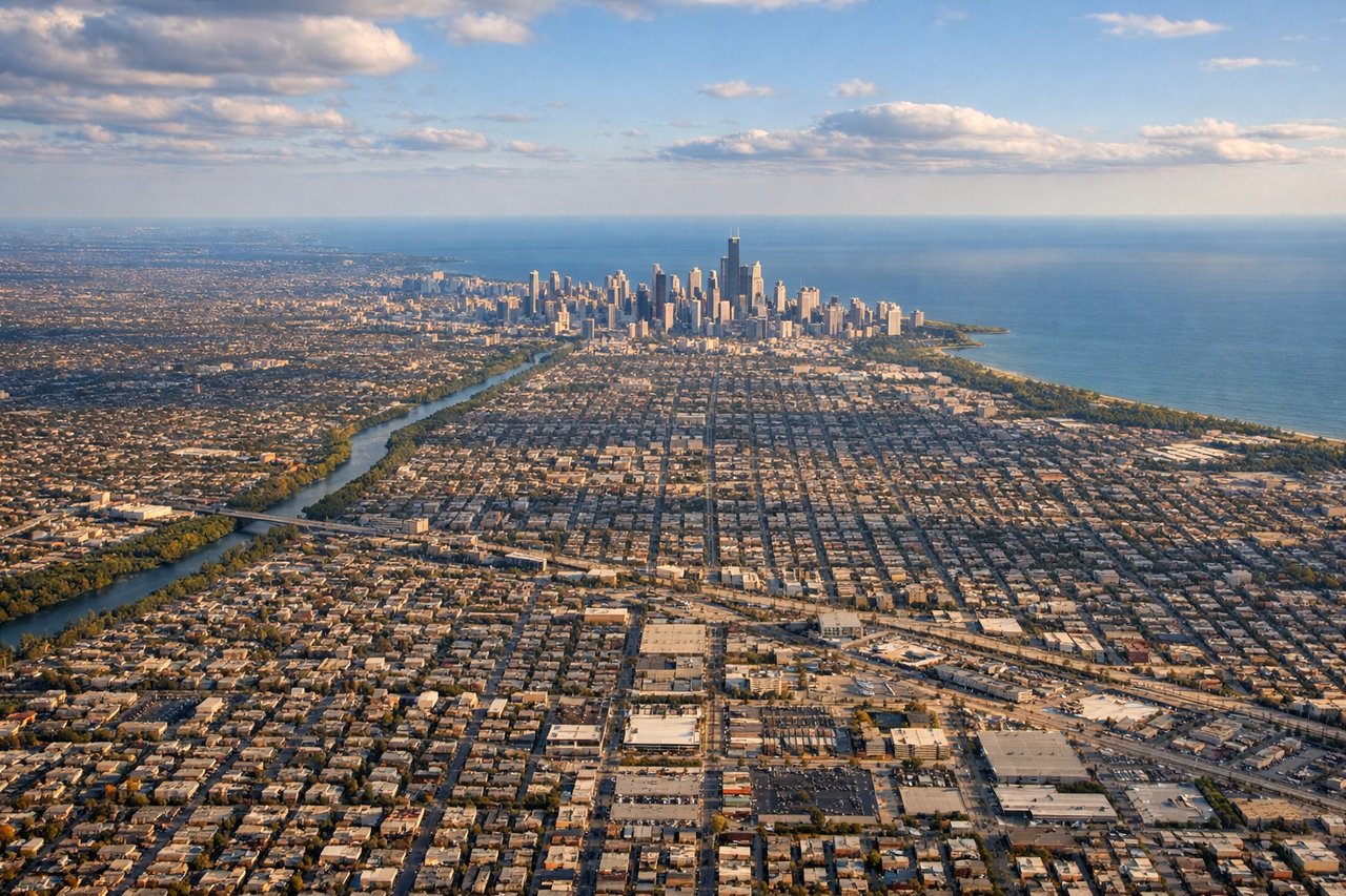
Landing at ORD
LEFTLeft-side seats provide excellent views during the descent into ORD. The approach typically comes from the southwest, and left-side passengers see Lake Michigan's shoreline, the Chicago skyline, and the transition from suburban sprawl to the dense urban core.
Will your flight be in sunlight?
Pick a date and time in the Sun Map to watch the sun move across your whole flight.
About This Route
Which side of the plane should I sit on flying from General Wayne A. Downing Peoria International Airport (PIA) to Chicago Ohare International (ORD)?
Sit on the Left side of the plane for the best views on flights from Peoria to Chicago. While takeoff offers pleasant river and agricultural views on the right, the landing approach on the left provides more dramatic urban and water scenery—Lake Michigan and the Chicago skyline are more visually striking than Peoria's departure landscape.
What can I see during takeoff from General Wayne A. Downing Peoria International Airport in Peoria?
During takeoff from General Wayne A. Downing Peoria International Airport (PIA), sit on the Right side for the best views. Right-side seats offer views of the Illinois River valley and the transition from Peoria's urban core to agricultural plains. The climb-out path typically heads northeast, giving right-side passengers a clear view of the river's meandering course and the surrounding farmland. Notable sights include: Illinois River (flowing north through Peoria), downtown Peoria skyline, agricultural grid pattern of central Illinois, Lake Springdale (small reservoir south of airport).
What can I see when landing at Chicago Ohare International in Chicago?
When landing at Chicago Ohare International (ORD), sit on the Left side for the best views. Left-side seats provide excellent views during the descent into ORD. The approach typically comes from the southwest, and left-side passengers see Lake Michigan's shoreline, the Chicago skyline, and the transition from suburban sprawl to the dense urban core. Notable sights include: Lake Michigan (western shore and open water), Chicago downtown skyline (Willis Tower, John Hancock Center visible as distant points), suburban grid of northwest Chicago neighborhoods, Des Plaines River valley.
How long is the flight from Peoria to Chicago?
The flight from General Wayne A. Downing Peoria International Airport (PIA) to Chicago Ohare International (ORD) takes about 50 minutes. The shortest flight path between them is 130 miles (209 km); winds and air traffic control usually add a few percent.
What does the Peoria to Chicago flight path pass over?
The flight path crosses central Illinois farmland, passing east of Bloomington-Normal. At cruise altitude (around 25,000 feet), passengers may see the Illinois River continuing northeast, scattered small towns and lakes, and the gradual transition from agricultural plains to suburban development as the aircraft approaches the Chicago metropolitan area. The Des Plaines River valley becomes visible in the final descent phase.