While takeoff offers Pittsburgh's river scenery, the landing approach into Tampa Bay provides more visually distinctive and extended views of a major coastal water body and urban waterfront. The bay's scale and the contrast between water and developed land make the approach more rewarding for window-seat viewing.
Flown PIT to TPA? Did we get it right?
Flight Path
Pittsburgh to Tampa is 875 miles (1,408 km), a flight of about 2 hours 45 minutes.
The flight path crosses the Appalachian Mountains (visible as rolling forested ridges during the first hour), then transitions into the Piedmont region of North Carolina and Georgia. The Great Smoky Mountains appear as a distant ridge line to the left (west) during the climb-out phase. As the aircraft moves south, the terrain flattens into the Piedmont and Coastal Plain. The Chattahoochee River valley and Atlanta metropolitan area may be visible to the left during the middle portion of the flight. In the final descent phase, the Florida peninsula's flat terrain and scattered lakes become prominent, with the Gulf of Mexico visible to the left (west) on clear days.
Great circle distance and headings ›Phase by phase
Takeoff from PIT
LEFTLeft side offers views of the Allegheny River valley and Pittsburgh's downtown skyline as the aircraft climbs southwestward. The river's distinctive meanders and the city's Golden Triangle district are clearly visible during the initial climb-out.
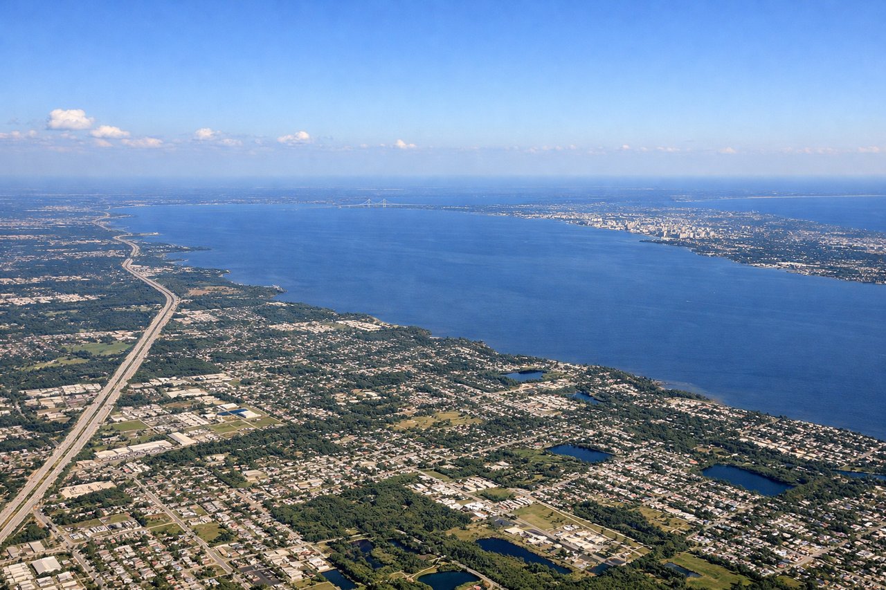
Landing at TPA
RIGHTRight side provides views of Tampa Bay's eastern shoreline and the city's downtown waterfront as the aircraft descends on final approach from the north. The bay's distinctive shape and Ybor City district are visible during descent.
Will your flight be in sunlight?
Pick a date and time in the Sun Map to watch the sun move across your whole flight.
About This Route
Which side of the plane should I sit on flying from Pittsburgh International (PIT) to Tampa International (TPA)?
Sit on the Right side of the plane for the best views on flights from Pittsburgh to Tampa. While takeoff offers Pittsburgh's river scenery, the landing approach into Tampa Bay provides more visually distinctive and extended views of a major coastal water body and urban waterfront. The bay's scale and the contrast between water and developed land make the approach more rewarding for window-seat viewing.
What can I see during takeoff from Pittsburgh International in Pittsburgh?
During takeoff from Pittsburgh International (PIT), sit on the Left side for the best views. Left side offers views of the Allegheny River valley and Pittsburgh's downtown skyline as the aircraft climbs southwestward. The river's distinctive meanders and the city's Golden Triangle district are clearly visible during the initial climb-out. Notable sights include: Allegheny River, Pittsburgh downtown skyline, Monongahela River confluence, Ohio River valley to the southwest.
What can I see when landing at Tampa International in Tampa?
When landing at Tampa International (TPA), sit on the Right side for the best views. Right side provides views of Tampa Bay's eastern shoreline and the city's downtown waterfront as the aircraft descends on final approach from the north. The bay's distinctive shape and Ybor City district are visible during descent. Notable sights include: Tampa Bay, Hillsborough Bay, downtown Tampa waterfront, Ybor City historic district.
How long is the flight from Pittsburgh to Tampa?
The flight from Pittsburgh International (PIT) to Tampa International (TPA) takes about 2 hours 45 minutes. The shortest flight path between them is 875 miles (1,408 km); winds and air traffic control usually add a few percent.
What does the Pittsburgh to Tampa flight path pass over?
The flight path crosses the Appalachian Mountains (visible as rolling forested ridges during the first hour), then transitions into the Piedmont region of North Carolina and Georgia. The Great Smoky Mountains appear as a distant ridge line to the left (west) during the climb-out phase. As the aircraft moves south, the terrain flattens into the Piedmont and Coastal Plain. The Chattahoochee River valley and Atlanta metropolitan area may be visible to the left during the middle portion of the flight. In the final descent phase, the Florida peninsula's flat terrain and scattered lakes become prominent, with the Gulf of Mexico visible to the left (west) on clear days.