The takeoff from Pangkalan Bun offers more distinctive and visually striking scenery—the Kapuas River delta and peatland wetlands are dramatic and unique. While the landing approach into Surabaya is interesting, the river delta landscape is more memorable and geographically distinctive.
Flown PKN to SUB? Did we get it right?
Flight Path
Pangkalan Bun to Surabaya is 332 miles (534 km), a flight of about 1 hour 15 minutes.
The flight path crosses central Kalimantan's peatland and forest regions, then transitions over the Java Sea. Notable features include the Kapuas River system, extensive peatland wetlands, the transition from Kalimantan's interior to coastal waters, and the approach over the Madura Strait toward Java's northern coast.
Great circle distance and headings ›Phase by phase
Takeoff from PKN
RIGHTRight-side seats offer views of the Kapuas River delta and surrounding peatland wetlands as the aircraft climbs out over central Kalimantan. The river's distinctive meandering channels and oxbow lakes are clearly visible from 5,000–15,000 feet during the initial climb.
Landing at SUB
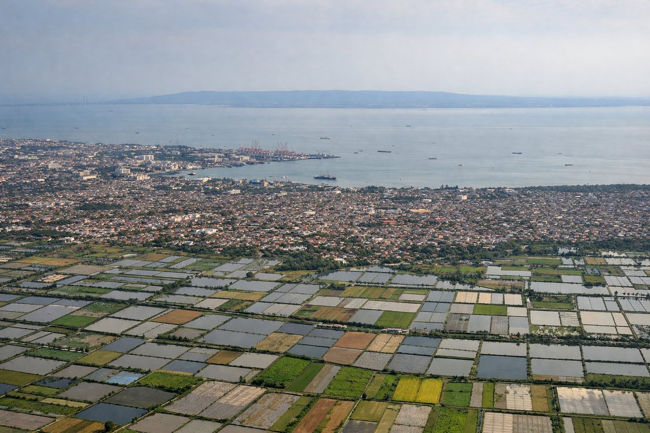
LEFTLeft-side seats provide excellent views of the Madura Strait and the approach into Surabaya over the Java Sea. As the aircraft descends toward Juanda Airport, you'll see the narrow strait separating Madura Island from eastern Java, plus the urban sprawl of Surabaya itself.
Will your flight be in sunlight?
Pick a date and time in the Sun Map to watch the sun move across your whole flight.
About This Route
Which side of the plane should I sit on flying from Iskandar Airport (PKN) to Juanda International Airport (SUB)?
Sit on the Right side of the plane for the best views on flights from Pangkalan Bun to Surabaya. The takeoff from Pangkalan Bun offers more distinctive and visually striking scenery—the Kapuas River delta and peatland wetlands are dramatic and unique. While the landing approach into Surabaya is interesting, the river delta landscape is more memorable and geographically distinctive.
What can I see during takeoff from Iskandar Airport in Pangkalan Bun?
During takeoff from Iskandar Airport (PKN), sit on the Right side for the best views. Right-side seats offer views of the Kapuas River delta and surrounding peatland wetlands as the aircraft climbs out over central Kalimantan. The river's distinctive meandering channels and oxbow lakes are clearly visible from 5,000–15,000 feet during the initial climb. Notable sights include: Kapuas River delta and oxbow lakes, Peatland wetlands of central Kalimantan, Kumai estuary to the north, Scattered logging clearings and forest patches.
What can I see when landing at Juanda International Airport in Surabaya?
When landing at Juanda International Airport (SUB), sit on the Left side for the best views. Left-side seats provide excellent views of the Madura Strait and the approach into Surabaya over the Java Sea. As the aircraft descends toward Juanda Airport, you'll see the narrow strait separating Madura Island from eastern Java, plus the urban sprawl of Surabaya itself. Notable sights include: Madura Strait (narrow water channel), Madura Island's eastern coastline, Surabaya urban area and harbor, Java Sea.
How long is the flight from Pangkalan Bun to Surabaya?
The flight from Iskandar Airport (PKN) to Juanda International Airport (SUB) takes about 1 hour 15 minutes. The shortest flight path between them is 332 miles (534 km); winds and air traffic control usually add a few percent.
What does the Pangkalan Bun to Surabaya flight path pass over?
The flight path crosses central Kalimantan's peatland and forest regions, then transitions over the Java Sea. Notable features include the Kapuas River system, extensive peatland wetlands, the transition from Kalimantan's interior to coastal waters, and the approach over the Madura Strait toward Java's northern coast.