While takeoff offers brief views of the Tararua Range on the right, the landing approach provides sustained, dramatic scenery of Waitemata Harbour, Rangitoto Island, and Auckland's geography. Left-side seats capture the most visually distinctive features of this route.
Flown PMR to AKL? Did we get it right?
Flight Path
Palmerston North to Auckland is 233 miles (375 km), a flight of about 55 minutes.
The flight path crosses the central North Island plateau, passing east of the Ruahine Range and west of the Kaingaroa Forest. The Waikato River valley becomes visible during the descent phase. Lake Taupo may be visible in clear conditions as a distant feature to the east during cruise, though it lies slightly off the direct flight path.
Great circle distance and headings ›Phase by phase
Takeoff from PMR
RIGHTRight-side seats capture the Tararua Range and Manawatu River valley during initial climb. The aircraft departs northwestward, and right-facing windows show the dramatic ridge line and surrounding farmland clearly before the aircraft banks toward Auckland.
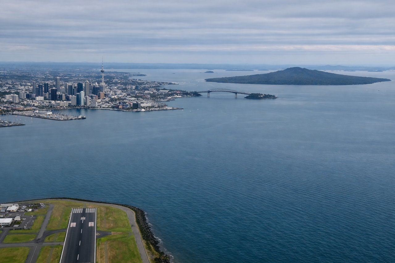
Landing at AKL
LEFTLeft-side seats offer the best views during descent into Auckland. The aircraft approaches from the south, and left windows frame the Waitemata Harbour, Rangitoto Island, and the Auckland isthmus clearly. Right-facing windows would show only water and the distant North Island.
Will your flight be in sunlight?
Pick a date and time in the Sun Map to watch the sun move across your whole flight.
About This Route
Which side of the plane should I sit on flying from Palmerston North (PMR) to Auckland International (AKL)?
Sit on the Left side of the plane for the best views on flights from Palmerston North to Auckland. While takeoff offers brief views of the Tararua Range on the right, the landing approach provides sustained, dramatic scenery of Waitemata Harbour, Rangitoto Island, and Auckland's geography. Left-side seats capture the most visually distinctive features of this route.
What can I see during takeoff from Palmerston North in Palmerston North?
During takeoff from Palmerston North (PMR), sit on the Right side for the best views. Right-side seats capture the Tararua Range and Manawatu River valley during initial climb. The aircraft departs northwestward, and right-facing windows show the dramatic ridge line and surrounding farmland clearly before the aircraft banks toward Auckland. Notable sights include: Tararua Range, Manawatu River, Palmerston North city grid, surrounding rural plateau.
What can I see when landing at Auckland International in Auckland?
When landing at Auckland International (AKL), sit on the Left side for the best views. Left-side seats offer the best views during descent into Auckland. The aircraft approaches from the south, and left windows frame the Waitemata Harbour, Rangitoto Island, and the Auckland isthmus clearly. Right-facing windows would show only water and the distant North Island. Notable sights include: Waitemata Harbour, Rangitoto Island, Auckland city skyline, Manukau Harbour.
How long is the flight from Palmerston North to Auckland?
The flight from Palmerston North (PMR) to Auckland International (AKL) takes about 55 minutes. The shortest flight path between them is 233 miles (375 km); winds and air traffic control usually add a few percent.
What does the Palmerston North to Auckland flight path pass over?
The flight path crosses the central North Island plateau, passing east of the Ruahine Range and west of the Kaingaroa Forest. The Waikato River valley becomes visible during the descent phase. Lake Taupo may be visible in clear conditions as a distant feature to the east during cruise, though it lies slightly off the direct flight path.