Phnom Penh to Taipei is 1,422 miles (2,288 km), a flight of about 3 hours 25 minutes.
Right side captures the most dramatic scenery: Tonlé Sap Lake during departure is visually superior to the urban approach into Taipei. The lake's scale and distinctive pale water color provide better scenic value than the city-focused landing view.
Flight Path
Flight path crosses central Thailand over the Korat Plateau and northeastern Thailand. Notable features include the Mekong River (forming Thailand-Laos border, visible as a dark ribbon), scattered mountains of the Phetchabun Range, and the transition from tropical forest to more open terrain. The aircraft crosses into the Gulf of Thailand briefly before heading northeast toward Taiwan. The Andaman Sea and Gulf of Thailand coastlines are visible on the left during the southern portion of the flight. As the aircraft approaches Taiwan, the Taiwan Strait becomes visible, and the volcanic peaks of northern Taiwan gradually emerge on the horizon.
Great circle distance and headings ›Phase by phase
Takeoff from PNH
RIGHTRight side captures the Tonlé Sap Lake immediately after departure, the largest freshwater lake in Southeast Asia. The lake dominates the landscape northwest of Phnom Penh and is visually striking during climb-out.
Landing at TPE
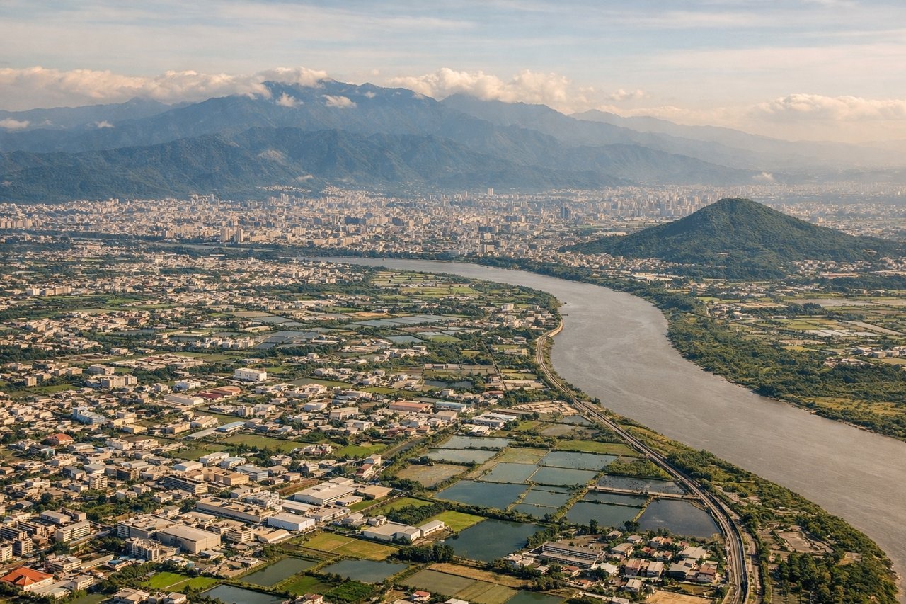
LEFTLeft side during descent into Taipei offers views of the Taipei Basin and the northern Taiwan coastline. The descent path typically brings aircraft over the Taiwan Strait, and left-side passengers see the coastal mountains and urban sprawl of northern Taiwan.
Will your flight be in sunlight?
Pick a date and time in the Sun Map to watch the sun move across your whole flight.
About This Route
Which side of the plane should I sit on flying from Pochentong International (PNH) to Chiang Kai Shek International (TPE)?
Sit on the Right side of the plane for the best views on flights from Phnom Penh to Taipei. Right side captures the most dramatic scenery: Tonlé Sap Lake during departure is visually superior to the urban approach into Taipei. The lake's scale and distinctive pale water color provide better scenic value than the city-focused landing view.
What can I see during takeoff from Pochentong International in Phnom Penh?
During takeoff from Pochentong International (PNH), sit on the Right side for the best views. Right side captures the Tonlé Sap Lake immediately after departure, the largest freshwater lake in Southeast Asia. The lake dominates the landscape northwest of Phnom Penh and is visually striking during climb-out. Notable sights include: Tonlé Sap Lake (massive water body with irregular shoreline), Phnom Penh city grid (visible briefly below), Cardamom Mountains (distant southwestern horizon), Mekong River confluence (visible as dark water channels).
What can I see when landing at Chiang Kai Shek International in Taipei?
When landing at Chiang Kai Shek International (TPE), sit on the Left side for the best views. Left side during descent into Taipei offers views of the Taipei Basin and the northern Taiwan coastline. The descent path typically brings aircraft over the Taiwan Strait, and left-side passengers see the coastal mountains and urban sprawl of northern Taiwan. Notable sights include: Taipei Basin (urban grid of the city), Yangmingshan volcanic mountains (north of city), Taiwan Strait coastline (northern shore), Keelung harbor and port facilities.
How long is the flight from Phnom Penh to Taipei?
The flight from Pochentong International (PNH) to Chiang Kai Shek International (TPE) takes about 3 hours 25 minutes. The shortest flight path between them is 1,422 miles (2,288 km); winds and air traffic control usually add a few percent.
What does the Phnom Penh to Taipei flight path pass over?
Flight path crosses central Thailand over the Korat Plateau and northeastern Thailand. Notable features include the Mekong River (forming Thailand-Laos border, visible as a dark ribbon), scattered mountains of the Phetchabun Range, and the transition from tropical forest to more open terrain. The aircraft crosses into the Gulf of Thailand briefly before heading northeast toward Taiwan. The Andaman Sea and Gulf of Thailand coastlines are visible on the left during the southern portion of the flight. As the aircraft approaches Taiwan, the Taiwan Strait becomes visible, and the volcanic peaks of northern Taiwan gradually emerge on the horizon.