Both sides are dominated by flat Deccan plateau scenery typical of this short hop, but the left side's payoff comes during landing, when Hyderabad's skyline and Hussain Sagar Lake come into view, giving it a slight edge over the right side's brief reservoir glimpse at takeoff.
Flown PNQ to HYD? Did we get it right?
Flight Path
Pune to Hyderabad is 311 miles (500 km), a flight of about 1 hour 15 minutes.
Flat semi-arid Deccan plateau farmland, the Bhima River valley near Solapur, and the Ujani Dam reservoir just south of the direct flight path.
Great circle distance and headings ›Phase by phase
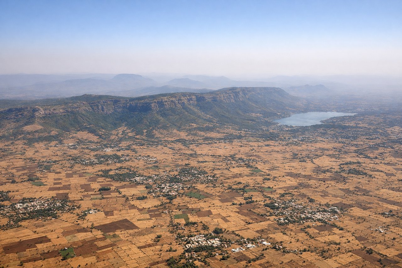
Takeoff from PNQ
RIGHTAs the aircraft climbs out from PNQ heading east, the right (south) side offers a brief look at Khadakwasla Dam's reservoir and the green foothills of the Sahyadris before the plane levels onto the flat Deccan plateau. The left side mostly shows Pune's northeastern suburbs fading into farmland with no distinct landmarks.
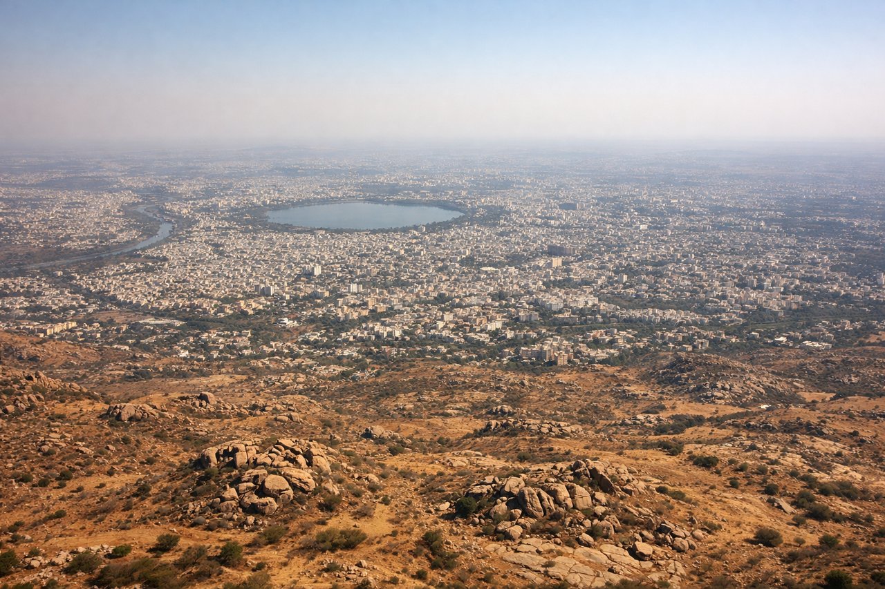
Landing at HYD
LEFTOn final approach into RGIA from the west, the left (north) side gives passengers a distant but clear view of Hyderabad's skyline, including Hussain Sagar Lake and the silhouette of Golconda Fort, before the runway threshold. The right side over Shamshabad's rural outskirts stays flat and featureless.
Will your flight be in sunlight?
Pick a date and time in the Sun Map to watch the sun move across your whole flight.
About This Route
Which side of the plane should I sit on flying from Pune (PNQ) to Rajiv Gandhi International Airport (HYD)?
Sit on the Left side of the plane for the best views on flights from Pune to Hyderabad. Both sides are dominated by flat Deccan plateau scenery typical of this short hop, but the left side's payoff comes during landing, when Hyderabad's skyline and Hussain Sagar Lake come into view, giving it a slight edge over the right side's brief reservoir glimpse at takeoff.
What can I see during takeoff from Pune in Pune?
During takeoff from Pune (PNQ), sit on the Right side for the best views. As the aircraft climbs out from PNQ heading east, the right (south) side offers a brief look at Khadakwasla Dam's reservoir and the green foothills of the Sahyadris before the plane levels onto the flat Deccan plateau. The left side mostly shows Pune's northeastern suburbs fading into farmland with no distinct landmarks. Notable sights include: Khadakwasla Dam reservoir, Sahyadri foothills (distant), Pune southern suburbs, Mutha River valley.
What can I see when landing at Rajiv Gandhi International Airport in Hyderabad?
When landing at Rajiv Gandhi International Airport (HYD), sit on the Left side for the best views. On final approach into RGIA from the west, the left (north) side gives passengers a distant but clear view of Hyderabad's skyline, including Hussain Sagar Lake and the silhouette of Golconda Fort, before the runway threshold. The right side over Shamshabad's rural outskirts stays flat and featureless. Notable sights include: Hyderabad skyline, Hussain Sagar Lake, Golconda Fort, Deccan plateau farmland near Shamshabad.
How long is the flight from Pune to Hyderabad?
The flight from Pune (PNQ) to Rajiv Gandhi International Airport (HYD) takes about 1 hour 15 minutes. The shortest flight path between them is 311 miles (500 km); winds and air traffic control usually add a few percent.
What does the Pune to Hyderabad flight path pass over?
Flat semi-arid Deccan plateau farmland, the Bhima River valley near Solapur, and the Ujani Dam reservoir just south of the direct flight path.