The right side scores higher (3.5 vs 2.5) because the landing approach to Thiruvananthapuram offers significantly more dramatic scenery: the Western Ghats mountains, the intricate backwater system, and the Arabian Sea coastline create visual variety and geographic interest. The takeoff from Pune is relatively flat and urban with minimal terrain drama. The landing sequence on the right side dominates the flight experience and justifies the higher overall score.
Flown PNQ to TRV? Did we get it right?
Flight Path
Pune to Trivandrum is 726 miles (1,169 km), a flight of about 2 hours 10 minutes.
Deccan Plateau terrain (flat to gently rolling, semi-arid), transition zone between plateau and Western Ghats foothills, Krishna River basin (southern section), early views of Western Ghats escarpment as flight approaches southern portion of route
Great circle distance and headings ›

Phase by phase
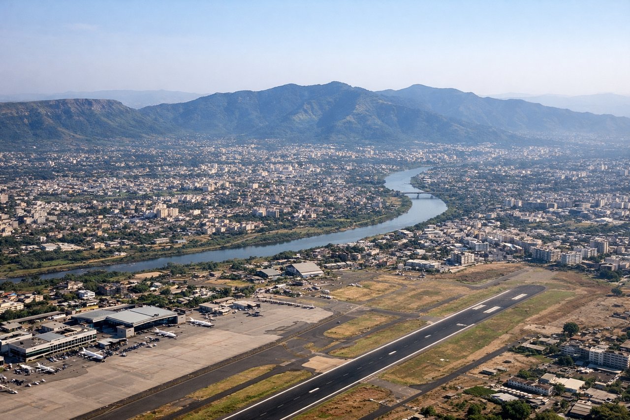
Takeoff from PNQ
LEFTPune's urban sprawl and surrounding Deccan Plateau terrain are visible on the left during climb-out. The city itself provides some urban detail, though the plateau is relatively flat and undramatic compared to what appears on approach to Thiruvananthapuram.

Landing at TRV
RIGHTThe approach to Thiruvananthapuram from the north reveals the dramatic transition from the Western Ghats mountains to the Kerala coastline and backwaters. The right side captures the lush green hills, the Neyyar River valley, and the Arabian Sea with its distinctive lagoons and lagoon systems that define the landscape around the airport.
Will your flight be in sunlight?
Pick a date and time in the Sun Map to watch the sun move across your whole flight.
About This Route
Which side of the plane should I sit on flying from Pune (PNQ) to Thiruvananthapuram International (TRV)?
Sit on the Right side of the plane for the best views on flights from Pune to Trivandrum. The right side scores higher (3.5 vs 2.5) because the landing approach to Thiruvananthapuram offers significantly more dramatic scenery: the Western Ghats mountains, the intricate backwater system, and the Arabian Sea coastline create visual variety and geographic interest. The takeoff from Pune is relatively flat and urban with minimal terrain drama. The landing sequence on the right side dominates the flight experience and justifies the higher overall score.
What can I see during takeoff from Pune in Pune?
During takeoff from Pune (PNQ), sit on the Left side for the best views. Pune's urban sprawl and surrounding Deccan Plateau terrain are visible on the left during climb-out. The city itself provides some urban detail, though the plateau is relatively flat and undramatic compared to what appears on approach to Thiruvananthapuram. Notable sights include: Pune city center and suburbs, Deccan Plateau escarpment (distant, low relief), Mula-Mutha River valley.
What can I see when landing at Thiruvananthapuram International in Trivandrum?
When landing at Thiruvananthapuram International (TRV), sit on the Right side for the best views. The approach to Thiruvananthapuram from the north reveals the dramatic transition from the Western Ghats mountains to the Kerala coastline and backwaters. The right side captures the lush green hills, the Neyyar River valley, and the Arabian Sea with its distinctive lagoons and lagoon systems that define the landscape around the airport. Notable sights include: Western Ghats mountain range (northern approach), Neyyar River and valley, Thiruvananthapuram backwaters and lagoons, Arabian Sea coastline.
How long is the flight from Pune to Trivandrum?
The flight from Pune (PNQ) to Thiruvananthapuram International (TRV) takes about 2 hours 10 minutes. The shortest flight path between them is 726 miles (1,169 km); winds and air traffic control usually add a few percent.
What does the Pune to Trivandrum flight path pass over?
Deccan Plateau terrain (flat to gently rolling, semi-arid), transition zone between plateau and Western Ghats foothills, Krishna River basin (southern section), early views of Western Ghats escarpment as flight approaches southern portion of route