Poznan to Warsaw is 176 miles (283 km), a flight of about 50 minutes.
Right-side seats offer better views during both takeoff (Poznan's river and city) and provide good perspective on the approach to Warsaw. The eastward flight path favors right-side viewing for the majority of the journey across the Masovian Plain.
Flight Path
Flat agricultural Masovian Plain with scattered villages and towns, Bzura River valley (tributary of Vistula), occasional lakes and ponds typical of glacial terrain, minimal elevation changes throughout the route
Great circle distance and headings ›Phase by phase
Takeoff from POZ
RIGHTPoznan's city center and the Warta River bend are positioned southeast of the runway. Right-side seats capture the urban sprawl and river meanders as the aircraft climbs eastward toward Warsaw.
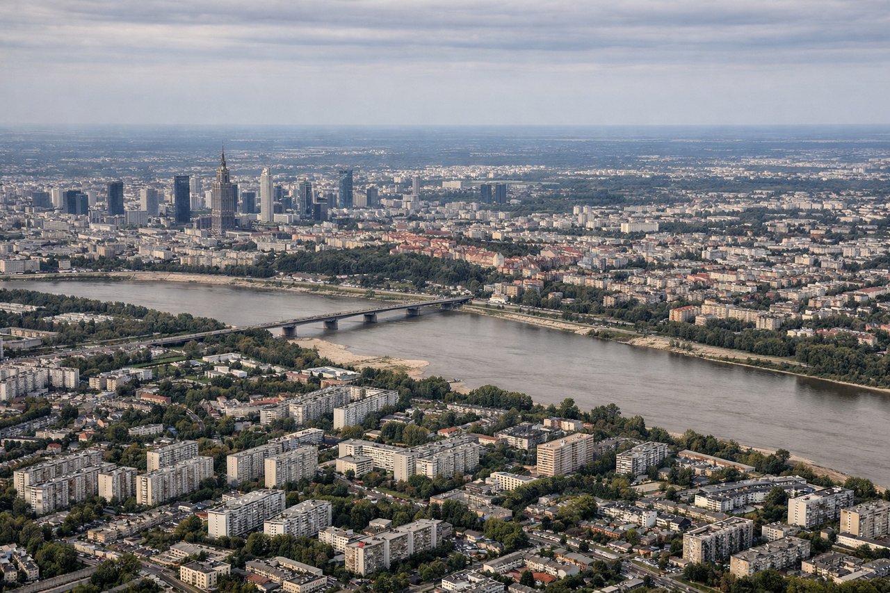
Landing at WAW
LEFTWarsaw's approach from the west brings the Vistula River and city center into view on the left side. The river's distinctive curves through the city and the urban density of central Warsaw are best framed from left-side seats during descent.
Will your flight be in sunlight?
Pick a date and time in the Sun Map to watch the sun move across your whole flight.
About This Route
Which side of the plane should I sit on flying from Lawica (POZ) to Okecie (WAW)?
Sit on the Right side of the plane for the best views on flights from Poznan to Warsaw. Right-side seats offer better views during both takeoff (Poznan's river and city) and provide good perspective on the approach to Warsaw. The eastward flight path favors right-side viewing for the majority of the journey across the Masovian Plain.
What can I see during takeoff from Lawica in Poznan?
During takeoff from Lawica (POZ), sit on the Right side for the best views. Poznan's city center and the Warta River bend are positioned southeast of the runway. Right-side seats capture the urban sprawl and river meanders as the aircraft climbs eastward toward Warsaw. Notable sights include: Poznan city center with its distinctive Old Town square, Warta River with visible oxbow bends, Lake Malta (artificial reservoir south of city), flat agricultural plains extending toward the horizon.
What can I see when landing at Okecie in Warsaw?
When landing at Okecie (WAW), sit on the Left side for the best views. Warsaw's approach from the west brings the Vistula River and city center into view on the left side. The river's distinctive curves through the city and the urban density of central Warsaw are best framed from left-side seats during descent. Notable sights include: Vistula River with its major bends through Warsaw, Warsaw city center and Old Town district, Masovian plain extending westward, suburban sprawl and approach corridors.
How long is the flight from Poznan to Warsaw?
The flight from Lawica (POZ) to Okecie (WAW) takes about 50 minutes. The shortest flight path between them is 176 miles (283 km); winds and air traffic control usually add a few percent.
What does the Poznan to Warsaw flight path pass over?
Flat agricultural Masovian Plain with scattered villages and towns, Bzura River valley (tributary of Vistula), occasional lakes and ponds typical of glacial terrain, minimal elevation changes throughout the route