Prosserpine to Brisbane is 556 miles (895 km), a flight of about 1 hour 50 minutes.
The left side wins because it captures the two most visually distinct features of this route: the Whitsunday Islands and reef waters at departure, and Moreton Bay's islands and the Brisbane River approach at arrival. The right side stays mostly over flat coastal plains and low ranges with less contrast.
Flight Path
The route roughly follows the Queensland coast southward, passing near Mackay and the Capricorn Coast around Rockhampton, with Great Keppel Island and the Fitzroy River delta visible near the midpoint before the path continues past the Fraser Coast and Hervey Bay toward the Sunshine Coast.
Great circle distance and headings ›
Phase by phase
Takeoff from PPP
LEFTDeparting Proserpine on runway 11 heads southeast toward the coast before the turn south toward Brisbane, giving left-side passengers a sweeping view of the Whitsunday Islands and the turquoise fringing reefs before the aircraft banks inland. The right side only shows the flat cane-field plains and distant Clarke Range foothills.
Landing at BNE
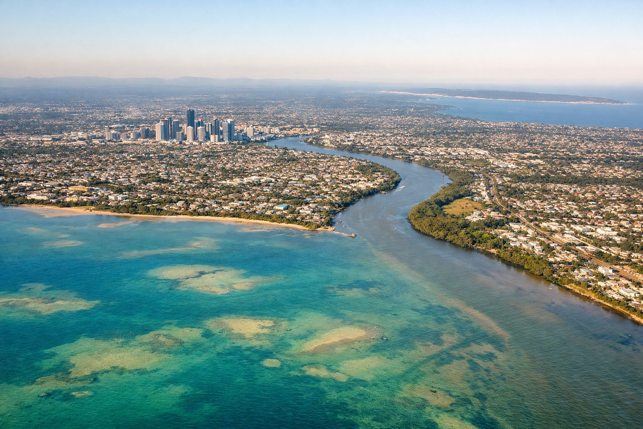
LEFTOn the descent into Brisbane from the north, the approach path tracks down over Moreton Bay, so left-side passengers get a clear look at the bay's sand islands and the Brisbane River winding toward the city skyline. The right side mostly shows suburban rooftops and the flatter inland terrain west of the airport.
Landmarks on this routeAll landmarks →
Will your flight be in sunlight?
Pick a date and time in the Sun Map to watch the sun move across your whole flight.
About This Route
Which side of the plane should I sit on flying from Proserpine Whitsunday Coast (PPP) to Brisbane International (BNE)?
Sit on the Left side of the plane for the best views on flights from Prosserpine to Brisbane. The left side wins because it captures the two most visually distinct features of this route: the Whitsunday Islands and reef waters at departure, and Moreton Bay's islands and the Brisbane River approach at arrival. The right side stays mostly over flat coastal plains and low ranges with less contrast.
What can I see during takeoff from Proserpine Whitsunday Coast in Prosserpine?
During takeoff from Proserpine Whitsunday Coast (PPP), sit on the Left side for the best views. Departing Proserpine on runway 11 heads southeast toward the coast before the turn south toward Brisbane, giving left-side passengers a sweeping view of the Whitsunday Islands and the turquoise fringing reefs before the aircraft banks inland. The right side only shows the flat cane-field plains and distant Clarke Range foothills. Notable sights include: Whitsunday Islands, Coral Sea coastline, Airlie Beach headlands, Conway National Park ridgelines.
What can I see when landing at Brisbane International in Brisbane?
When landing at Brisbane International (BNE), sit on the Left side for the best views. On the descent into Brisbane from the north, the approach path tracks down over Moreton Bay, so left-side passengers get a clear look at the bay's sand islands and the Brisbane River winding toward the city skyline. The right side mostly shows suburban rooftops and the flatter inland terrain west of the airport. Notable sights include: Moreton Bay, Moreton Island, North Stradbroke Island, Brisbane River mouth and CBD skyline.
How long is the flight from Prosserpine to Brisbane?
The flight from Proserpine Whitsunday Coast (PPP) to Brisbane International (BNE) takes about 1 hour 50 minutes. The shortest flight path between them is 556 miles (895 km); winds and air traffic control usually add a few percent.
What does the Prosserpine to Brisbane flight path pass over?
The route roughly follows the Queensland coast southward, passing near Mackay and the Capricorn Coast around Rockhampton, with Great Keppel Island and the Fitzroy River delta visible near the midpoint before the path continues past the Fraser Coast and Hervey Bay toward the Sunshine Coast.