Prosserpine to Melbourne is 1,207 miles (1,943 km), a flight of about 3 hours 15 minutes.
The takeoff view of the Whitsunday Islands and Coral Sea is more visually distinctive and geographically dramatic than the landing approach. While the landing offers Port Phillip Bay and the city skyline, the island archipelago at takeoff provides more varied and striking aerial scenery.
Flight Path
The flight path crosses inland Queensland, passing west of the Great Dividing Range. Notable features include the Mackay region (agricultural and mining areas), the transition from tropical to subtropical landscape around latitude -25°, and the Brisbane metropolitan area and Moreton Bay region (visible if passing near Brisbane airspace). The flight then crosses into New South Wales, passing over the Northern Tablelands and New England region before descending toward Victoria.
Great circle distance and headings ›
Phase by phase
Takeoff from PPP
RIGHTProserpine typically departs to the northeast or east. Right-side seats face toward the Whitsunday Islands and Coral Sea immediately after takeoff, offering clear views of the island archipelago and reef systems. Left seats face inland toward less visually distinctive terrain.
Landing at MEL
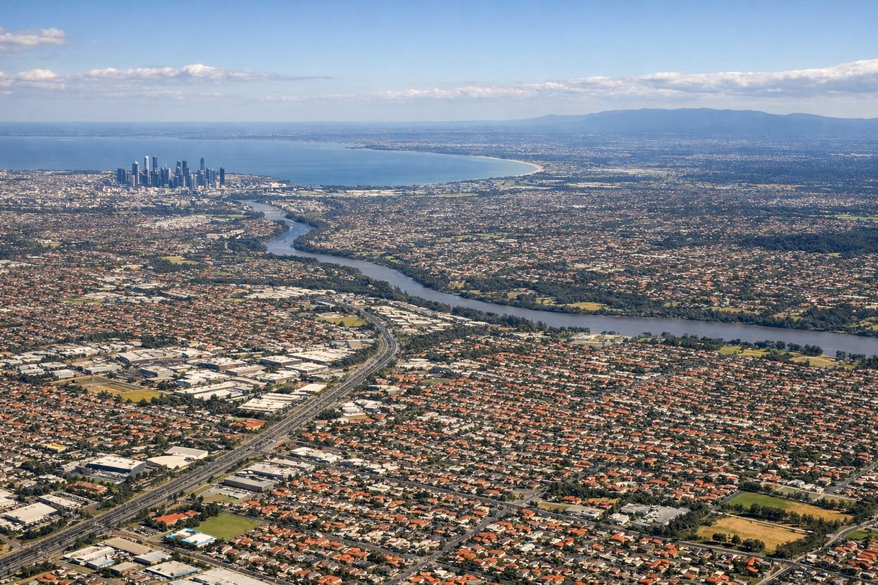
LEFTMelbourne typically lands on runways 27 or 09 depending on wind. Approach vectors from the north mean left-side seats face toward Port Phillip Bay and the city skyline during descent. Right seats face inland toward less distinctive suburban sprawl and farmland.
Landmarks on this routeAll landmarks →
Will your flight be in sunlight?
Pick a date and time in the Sun Map to watch the sun move across your whole flight.
About This Route
Which side of the plane should I sit on flying from Proserpine Whitsunday Coast (PPP) to Melbourne International (MEL)?
Sit on the Right side of the plane for the best views on flights from Prosserpine to Melbourne. The takeoff view of the Whitsunday Islands and Coral Sea is more visually distinctive and geographically dramatic than the landing approach. While the landing offers Port Phillip Bay and the city skyline, the island archipelago at takeoff provides more varied and striking aerial scenery.
What can I see during takeoff from Proserpine Whitsunday Coast in Prosserpine?
During takeoff from Proserpine Whitsunday Coast (PPP), sit on the Right side for the best views. Proserpine typically departs to the northeast or east. Right-side seats face toward the Whitsunday Islands and Coral Sea immediately after takeoff, offering clear views of the island archipelago and reef systems. Left seats face inland toward less visually distinctive terrain. Notable sights include: Whitsunday Islands (scattered across the Coral Sea to the east), Repulse Bay (coastal inlet visible below), Pioneer Valley (inland agricultural area to the west), Shute Harbour (small coastal settlement southeast).
What can I see when landing at Melbourne International in Melbourne?
When landing at Melbourne International (MEL), sit on the Left side for the best views. Melbourne typically lands on runways 27 or 09 depending on wind. Approach vectors from the north mean left-side seats face toward Port Phillip Bay and the city skyline during descent. Right seats face inland toward less distinctive suburban sprawl and farmland. Notable sights include: Port Phillip Bay (large enclosed bay dominating the approach), Melbourne CBD skyline (visible as a cluster of tall buildings on the horizon), Dandenong Ranges (forested hills to the east appearing as a dark ridge), Yarra River (winding through the city, visible as a dark line through urban areas).
How long is the flight from Prosserpine to Melbourne?
The flight from Proserpine Whitsunday Coast (PPP) to Melbourne International (MEL) takes about 3 hours 15 minutes. The shortest flight path between them is 1,207 miles (1,943 km); winds and air traffic control usually add a few percent.
What does the Prosserpine to Melbourne flight path pass over?
The flight path crosses inland Queensland, passing west of the Great Dividing Range. Notable features include the Mackay region (agricultural and mining areas), the transition from tropical to subtropical landscape around latitude -25°, and the Brisbane metropolitan area and Moreton Bay region (visible if passing near Brisbane airspace). The flight then crosses into New South Wales, passing over the Northern Tablelands and New England region before descending toward Victoria.