Punta Arenas to Santiago is 1,355 miles (2,180 km), a flight of about 3 hours 30 minutes.
The left side captures the flight's signature scenery: Torres del Paine and the Patagonian ice field right after takeoff, the fjords and Lake District volcanoes along the cruise track, and a close Andes view on final approach into Santiago. The right side spends most of the flight over the comparatively flat Argentine steppe and central Chilean valley.
Flight Path
Around the midpoint near Puerto Montt and Chiloe Island, the route passes the Chilean Lake District, where snow-capped stratovolcanoes like Osorno and Villarrica rise above forested foothills and glacial lakes, visible to the left of the flight path.
Great circle distance and headings ›


Phase by phase
Takeoff from PUQ
LEFTOnce the aircraft turns north out of Punta Arenas, the left side faces west toward the granite spires of Torres del Paine and the edge of the Southern Patagonian Ice Field, with the braided channels of the Strait of Magellan and Otway Sound receding below. The right side mostly shows the flat Argentine Patagonian steppe, which is comparatively featureless.
Landing at SCL
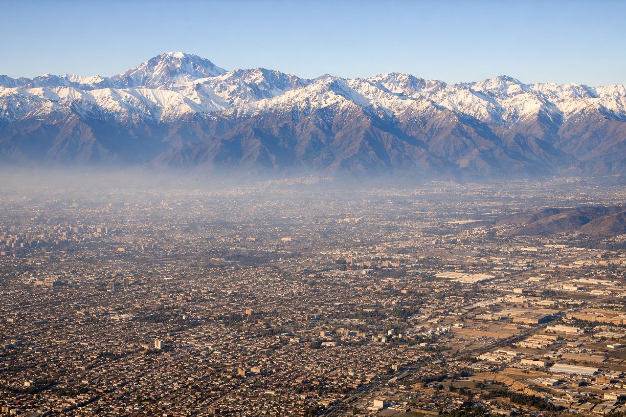
LEFTArrivals into Santiago typically loop around and land heading south, which puts the Andes on the left side during final descent. Passengers get a close view of snow-capped peaks framing the Maipo Valley and the eastern edge of the city just before touchdown, while the right side only shows the flatter coastal hills toward Valparaiso.
Landmarks on this routeAll landmarks →
Will your flight be in sunlight?
Pick a date and time in the Sun Map to watch the sun move across your whole flight.
About This Route
Which side of the plane should I sit on flying from Carlos Ibanez Del Campo International (PUQ) to Arturo Merino Benitez International (SCL)?
Sit on the Left side of the plane for the best views on flights from Punta Arenas to Santiago. The left side captures the flight's signature scenery: Torres del Paine and the Patagonian ice field right after takeoff, the fjords and Lake District volcanoes along the cruise track, and a close Andes view on final approach into Santiago. The right side spends most of the flight over the comparatively flat Argentine steppe and central Chilean valley.
What can I see during takeoff from Carlos Ibanez Del Campo International in Punta Arenas?
During takeoff from Carlos Ibanez Del Campo International (PUQ), sit on the Left side for the best views. Once the aircraft turns north out of Punta Arenas, the left side faces west toward the granite spires of Torres del Paine and the edge of the Southern Patagonian Ice Field, with the braided channels of the Strait of Magellan and Otway Sound receding below. The right side mostly shows the flat Argentine Patagonian steppe, which is comparatively featureless. Notable sights include: Torres del Paine massif, Southern Patagonian Ice Field, Strait of Magellan, Otway Sound fjord channels.
What can I see when landing at Arturo Merino Benitez International in Santiago?
When landing at Arturo Merino Benitez International (SCL), sit on the Left side for the best views. Arrivals into Santiago typically loop around and land heading south, which puts the Andes on the left side during final descent. Passengers get a close view of snow-capped peaks framing the Maipo Valley and the eastern edge of the city just before touchdown, while the right side only shows the flatter coastal hills toward Valparaiso. Notable sights include: Andes Cordillera peaks (Cerro El Plomo, La Parva/Farellones ski slopes), Maipo Valley vineyards, Santiago's eastern skyline, distant Aconcagua on very clear days.
How long is the flight from Punta Arenas to Santiago?
The flight from Carlos Ibanez Del Campo International (PUQ) to Arturo Merino Benitez International (SCL) takes about 3 hours 30 minutes. The shortest flight path between them is 1,355 miles (2,180 km); winds and air traffic control usually add a few percent.
What does the Punta Arenas to Santiago flight path pass over?
Around the midpoint near Puerto Montt and Chiloe Island, the route passes the Chilean Lake District, where snow-capped stratovolcanoes like Osorno and Villarrica rise above forested foothills and glacial lakes, visible to the left of the flight path.