Santiago to Punta Arenas is 1,355 miles (2,180 km), a flight of about 3 hours 30 minutes.
The east-facing side tracks the spine of the Andes for nearly the entire flight, offering volcanoes near Santiago, the Patagonian ice fields mid-route, and the Strait of Magellan on arrival — a continuously changing, high-drama landscape that the ocean-and-fjord west side, often masked by marine cloud, can't match.
Flight Path
Northern Patagonian Ice Field and Southern Patagonian Ice Field along the Andes, volcanic peaks near Osorno and Chaitén, the Chonos Archipelago and Chiloé Island visible further west toward the Pacific coast
Great circle distance and headings ›

Phase by phase
Takeoff from SCL
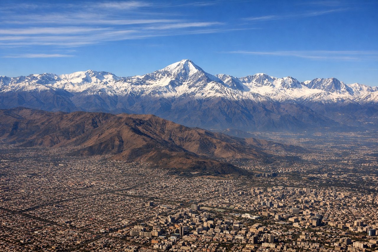
LEFTDeparting SCL to the south, the Andes rise immediately to the east of the aircraft, with Aconcagua's snowcapped massif and the volcanic cones of Tupungato and Maipo visible right off the wingtip during initial climb. The Santiago valley itself, framed by the cordillera, adds a dramatic urban-to-mountain contrast rarely matched on takeoff.
Landing at PUQ
LEFTOn final approach into PUQ from the north, the aircraft typically lines up for runway 25, putting the Strait of Magellan and the mountainous silhouette of Tierra del Fuego on the southern (left) side of the cabin. This is a rare, dramatic close to the flight, with the strait's steel-grey water and the Brunswick Peninsula's steppe visible just before touchdown.
Landmarks on this routeAll landmarks →
Will your flight be in sunlight?
Pick a date and time in the Sun Map to watch the sun move across your whole flight.
About This Route
Which side of the plane should I sit on flying from Arturo Merino Benitez International (SCL) to Carlos Ibanez Del Campo International (PUQ)?
Sit on the Left side of the plane for the best views on flights from Santiago to Punta Arenas. The east-facing side tracks the spine of the Andes for nearly the entire flight, offering volcanoes near Santiago, the Patagonian ice fields mid-route, and the Strait of Magellan on arrival — a continuously changing, high-drama landscape that the ocean-and-fjord west side, often masked by marine cloud, can't match.
What can I see during takeoff from Arturo Merino Benitez International in Santiago?
During takeoff from Arturo Merino Benitez International (SCL), sit on the Left side for the best views. Departing SCL to the south, the Andes rise immediately to the east of the aircraft, with Aconcagua's snowcapped massif and the volcanic cones of Tupungato and Maipo visible right off the wingtip during initial climb. The Santiago valley itself, framed by the cordillera, adds a dramatic urban-to-mountain contrast rarely matched on takeoff. Notable sights include: Aconcagua, Tupungato Volcano, Maipo Volcano, Santiago's eastern foothill suburbs.
What can I see when landing at Carlos Ibanez Del Campo International in Punta Arenas?
When landing at Carlos Ibanez Del Campo International (PUQ), sit on the Left side for the best views. On final approach into PUQ from the north, the aircraft typically lines up for runway 25, putting the Strait of Magellan and the mountainous silhouette of Tierra del Fuego on the southern (left) side of the cabin. This is a rare, dramatic close to the flight, with the strait's steel-grey water and the Brunswick Peninsula's steppe visible just before touchdown. Notable sights include: Strait of Magellan, Tierra del Fuego, Brunswick Peninsula, Punta Arenas waterfront.
How long is the flight from Santiago to Punta Arenas?
The flight from Arturo Merino Benitez International (SCL) to Carlos Ibanez Del Campo International (PUQ) takes about 3 hours 30 minutes. The shortest flight path between them is 1,355 miles (2,180 km); winds and air traffic control usually add a few percent.
What does the Santiago to Punta Arenas flight path pass over?
Northern Patagonian Ice Field and Southern Patagonian Ice Field along the Andes, volcanic peaks near Osorno and Chaitén, the Chonos Archipelago and Chiloé Island visible further west toward the Pacific coast