While the left side offers dramatic volcanic terrain during takeoff from Redding, the right side provides more consistent scenic value across the full flight. The approach into Toronto over Lake Ontario and the waterfront delivers compelling urban and water scenery during landing, whereas the left side over the Midwest offers primarily flat agricultural terrain for most of the cruise. Right seats capture both the departure drama (Cascades visible to the left/north) and the arrival spectacle (Great Lakes and Toronto skyline), making it the stronger choice overall.
Flown RDD to YYZ? Did we get it right?
Flight Path
Redding to Toronto is 2,174 miles (3,499 km), a flight of about 5 hours 15 minutes.
The flight path crosses the Sierra Nevada and Cascade ranges during initial climb, then traverses the Great Basin and Rocky Mountains (visible to the north/left). Over the Midwest, the route passes north of the Great Plains, with the Upper Mississippi River valley and Great Lakes region becoming prominent in the final hours. Lake Michigan appears on the left during the approach corridor into Toronto. The entire route follows a great-circle path that maximizes views of major mountain ranges during the first 2 hours and water features during the final descent.
Great circle distance and headings ›


Phase by phase
Takeoff from RDD
LEFTRedding sits in the northern Sacramento Valley with the Cascade Range and Sierra Nevada immediately visible to the east and southeast. Left (north/northeast) seats capture the volcanic peaks and forested terrain of the southern Cascades during climb-out, offering immediate dramatic relief from the valley floor.
Landing at YYZ
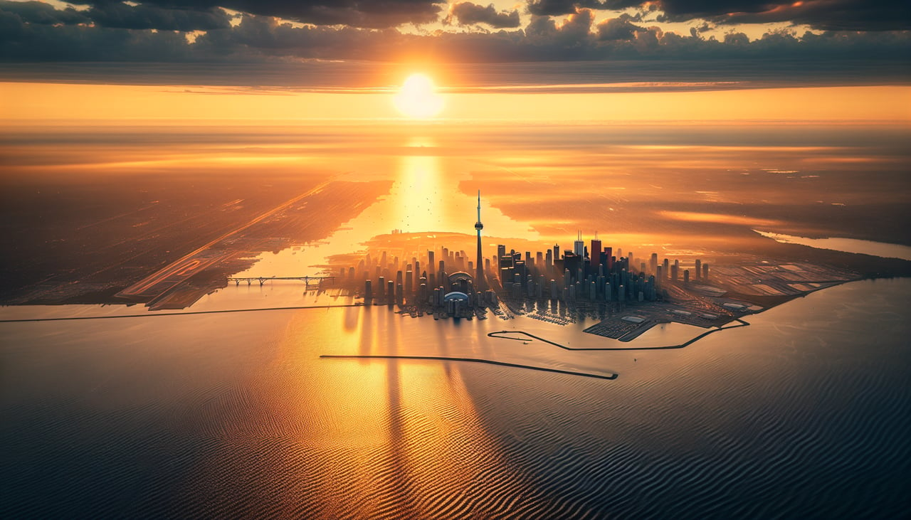
RIGHTThe approach to Toronto from the west brings aircraft over the Great Lakes and the Ontario shoreline. Right (south/southeast) seats offer views of Lake Ontario's expanse, the Toronto waterfront with its harbor and downtown skyline, and the Scarborough Bluffs during descent. This provides urban scenery and water features absent on the left side.
Will your flight be in sunlight?
Pick a date and time in the Sun Map to watch the sun move across your whole flight.
About This Route
Which side of the plane should I sit on flying from Redding Municipal Airport (RDD) to Lester B Pearson International (YYZ)?
Sit on the Right side of the plane for the best views on flights from Redding to Toronto. While the left side offers dramatic volcanic terrain during takeoff from Redding, the right side provides more consistent scenic value across the full flight. The approach into Toronto over Lake Ontario and the waterfront delivers compelling urban and water scenery during landing, whereas the left side over the Midwest offers primarily flat agricultural terrain for most of the cruise. Right seats capture both the departure drama (Cascades visible to the left/north) and the arrival spectacle (Great Lakes and Toronto skyline), making it the stronger choice overall.
What can I see during takeoff from Redding Municipal Airport in Redding?
During takeoff from Redding Municipal Airport (RDD), sit on the Left side for the best views. Redding sits in the northern Sacramento Valley with the Cascade Range and Sierra Nevada immediately visible to the east and southeast. Left (north/northeast) seats capture the volcanic peaks and forested terrain of the southern Cascades during climb-out, offering immediate dramatic relief from the valley floor. Notable sights include: Mount Shasta (visible ~80 miles northeast), Lassen Volcanic National Park region, Sacramento Valley floor, Pit River canyon system.
What can I see when landing at Lester B Pearson International in Toronto?
When landing at Lester B Pearson International (YYZ), sit on the Right side for the best views. The approach to Toronto from the west brings aircraft over the Great Lakes and the Ontario shoreline. Right (south/southeast) seats offer views of Lake Ontario's expanse, the Toronto waterfront with its harbor and downtown skyline, and the Scarborough Bluffs during descent. This provides urban scenery and water features absent on the left side. Notable sights include: Lake Ontario, Toronto harbor and waterfront, Scarborough Bluffs, downtown Toronto skyline.
How long is the flight from Redding to Toronto?
The flight from Redding Municipal Airport (RDD) to Lester B Pearson International (YYZ) takes about 5 hours 15 minutes. The shortest flight path between them is 2,174 miles (3,499 km); winds and air traffic control usually add a few percent.
What does the Redding to Toronto flight path pass over?
The flight path crosses the Sierra Nevada and Cascade ranges during initial climb, then traverses the Great Basin and Rocky Mountains (visible to the north/left). Over the Midwest, the route passes north of the Great Plains, with the Upper Mississippi River valley and Great Lakes region becoming prominent in the final hours. Lake Michigan appears on the left during the approach corridor into Toronto. The entire route follows a great-circle path that maximizes views of major mountain ranges during the first 2 hours and water features during the final descent.