While left offers better takeoff views of the Piedmont landscape, right provides superior landing scenery with Lake Ontario and the Niagara Escarpment. The landing approach is longer and more visually rewarding, making right the better overall choice for this northbound route.
Flown RDU to BUF? Did we get it right?
Flight Path
Raleigh-Durham to Buffalo is 488 miles (785 km), a flight of about 1 hour 45 minutes.
The flight path crosses the Appalachian foothills of Pennsylvania and West Virginia, passing east of the Blue Ridge Mountains. Notable features include the Susquehanna River valley in Pennsylvania, the ridge-and-valley topography of the Appalachian region, and the transition from Piedmont to Appalachian terrain. The Allegheny Plateau becomes visible in the latter portion of the flight before descending into the Great Lakes region and Lake Ontario.
Great circle distance and headings ›

Phase by phase
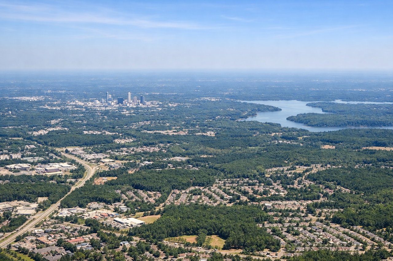
Takeoff from RDU
LEFTLeft side offers views of the Neuse River valley and the transition from Raleigh's urban sprawl into the Piedmont region. Right side faces mostly inland terrain with fewer distinctive landmarks during initial climb.
Landing at BUF
RIGHTRight side provides views of Lake Ontario's shoreline and the Niagara Escarpment as you descend into Buffalo. Left side faces inland terrain with fewer distinctive visual features during approach.
Will your flight be in sunlight?
Pick a date and time in the Sun Map to watch the sun move across your whole flight.
About This Route
Which side of the plane should I sit on flying from Raleigh Durham International (RDU) to Buffalo Niagara International (BUF)?
Sit on the Right side of the plane for the best views on flights from Raleigh-Durham to Buffalo. While left offers better takeoff views of the Piedmont landscape, right provides superior landing scenery with Lake Ontario and the Niagara Escarpment. The landing approach is longer and more visually rewarding, making right the better overall choice for this northbound route.
What can I see during takeoff from Raleigh Durham International in Raleigh-Durham?
During takeoff from Raleigh Durham International (RDU), sit on the Left side for the best views. Left side offers views of the Neuse River valley and the transition from Raleigh's urban sprawl into the Piedmont region. Right side faces mostly inland terrain with fewer distinctive landmarks during initial climb. Notable sights include: Neuse River, Raleigh city grid, Jordan Lake (visible to the northwest), Piedmont foothills.
What can I see when landing at Buffalo Niagara International in Buffalo?
When landing at Buffalo Niagara International (BUF), sit on the Right side for the best views. Right side provides views of Lake Ontario's shoreline and the Niagara Escarpment as you descend into Buffalo. Left side faces inland terrain with fewer distinctive visual features during approach. Notable sights include: Lake Ontario, Niagara Escarpment, Niagara River, Buffalo city waterfront.
How long is the flight from Raleigh-Durham to Buffalo?
The flight from Raleigh Durham International (RDU) to Buffalo Niagara International (BUF) takes about 1 hour 45 minutes. The shortest flight path between them is 488 miles (785 km); winds and air traffic control usually add a few percent.
What does the Raleigh-Durham to Buffalo flight path pass over?
The flight path crosses the Appalachian foothills of Pennsylvania and West Virginia, passing east of the Blue Ridge Mountains. Notable features include the Susquehanna River valley in Pennsylvania, the ridge-and-valley topography of the Appalachian region, and the transition from Piedmont to Appalachian terrain. The Allegheny Plateau becomes visible in the latter portion of the flight before descending into the Great Lakes region and Lake Ontario.