The right side offers the better overall experience. While left is marginally better at takeoff for Raleigh city views, the right side during the cruise and descent provides the Piedmont-to-Appalachian foothills transition view and the far superior arrival sequence over the Potomac corridor and greater Washington area.
Flown RDU to IAD? Did we get it right?
Flight Path
Raleigh-Durham to Washington is 224 miles (361 km), a flight of about 1 hour 5 minutes.
The flight tracks roughly north-northeast over the Virginia Piedmont. Notable features include the Dan River basin in southern Virginia, the rolling terrain of the Virginia Piedmont transitioning from flat Carolinas, the Rappahannock River crossing in central Virginia, and the broad agricultural and forested landscape of Culpeper and Fauquier counties before descending into the Northern Virginia suburbs.
Great circle distance and headings ›Phase by phase
Takeoff from RDU
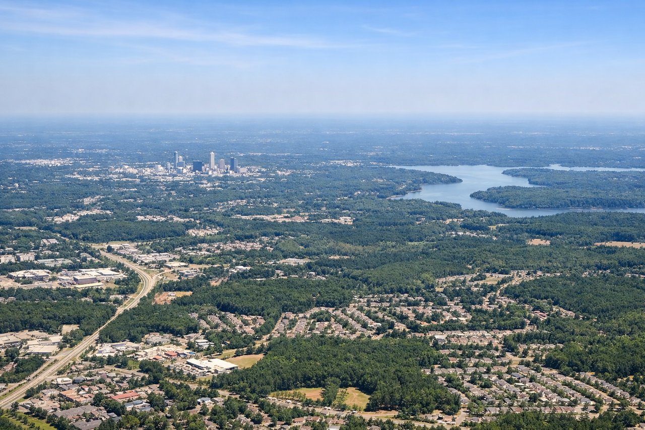
LEFTRDU's primary departure runway 23L sends aircraft southwest before turning north, putting the left side over downtown Raleigh and the Research Triangle urban core. You get a clear look at the city grid and Jordan Lake to the southwest before the aircraft banks northward.
Landing at IAD
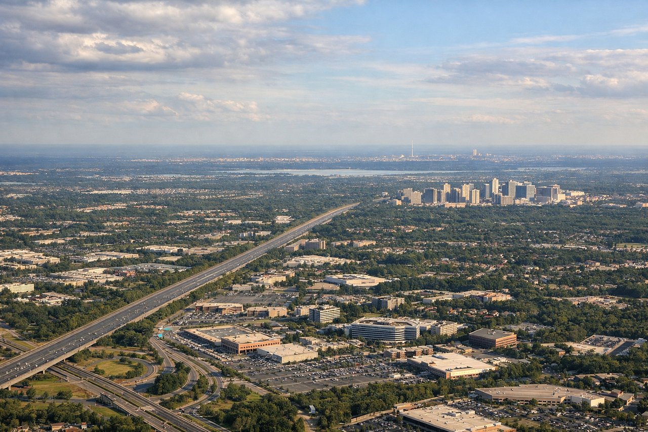
RIGHTIAD typically receives arrivals from the south on runways 01L/01R or 19L/19R depending on winds. On a southerly approach to runway 01, the right side faces east toward the Potomac River corridor, the Virginia suburbs, and on clear days the distant Washington DC monuments. The left side faces west into rural Loudoun County farmland.
Will your flight be in sunlight?
Pick a date and time in the Sun Map to watch the sun move across your whole flight.
About This Route
Which side of the plane should I sit on flying from Raleigh Durham International (RDU) to Washington Dulles International (IAD)?
Sit on the Right side of the plane for the best views on flights from Raleigh-Durham to Washington. The right side offers the better overall experience. While left is marginally better at takeoff for Raleigh city views, the right side during the cruise and descent provides the Piedmont-to-Appalachian foothills transition view and the far superior arrival sequence over the Potomac corridor and greater Washington area.
What can I see during takeoff from Raleigh Durham International in Raleigh-Durham?
During takeoff from Raleigh Durham International (RDU), sit on the Left side for the best views. RDU's primary departure runway 23L sends aircraft southwest before turning north, putting the left side over downtown Raleigh and the Research Triangle urban core. You get a clear look at the city grid and Jordan Lake to the southwest before the aircraft banks northward. Notable sights include: Downtown Raleigh skyline, Jordan Lake reservoir, Falls Lake reservoir to the north, Research Triangle Park campus sprawl.
What can I see when landing at Washington Dulles International in Washington?
When landing at Washington Dulles International (IAD), sit on the Right side for the best views. IAD typically receives arrivals from the south on runways 01L/01R or 19L/19R depending on winds. On a southerly approach to runway 01, the right side faces east toward the Potomac River corridor, the Virginia suburbs, and on clear days the distant Washington DC monuments. The left side faces west into rural Loudoun County farmland. Notable sights include: Potomac River corridor, Dulles Toll Road and Route 28 interchange below, Tysons Corner office cluster to the east, distant Washington DC skyline on the horizon.
How long is the flight from Raleigh-Durham to Washington?
The flight from Raleigh Durham International (RDU) to Washington Dulles International (IAD) takes about 1 hour 5 minutes. The shortest flight path between them is 224 miles (361 km); winds and air traffic control usually add a few percent.
What does the Raleigh-Durham to Washington flight path pass over?
The flight tracks roughly north-northeast over the Virginia Piedmont. Notable features include the Dan River basin in southern Virginia, the rolling terrain of the Virginia Piedmont transitioning from flat Carolinas, the Rappahannock River crossing in central Virginia, and the broad agricultural and forested landscape of Culpeper and Fauquier counties before descending into the Northern Virginia suburbs.