Colombo to Kuwait is 2,590 miles (4,168 km), a flight of about 4 hours 15 minutes.
Right-side seats capture the more dramatic geography: the Sri Lankan coast and highlands during departure, then the Arabian Sea crossing, and finally the Persian Gulf's shallow waters and Kuwait's coastal features during approach. Left side offers less varied scenery over the open ocean crossing.
Flight Path
Arabian Sea (open water, minimal landmarks), Oman coastline (visible from altitude as a distant dark line if flying northern route), Strait of Hormuz approaches (if routing via northern corridor—visible as the convergence of Persian Gulf waters), scattered shipping traffic throughout the route
Great circle distance and headings ›.jpeg?width=600)


_and_the_Dubai_skyline_(25781049892).jpg?width=600)
.jpg?width=600)

Phase by phase
Takeoff from RML
RIGHTColombo typically departs eastbound (Runway 04). Right-side seats offer views of the Indian Ocean and Colombo's coastal geography as you climb out over the Negombo Lagoon area, then the central highlands come into view during the climb.
Landing at KWI
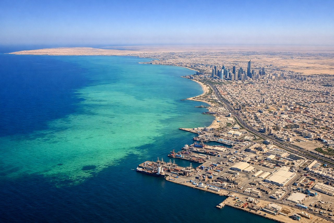
LEFTKuwait typically lands westbound (Runway 30L/30R). Left-side seats provide views of the Persian Gulf's shallow turquoise waters and the Kuwait coastline during descent. You'll see the distinctive flat desert terrain and the gulf's characteristic shallow banks and shipping lanes.
Landmarks on this routeAll landmarks →
Will your flight be in sunlight?
Pick a date and time in the Sun Map to watch the sun move across your whole flight.
About This Route
Which side of the plane should I sit on flying from Colombo Ratmalana (RML) to Kuwait International Airport (KWI)?
Sit on the Right side of the plane for the best views on flights from Colombo to Kuwait. Right-side seats capture the more dramatic geography: the Sri Lankan coast and highlands during departure, then the Arabian Sea crossing, and finally the Persian Gulf's shallow waters and Kuwait's coastal features during approach. Left side offers less varied scenery over the open ocean crossing.
What can I see during takeoff from Colombo Ratmalana in Colombo?
During takeoff from Colombo Ratmalana (RML), sit on the Right side for the best views. Colombo typically departs eastbound (Runway 04). Right-side seats offer views of the Indian Ocean and Colombo's coastal geography as you climb out over the Negombo Lagoon area, then the central highlands come into view during the climb. Notable sights include: Indian Ocean (immediate offshore), Negombo Lagoon (shallow water body north of Colombo), Colombo city grid and harbor, central Sri Lankan highlands (distant, appearing as elevated terrain to the east).
What can I see when landing at Kuwait International Airport in Kuwait?
When landing at Kuwait International Airport (KWI), sit on the Left side for the best views. Kuwait typically lands westbound (Runway 30L/30R). Left-side seats provide views of the Persian Gulf's shallow turquoise waters and the Kuwait coastline during descent. You'll see the distinctive flat desert terrain and the gulf's characteristic shallow banks and shipping lanes. Notable sights include: Persian Gulf (shallow turquoise waters with visible sandbars), Kuwait coastline and Shuwaikh Port area, flat desert interior (beige and tan), offshore oil platforms and tanker traffic.
How long is the flight from Colombo to Kuwait?
The flight from Colombo Ratmalana (RML) to Kuwait International Airport (KWI) takes about 4 hours 15 minutes. The shortest flight path between them is 2,590 miles (4,168 km); winds and air traffic control usually add a few percent.
What does the Colombo to Kuwait flight path pass over?
Arabian Sea (open water, minimal landmarks), Oman coastline (visible from altitude as a distant dark line if flying northern route), Strait of Hormuz approaches (if routing via northern corridor—visible as the convergence of Persian Gulf waters), scattered shipping traffic throughout the route