The right side scores higher (3.0 vs 2.5) due to superior scenic variety across the full flight. Takeoff from RMO offers the Prut River valley and Carpathian foothills transition; the cruise phase crosses the Carpathian Mountains and Danube valley (visible from the right side of the aircraft's westward track); and the CDG approach provides the Seine River meanders and Paris suburban landscape. The left side remains predominantly flat agricultural plains throughout, with minimal terrain drama or recognizable landmarks.
Flown RMO to CDG? Did we get it right?
Flight Path
Chişinău to Paris is 1,222 miles (1,967 km), a flight of about 2 hours 45 minutes.
Carpathian Mountains (central Romania, visible as a major east-west ridge during cruise at 35,000 feet); Danube River valley (southern Romania, appearing as a broad silvery corridor); Transylvanian Plateau (elevated terrain between Carpathian ranges); Hungarian Plain (flat agricultural landscape west of the Carpathians); Île-de-France region (rolling farmland and forests surrounding Paris basin)
Great circle distance and headings ›Phase by phase
Takeoff from RMO
RIGHTRight-side departures from RMO runway 08 or 26 offer views of the Prut River valley and the transition from Moldovan plains toward the Carpathian foothills. Left-side views show flat agricultural plains with minimal terrain variation.
Landing at CDG
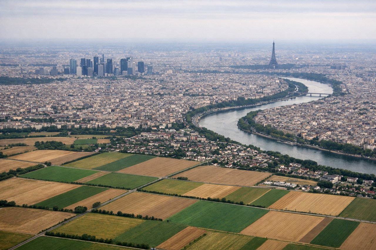
RIGHTRight-side approaches to CDG (typically runways 26R/27L with westerly winds) descend over the Seine River valley and suburban Paris, offering views of the Île-de-France region, the Seine's meanders, and the city's urban sprawl. Left-side approaches show open farmland and forest with fewer distinctive landmarks.
Will your flight be in sunlight?
Pick a date and time in the Sun Map to watch the sun move across your whole flight.
About This Route
Which side of the plane should I sit on flying from Chişinău International Airport (RMO) to Charles De Gaulle (CDG)?
Sit on the Right side of the plane for the best views on flights from Chişinău to Paris. The right side scores higher (3.0 vs 2.5) due to superior scenic variety across the full flight. Takeoff from RMO offers the Prut River valley and Carpathian foothills transition; the cruise phase crosses the Carpathian Mountains and Danube valley (visible from the right side of the aircraft's westward track); and the CDG approach provides the Seine River meanders and Paris suburban landscape. The left side remains predominantly flat agricultural plains throughout, with minimal terrain drama or recognizable landmarks.
What can I see during takeoff from Chişinău International Airport in Chişinău?
During takeoff from Chişinău International Airport (RMO), sit on the Right side for the best views. Right-side departures from RMO runway 08 or 26 offer views of the Prut River valley and the transition from Moldovan plains toward the Carpathian foothills. Left-side views show flat agricultural plains with minimal terrain variation. Notable sights include: Prut River (Moldova-Romania border), Carpathian Mountain foothills to the west, Chişinău urban sprawl receding southward.
What can I see when landing at Charles De Gaulle in Paris?
When landing at Charles De Gaulle (CDG), sit on the Right side for the best views. Right-side approaches to CDG (typically runways 26R/27L with westerly winds) descend over the Seine River valley and suburban Paris, offering views of the Île-de-France region, the Seine's meanders, and the city's urban sprawl. Left-side approaches show open farmland and forest with fewer distinctive landmarks. Notable sights include: Seine River with its characteristic meanders, suburban Paris (Roissy district and northern suburbs), Île-de-France agricultural landscape, CDG airport complex itself.
How long is the flight from Chişinău to Paris?
The flight from Chişinău International Airport (RMO) to Charles De Gaulle (CDG) takes about 2 hours 45 minutes. The shortest flight path between them is 1,222 miles (1,967 km); winds and air traffic control usually add a few percent.
What does the Chişinău to Paris flight path pass over?
Carpathian Mountains (central Romania, visible as a major east-west ridge during cruise at 35,000 feet); Danube River valley (southern Romania, appearing as a broad silvery corridor); Transylvanian Plateau (elevated terrain between Carpathian ranges); Hungarian Plain (flat agricultural landscape west of the Carpathians); Île-de-France region (rolling farmland and forests surrounding Paris basin)