Reno to Las Vegas is 345 miles (556 km), a flight of about 1 hour 15 minutes.
The right side wins both phases of the flight: dramatic Sierra Nevada terrain during departure from Reno and the iconic Las Vegas Strip skyline during arrival, while the left side offers only flat desert valleys and undistinguished ranges throughout.
Flight Path
The route crosses Nevada's Basin and Range desert, passing near Walker Lake and a series of parallel north-south mountain ranges (including the Toiyabe and Toquima ranges) before descending into the Las Vegas valley.
Great circle distance and headings ›


Phase by phase
Takeoff from RNO
RIGHTDeparting RNO to the south, the right side faces west toward the Sierra Nevada front range, including the peaks above Mt. Rose and the edge of the Tahoe basin, before the aircraft turns southeast toward Nevada. The left side only shows the lower, less distinctive Virginia Range and Washoe Valley.
Landing at LAS
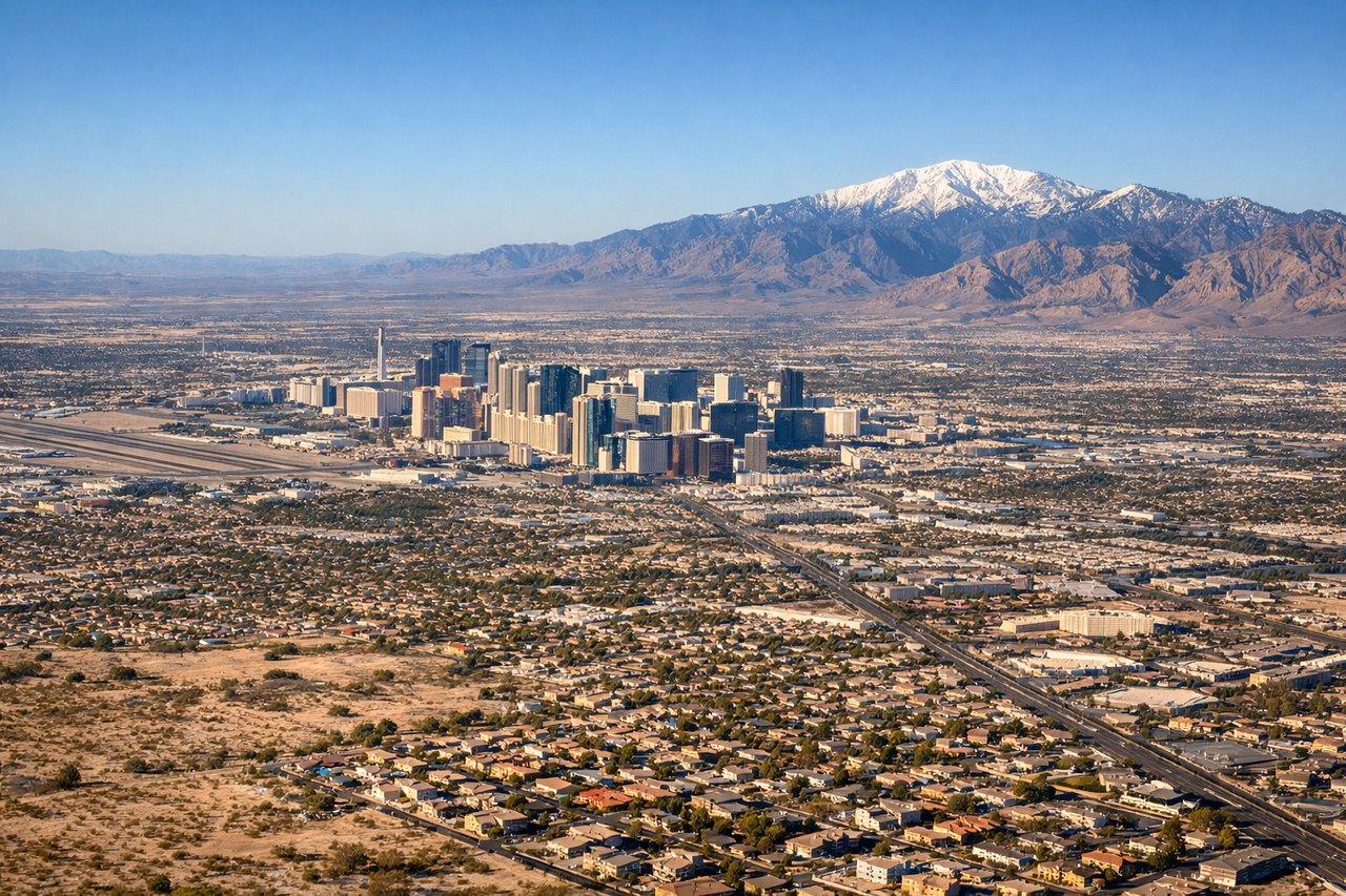
RIGHTArrivals from the north into LAS typically line up for a westbound landing on runway 26, which puts the Las Vegas Strip's skyline directly off the right side during final descent. The left side instead shows the flatter, less distinctive eastern suburbs and Sunrise Mountain foothills.
Landmarks on this routeAll landmarks →
Will your flight be in sunlight?
Pick a date and time in the Sun Map to watch the sun move across your whole flight.
About This Route
Which side of the plane should I sit on flying from Reno Tahoe International (RNO) to Mc Carran International (LAS)?
Sit on the Right side of the plane for the best views on flights from Reno to Las Vegas. The right side wins both phases of the flight: dramatic Sierra Nevada terrain during departure from Reno and the iconic Las Vegas Strip skyline during arrival, while the left side offers only flat desert valleys and undistinguished ranges throughout.
What can I see during takeoff from Reno Tahoe International in Reno?
During takeoff from Reno Tahoe International (RNO), sit on the Right side for the best views. Departing RNO to the south, the right side faces west toward the Sierra Nevada front range, including the peaks above Mt. Rose and the edge of the Tahoe basin, before the aircraft turns southeast toward Nevada. The left side only shows the lower, less distinctive Virginia Range and Washoe Valley. Notable sights include: Sierra Nevada crest, Mt. Rose, Washoe Valley, edge of Lake Tahoe basin.
What can I see when landing at Mc Carran International in Las Vegas?
When landing at Mc Carran International (LAS), sit on the Right side for the best views. Arrivals from the north into LAS typically line up for a westbound landing on runway 26, which puts the Las Vegas Strip's skyline directly off the right side during final descent. The left side instead shows the flatter, less distinctive eastern suburbs and Sunrise Mountain foothills. Notable sights include: Las Vegas Strip skyline, Spring Mountains in the distance, Downtown Las Vegas towers.
How long is the flight from Reno to Las Vegas?
The flight from Reno Tahoe International (RNO) to Mc Carran International (LAS) takes about 1 hour 15 minutes. The shortest flight path between them is 345 miles (556 km); winds and air traffic control usually add a few percent.
What does the Reno to Las Vegas flight path pass over?
The route crosses Nevada's Basin and Range desert, passing near Walker Lake and a series of parallel north-south mountain ranges (including the Toiyabe and Toquima ranges) before descending into the Las Vegas valley.