Reno to Seattle is 564 miles (907 km), a flight of about 1 hour 50 minutes.
The left side strings together the Sierra Nevada at departure, glimpses of the southern and central Cascade volcanoes near cruise altitude, and a dramatic Puget Sound/Olympic Mountains finale on landing, giving it more continuous visual interest than the right side's desert plateau and Lake Washington suburbs.
Flight Path
Northern Nevada's high desert basins, the Columbia Plateau of central Oregon, and the Cascade Range volcanoes including the Three Sisters, Mount Hood, Mount Adams, and Mount Rainier visible along the route as it threads close to the Cascade crest.
Great circle distance and headings ›


Phase by phase
Takeoff from RNO
LEFTDeparting RNO to the north, the Sierra Nevada front rises abruptly along the western horizon, with Mt. Rose and the Carson Range clearly visible as the aircraft climbs out of the Truckee Meadows. The east side shows only the flatter Virginia Range and high desert basins.
Landing at SEA
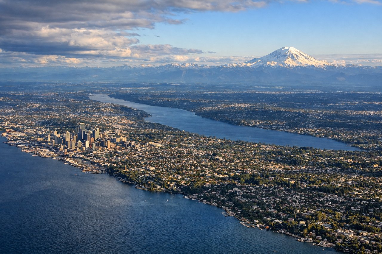
LEFTOn the approach into SEA from the south, the west side reveals Puget Sound's blue waters, the jagged Olympic Mountains beyond, and the Seattle skyline near Elliott Bay just before touchdown. The east side mainly shows Lake Washington and suburban Bellevue, which is less dramatic.
Landmarks on this routeAll landmarks →
Will your flight be in sunlight?
Pick a date and time in the Sun Map to watch the sun move across your whole flight.
About This Route
Which side of the plane should I sit on flying from Reno Tahoe International (RNO) to Seattle Tacoma International (SEA)?
Sit on the Left side of the plane for the best views on flights from Reno to Seattle. The left side strings together the Sierra Nevada at departure, glimpses of the southern and central Cascade volcanoes near cruise altitude, and a dramatic Puget Sound/Olympic Mountains finale on landing, giving it more continuous visual interest than the right side's desert plateau and Lake Washington suburbs.
What can I see during takeoff from Reno Tahoe International in Reno?
During takeoff from Reno Tahoe International (RNO), sit on the Left side for the best views. Departing RNO to the north, the Sierra Nevada front rises abruptly along the western horizon, with Mt. Rose and the Carson Range clearly visible as the aircraft climbs out of the Truckee Meadows. The east side shows only the flatter Virginia Range and high desert basins. Notable sights include: Mt. Rose, Carson Range/Sierra Nevada front, Truckee River valley, Peavine Mountain.
What can I see when landing at Seattle Tacoma International in Seattle?
When landing at Seattle Tacoma International (SEA), sit on the Left side for the best views. On the approach into SEA from the south, the west side reveals Puget Sound's blue waters, the jagged Olympic Mountains beyond, and the Seattle skyline near Elliott Bay just before touchdown. The east side mainly shows Lake Washington and suburban Bellevue, which is less dramatic. Notable sights include: Puget Sound, Olympic Mountains, Seattle skyline near Elliott Bay, Vashon Island.
How long is the flight from Reno to Seattle?
The flight from Reno Tahoe International (RNO) to Seattle Tacoma International (SEA) takes about 1 hour 50 minutes. The shortest flight path between them is 564 miles (907 km); winds and air traffic control usually add a few percent.
What does the Reno to Seattle flight path pass over?
Northern Nevada's high desert basins, the Columbia Plateau of central Oregon, and the Cascade Range volcanoes including the Three Sisters, Mount Hood, Mount Adams, and Mount Rainier visible along the route as it threads close to the Cascade crest.