Seattle to Reno is 564 miles (907 km), a flight of about 1 hour 35 minutes.
The left side wins overall because the Cascade volcano chain — Rainier, Adams, St. Helens, and eventually Shasta near the Oregon-California border — dominates both takeoff and a long stretch of cruise, offering sustained, dramatic mountain scenery that outlasts the shorter but still impressive Sierra Nevada view on landing.
Flight Path
Southern Cascade Range including Mount Shasta, the Klamath Basin, and the high desert plateau of northeastern California transitioning into the Nevada basin-and-range terrain near Reno
Great circle distance and headings ›


Phase by phase
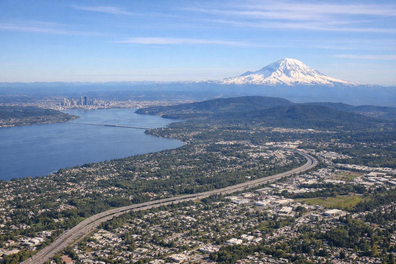
Takeoff from SEA
LEFTDeparting SEA southbound, the left side puts Mount Rainier's glaciated summit directly in view during initial climb, with the Cascade volcanic chain continuing to unfold as the flight tracks south. This is one of the most recognizable volcano skylines in North America.
Landing at RNO
RIGHTOn approach into RNO from the north, the right side faces west toward the Sierra Nevada front range, with the granite peaks near Lake Tahoe visible in the distance before the final turn into the Truckee Meadows valley. The high desert basin gives way abruptly to serious mountains, a dramatic contrast during descent.
Landmarks on this routeAll landmarks →
Will your flight be in sunlight?
Pick a date and time in the Sun Map to watch the sun move across your whole flight.
About This Route
Which side of the plane should I sit on flying from Seattle Tacoma International (SEA) to Reno Tahoe International (RNO)?
Sit on the Left side of the plane for the best views on flights from Seattle to Reno. The left side wins overall because the Cascade volcano chain — Rainier, Adams, St. Helens, and eventually Shasta near the Oregon-California border — dominates both takeoff and a long stretch of cruise, offering sustained, dramatic mountain scenery that outlasts the shorter but still impressive Sierra Nevada view on landing.
What can I see during takeoff from Seattle Tacoma International in Seattle?
During takeoff from Seattle Tacoma International (SEA), sit on the Left side for the best views. Departing SEA southbound, the left side puts Mount Rainier's glaciated summit directly in view during initial climb, with the Cascade volcanic chain continuing to unfold as the flight tracks south. This is one of the most recognizable volcano skylines in North America. Notable sights include: Mount Rainier, Mount St. Helens, Mount Adams, Cascade foothills.
What can I see when landing at Reno Tahoe International in Reno?
When landing at Reno Tahoe International (RNO), sit on the Right side for the best views. On approach into RNO from the north, the right side faces west toward the Sierra Nevada front range, with the granite peaks near Lake Tahoe visible in the distance before the final turn into the Truckee Meadows valley. The high desert basin gives way abruptly to serious mountains, a dramatic contrast during descent. Notable sights include: Sierra Nevada crest, Lake Tahoe basin (distant), Truckee Meadows valley, Peavine Mountain.
How long is the flight from Seattle to Reno?
The flight from Seattle Tacoma International (SEA) to Reno Tahoe International (RNO) takes about 1 hour 35 minutes. The shortest flight path between them is 564 miles (907 km); winds and air traffic control usually add a few percent.
What does the Seattle to Reno flight path pass over?
Southern Cascade Range including Mount Shasta, the Klamath Basin, and the high desert plateau of northeastern California transitioning into the Nevada basin-and-range terrain near Reno