Right side edges ahead due to the superior takeoff experience with genuine coastal scenery (Gulf of Mexico, barrier islands, estuaries) that provides more visual interest during the first 30 minutes of flight. While the landing favors the left side with DC views, the takeoff advantage and the fact that both sides score equally on the long cruise phase over the Appalachian plateau and Atlantic coastal plain make right slightly preferable overall.
Flight Path
The flight path crosses the Appalachian Mountains (Blue Ridge and Allegheny ranges visible during cruise), the Shenandoah Valley, and the Piedmont region of Virginia and North Carolina. The Atlantic coastal plain becomes visible in the final descent phase. Major cities passed near or under the flight corridor include Charlotte, North Carolina and Richmond, Virginia, though these are typically not directly on the flight path. The terrain transitions from flat coastal Florida through rolling Piedmont hills to the Appalachian ridge system, then descends again through the Shenandoah Valley toward the Potomac River basin.
Great circle distance and headings ›Phase by phase
Takeoff from RSW
RIGHTRight side captures the coastal departure from RSW with views of the Gulf of Mexico, Estero Bay, and the barrier islands of southwest Florida during initial climb. Left side shows inland swamps and flat terrain with minimal visual interest.
Landing at IAD
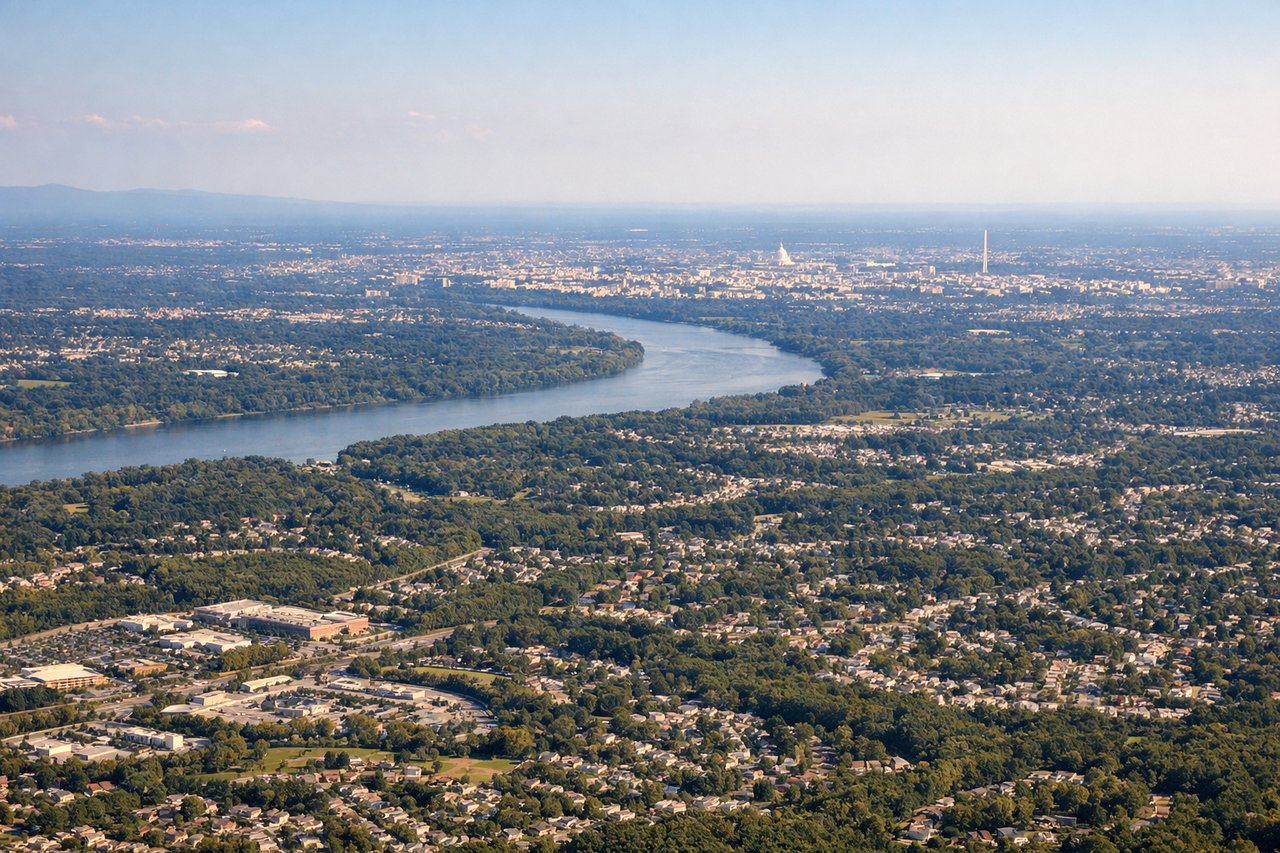
LEFTLeft side provides superior approach scenery into IAD with views of the Potomac River, Washington DC skyline, and the Appalachian foothills during descent and final approach. Right side shows suburban sprawl and less distinctive terrain.
Landmarks on this routeAll landmarks →
Will your flight be in sunlight?
See exactly which side of the plane gets sun and shade at your departure time.
About This Route
Which side of the plane should I sit on flying from Southwest Florida International (RSW) to Washington Dulles International (IAD)?
Sit on the Right side of the plane for the best views on flights from Fort Myers to Washington. Right side edges ahead due to the superior takeoff experience with genuine coastal scenery (Gulf of Mexico, barrier islands, estuaries) that provides more visual interest during the first 30 minutes of flight. While the landing favors the left side with DC views, the takeoff advantage and the fact that both sides score equally on the long cruise phase over the Appalachian plateau and Atlantic coastal plain make right slightly preferable overall.
What can I see during takeoff from Southwest Florida International in Fort Myers?
During takeoff from Southwest Florida International (RSW), sit on the Right side for the best views. Right side captures the coastal departure from RSW with views of the Gulf of Mexico, Estero Bay, and the barrier islands of southwest Florida during initial climb. Left side shows inland swamps and flat terrain with minimal visual interest. Notable sights include: Gulf of Mexico coastline, Estero Bay, Sanibel Island and Captiva Island barrier islands, Caloosahatchee River estuary.
What can I see when landing at Washington Dulles International in Washington?
When landing at Washington Dulles International (IAD), sit on the Left side for the best views. Left side provides superior approach scenery into IAD with views of the Potomac River, Washington DC skyline, and the Appalachian foothills during descent and final approach. Right side shows suburban sprawl and less distinctive terrain. Notable sights include: Potomac River, Washington DC downtown skyline and monuments, Appalachian foothills to the west, Dulles Airport runways and surrounding Loudoun County terrain.
How long is the flight from Fort Myers to Washington?
The flight from Southwest Florida International (RSW) to Washington Dulles International (IAD) takes 3h 15m.
What does the Fort Myers to Washington flight path pass over?
The flight path crosses the Appalachian Mountains (Blue Ridge and Allegheny ranges visible during cruise), the Shenandoah Valley, and the Piedmont region of Virginia and North Carolina. The Atlantic coastal plain becomes visible in the final descent phase. Major cities passed near or under the flight corridor include Charlotte, North Carolina and Richmond, Virginia, though these are typically not directly on the flight path. The terrain transitions from flat coastal Florida through rolling Piedmont hills to the Appalachian ridge system, then descends again through the Shenandoah Valley toward the Potomac River basin.