Both sides score equally at 2.0 due to the short flight duration (approximately 2 hours 45 minutes) over predominantly flat terrain with minimal dramatic geography. However, the right side edges ahead for the landing sequence, where Indianapolis's urban core and the White River valley provide more concentrated visual interest during descent than the dispersed coastal features visible on the left during takeoff. Neither side offers mountain ranges, significant canyons, or other terrain drama typical of higher-scoring routes.
Flown RSW to IND? Did we get it right?
Flight Path
Fort Myers to Indianapolis is 948 miles (1,525 km), a flight of about 2 hours 45 minutes.
The flight path crosses central Georgia and Tennessee, passing over the Cumberland Plateau region and the Tennessee River valley. While these areas contain rolling terrain and river systems, they are not dramatically visible at cruise altitude and the aircraft typically maintains 30,000+ feet where individual geographic features blend into a hazy landscape. The route crosses no major mountain ranges or distinctive landmarks that would significantly enhance the scenic experience at cruise altitude.
Great circle distance and headings ›Phase by phase
Takeoff from RSW
LEFTLeft side captures Fort Myers' coastal geography during initial climb. The Caloosahatchee River estuary and nearby Gulf of Mexico shoreline are visible during the northeast departure from runway 06, providing brief water and urban fringe scenery before the aircraft turns northward.
Landing at IND
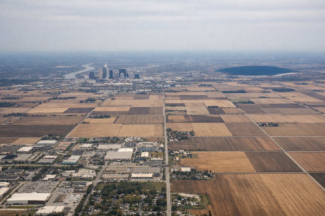
RIGHTRight side offers better views during the final approach to Indianapolis. Depending on wind conditions, runway 23 (southwest-facing) landings are common, which would position the aircraft on a northeast descent path. This approach angle reveals the urban landscape of Indianapolis and surrounding central Indiana terrain as the aircraft descends through 5,000 feet to landing.
Will your flight be in sunlight?
Pick a date and time in the Sun Map to watch the sun move across your whole flight.
About This Route
Which side of the plane should I sit on flying from Southwest Florida International (RSW) to Indianapolis International (IND)?
Sit on the Right side of the plane for the best views on flights from Fort Myers to Indianapolis. Both sides score equally at 2.0 due to the short flight duration (approximately 2 hours 45 minutes) over predominantly flat terrain with minimal dramatic geography. However, the right side edges ahead for the landing sequence, where Indianapolis's urban core and the White River valley provide more concentrated visual interest during descent than the dispersed coastal features visible on the left during takeoff. Neither side offers mountain ranges, significant canyons, or other terrain drama typical of higher-scoring routes.
What can I see during takeoff from Southwest Florida International in Fort Myers?
During takeoff from Southwest Florida International (RSW), sit on the Left side for the best views. Left side captures Fort Myers' coastal geography during initial climb. The Caloosahatchee River estuary and nearby Gulf of Mexico shoreline are visible during the northeast departure from runway 06, providing brief water and urban fringe scenery before the aircraft turns northward. Notable sights include: Caloosahatchee River estuary, Fort Myers urban area, Gulf of Mexico coastline, Sanibel Island (distant).
What can I see when landing at Indianapolis International in Indianapolis?
When landing at Indianapolis International (IND), sit on the Right side for the best views. Right side offers better views during the final approach to Indianapolis. Depending on wind conditions, runway 23 (southwest-facing) landings are common, which would position the aircraft on a northeast descent path. This approach angle reveals the urban landscape of Indianapolis and surrounding central Indiana terrain as the aircraft descends through 5,000 feet to landing. Notable sights include: Indianapolis downtown skyline, White River valley, Marion County suburban sprawl, flat Indiana plains.
How long is the flight from Fort Myers to Indianapolis?
The flight from Southwest Florida International (RSW) to Indianapolis International (IND) takes about 2 hours 45 minutes. The shortest flight path between them is 948 miles (1,525 km); winds and air traffic control usually add a few percent.
What does the Fort Myers to Indianapolis flight path pass over?
The flight path crosses central Georgia and Tennessee, passing over the Cumberland Plateau region and the Tennessee River valley. While these areas contain rolling terrain and river systems, they are not dramatically visible at cruise altitude and the aircraft typically maintains 30,000+ feet where individual geographic features blend into a hazy landscape. The route crosses no major mountain ranges or distinctive landmarks that would significantly enhance the scenic experience at cruise altitude.