While takeoff favors the right for coastal views, the landing approach on the left captures the dramatic North Shore Mountains and Burrard Inlet—the most visually striking geography on this route. The approach descent provides superior scenic value.
Flown RSW to YVR? Did we get it right?
Flight Path
Fort Myers to Vancouver is 2,699 miles (4,343 km), a flight of about 5 hours 15 minutes.
The flight path crosses the Great Plains and Rocky Mountains. Notable features include the Mississippi River valley (visible around 1.5 hours out), the Canadian Prairies (Saskatchewan/Alberta), the Canadian Rockies (Banff/Lake Louise region around 4 hours), and the Columbia Mountains before descending into the Pacific coastal ranges near Vancouver.
Great circle distance and headings ›


Phase by phase
Takeoff from RSW
RIGHTRSW typically departs to the north or northeast. Right-side seats offer views of the Caloosahatchee River estuary and the Gulf of Mexico coastline as you climb out. Left side faces inland swamps with less visual interest.
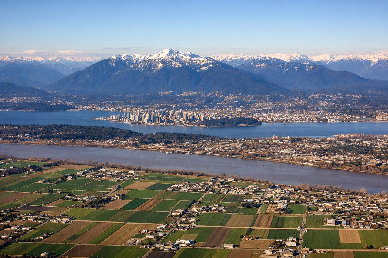
Landing at YVR
LEFTApproaching YVR from the south typically uses runways 26L/26R or 27L/27R (westerly headings). Left-side seats capture the North Shore Mountains and Burrard Inlet as you descend. The Strait of Georgia and Vancouver Island are also visible on approach. Right side faces the city and suburban sprawl with less dramatic terrain.
Will your flight be in sunlight?
Pick a date and time in the Sun Map to watch the sun move across your whole flight.
About This Route
Which side of the plane should I sit on flying from Southwest Florida International (RSW) to Vancouver International (YVR)?
Sit on the Left side of the plane for the best views on flights from Fort Myers to Vancouver. While takeoff favors the right for coastal views, the landing approach on the left captures the dramatic North Shore Mountains and Burrard Inlet—the most visually striking geography on this route. The approach descent provides superior scenic value.
What can I see during takeoff from Southwest Florida International in Fort Myers?
During takeoff from Southwest Florida International (RSW), sit on the Right side for the best views. RSW typically departs to the north or northeast. Right-side seats offer views of the Caloosahatchee River estuary and the Gulf of Mexico coastline as you climb out. Left side faces inland swamps with less visual interest. Notable sights include: Caloosahatchee River estuary, Sanibel Island barrier island, Gulf of Mexico, Pine Island Sound.
What can I see when landing at Vancouver International in Vancouver?
When landing at Vancouver International (YVR), sit on the Left side for the best views. Approaching YVR from the south typically uses runways 26L/26R or 27L/27R (westerly headings). Left-side seats capture the North Shore Mountains and Burrard Inlet as you descend. The Strait of Georgia and Vancouver Island are also visible on approach. Right side faces the city and suburban sprawl with less dramatic terrain. Notable sights include: North Shore Mountains (Grouse, Seymour, Cypress peaks), Burrard Inlet, Strait of Georgia, Vancouver Island.
How long is the flight from Fort Myers to Vancouver?
The flight from Southwest Florida International (RSW) to Vancouver International (YVR) takes about 5 hours 15 minutes. The shortest flight path between them is 2,699 miles (4,343 km); winds and air traffic control usually add a few percent.
What does the Fort Myers to Vancouver flight path pass over?
The flight path crosses the Great Plains and Rocky Mountains. Notable features include the Mississippi River valley (visible around 1.5 hours out), the Canadian Prairies (Saskatchewan/Alberta), the Canadian Rockies (Banff/Lake Louise region around 4 hours), and the Columbia Mountains before descending into the Pacific coastal ranges near Vancouver.