The right side delivers the spectacular Gulf Coast departure over Sanibel, Charlotte Harbor, and the barrier islands, which is the most visually dramatic part of this flight. The left side wins at landing for the Toronto skyline, but the takeoff scenery is more unique and harder to replicate on other routes.
Flown RSW to YYZ? Did we get it right?
Flight Path
Fort Myers to Toronto is 1,190 miles (1,916 km), a flight of about 2 hours 55 minutes.
The flight tracks north-northeast over central Florida, then crosses Georgia and the Carolinas. Over Kentucky and Ohio the terrain is rolling agricultural land with the Ohio River visible as a broad winding feature. Lake Erie comes into view as the aircraft descends into Ontario, its southern shore and the Canadian shoreline clearly visible before the final approach over Lake Ontario into Toronto.
Great circle distance and headings ›

Phase by phase
Takeoff from RSW
RIGHTRSW's primary departure runway is 06, heading northeast, which puts the right side facing southeast over the Gulf Coast, Charlotte Harbor, and the barrier islands of Sanibel and Captiva. The left side faces inland over flat agricultural land with little visual interest.
Landing at YYZ
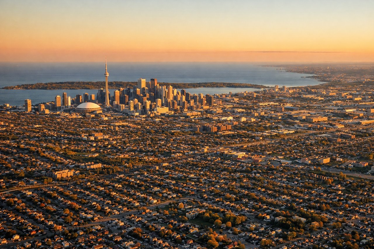
LEFTYYZ's primary arrival from the south is typically runway 23 or 24L/24R, with aircraft approaching from the southeast over Lake Ontario. The left side faces east toward downtown Toronto's skyline and the CN Tower, clearly visible during the approach. The right side faces west over suburban Mississauga with little of note.
Will your flight be in sunlight?
Pick a date and time in the Sun Map to watch the sun move across your whole flight.
About This Route
Which side of the plane should I sit on flying from Southwest Florida International (RSW) to Lester B Pearson International (YYZ)?
Sit on the Right side of the plane for the best views on flights from Fort Myers to Toronto. The right side delivers the spectacular Gulf Coast departure over Sanibel, Charlotte Harbor, and the barrier islands, which is the most visually dramatic part of this flight. The left side wins at landing for the Toronto skyline, but the takeoff scenery is more unique and harder to replicate on other routes.
What can I see during takeoff from Southwest Florida International in Fort Myers?
During takeoff from Southwest Florida International (RSW), sit on the Right side for the best views. RSW's primary departure runway is 06, heading northeast, which puts the right side facing southeast over the Gulf Coast, Charlotte Harbor, and the barrier islands of Sanibel and Captiva. The left side faces inland over flat agricultural land with little visual interest. Notable sights include: Sanibel and Captiva Islands, Charlotte Harbor estuary, Pine Island Sound, Cape Coral canal grid.
What can I see when landing at Lester B Pearson International in Toronto?
When landing at Lester B Pearson International (YYZ), sit on the Left side for the best views. YYZ's primary arrival from the south is typically runway 23 or 24L/24R, with aircraft approaching from the southeast over Lake Ontario. The left side faces east toward downtown Toronto's skyline and the CN Tower, clearly visible during the approach. The right side faces west over suburban Mississauga with little of note. Notable sights include: CN Tower and downtown Toronto skyline, Lake Ontario, Toronto Islands, Humber Bay.
How long is the flight from Fort Myers to Toronto?
The flight from Southwest Florida International (RSW) to Lester B Pearson International (YYZ) takes about 2 hours 55 minutes. The shortest flight path between them is 1,190 miles (1,916 km); winds and air traffic control usually add a few percent.
What does the Fort Myers to Toronto flight path pass over?
The flight tracks north-northeast over central Florida, then crosses Georgia and the Carolinas. Over Kentucky and Ohio the terrain is rolling agricultural land with the Ohio River visible as a broad winding feature. Lake Erie comes into view as the aircraft descends into Ontario, its southern shore and the Canadian shoreline clearly visible before the final approach over Lake Ontario into Toronto.