While takeoff offers excellent mountain views on the right, the landing sequence on the left provides more dramatic and sustained views of major geographic features: the Columbia River gorge, Mount Hood, and the Cascade Range. These are more visually distinctive than the takeoff terrain.
Flown SAF to PDX? Did we get it right?
Flight Path
Santa Fe to Portland is 1,103 miles (1,775 km), a flight of about 3 hours 15 minutes.
The flight path crosses the high desert plateau of central Oregon. Notable features include the Deschutes River canyon (visible from altitude as a linear feature), the Cascade Range spine running north-south (Mount Jefferson, Three Sisters volcanoes visible as isolated peaks), and the transition from arid sagebrush terrain to the greener Willamette Valley approaching Portland. The Blue Mountains appear to the northeast during the northern Oregon segment.
Great circle distance and headings ›


Phase by phase
Takeoff from SAF
RIGHTSanta Fe typically departs to the north or northeast. Right-side seats capture the Sangre de Cristo Mountains rising immediately east of the airport, with the Rio Grande valley visible to the west. This orientation gives the best immediate terrain contrast.
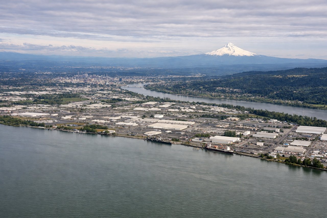
Landing at PDX
LEFTPortland typically lands on runways 28L/28R (westbound) or 10L/10R (eastbound). On a westbound approach, left seats face north and capture the Columbia River gorge, the Cascade Range peaks (Mount Hood, Mount St. Helens), and the Willamette River confluence. Eastbound approaches favor left seats viewing the same major features during descent.
Will your flight be in sunlight?
Pick a date and time in the Sun Map to watch the sun move across your whole flight.
About This Route
Which side of the plane should I sit on flying from Santa Fe Muni (SAF) to Portland International (PDX)?
Sit on the Left side of the plane for the best views on flights from Santa Fe to Portland. While takeoff offers excellent mountain views on the right, the landing sequence on the left provides more dramatic and sustained views of major geographic features: the Columbia River gorge, Mount Hood, and the Cascade Range. These are more visually distinctive than the takeoff terrain.
What can I see during takeoff from Santa Fe Muni in Santa Fe?
During takeoff from Santa Fe Muni (SAF), sit on the Right side for the best views. Santa Fe typically departs to the north or northeast. Right-side seats capture the Sangre de Cristo Mountains rising immediately east of the airport, with the Rio Grande valley visible to the west. This orientation gives the best immediate terrain contrast. Notable sights include: Sangre de Cristo Mountains (east), Rio Grande valley (west), Santa Fe city grid (directly below during initial climb), Jemez Mountains (northwest, distant).
What can I see when landing at Portland International in Portland?
When landing at Portland International (PDX), sit on the Left side for the best views. Portland typically lands on runways 28L/28R (westbound) or 10L/10R (eastbound). On a westbound approach, left seats face north and capture the Columbia River gorge, the Cascade Range peaks (Mount Hood, Mount St. Helens), and the Willamette River confluence. Eastbound approaches favor left seats viewing the same major features during descent. Notable sights include: Columbia River (prominent waterway), Cascade Range peaks including Mount Hood (dominant, ~50 miles southeast), Willamette River (confluence visible near airport), Portland metro sprawl (foreground).
How long is the flight from Santa Fe to Portland?
The flight from Santa Fe Muni (SAF) to Portland International (PDX) takes about 3 hours 15 minutes. The shortest flight path between them is 1,103 miles (1,775 km); winds and air traffic control usually add a few percent.
What does the Santa Fe to Portland flight path pass over?
The flight path crosses the high desert plateau of central Oregon. Notable features include the Deschutes River canyon (visible from altitude as a linear feature), the Cascade Range spine running north-south (Mount Jefferson, Three Sisters volcanoes visible as isolated peaks), and the transition from arid sagebrush terrain to the greener Willamette Valley approaching Portland. The Blue Mountains appear to the northeast during the northern Oregon segment.