While takeoff offers good volcanic scenery on the right, the landing approach into Bogotá provides more dramatic and sustained views of high-altitude Andean terrain on the left side. The descent into the Colombian highlands offers more visually distinctive geography than the El Salvador departure.
Flown SAL to BOG? Did we get it right?
Flight Path
San Salvador to Bogota is 1,182 miles (1,902 km), a flight of about 2 hours 15 minutes.
The flight path crosses the Caribbean coast of Central America (Nicaragua/Honduras border region), passes over the Mosquito Coast lowlands, crosses the Caribbean Sea, then approaches the Colombian Pacific coast before turning inland toward the Andes. Notable features include the Yucatán Peninsula's limestone platform to the north (visible on left during cruise), the Caribbean coastline of Central America, and the transition from tropical lowlands to the high Andean plateau as you approach Bogotá.
Great circle distance and headings ›

Phase by phase
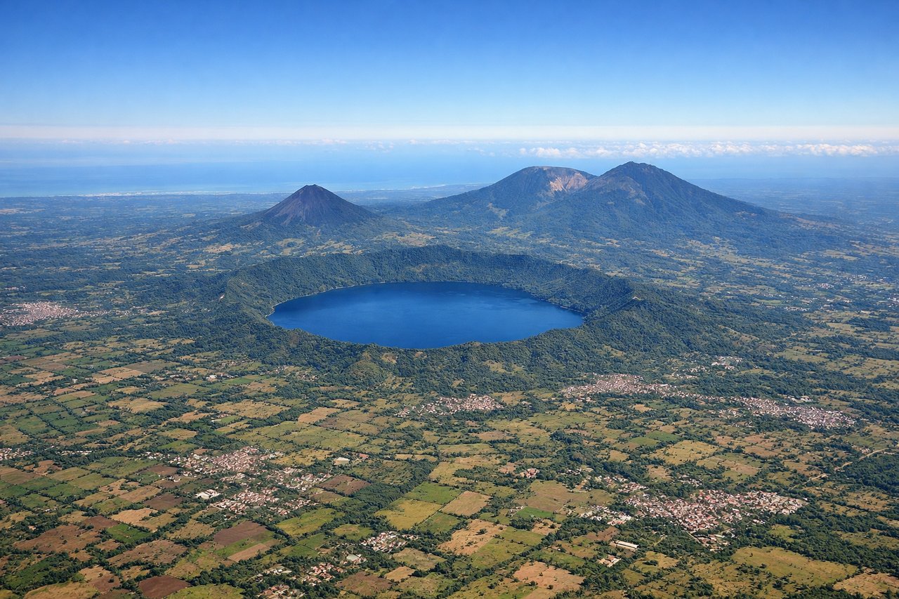
Takeoff from SAL
RIGHTRight-side seats offer views of the Pacific coastal plain and the volcanic highlands of El Salvador during the initial climb. The terrain rises dramatically southward from San Salvador toward the Central American volcanic belt, creating strong visual contrast.
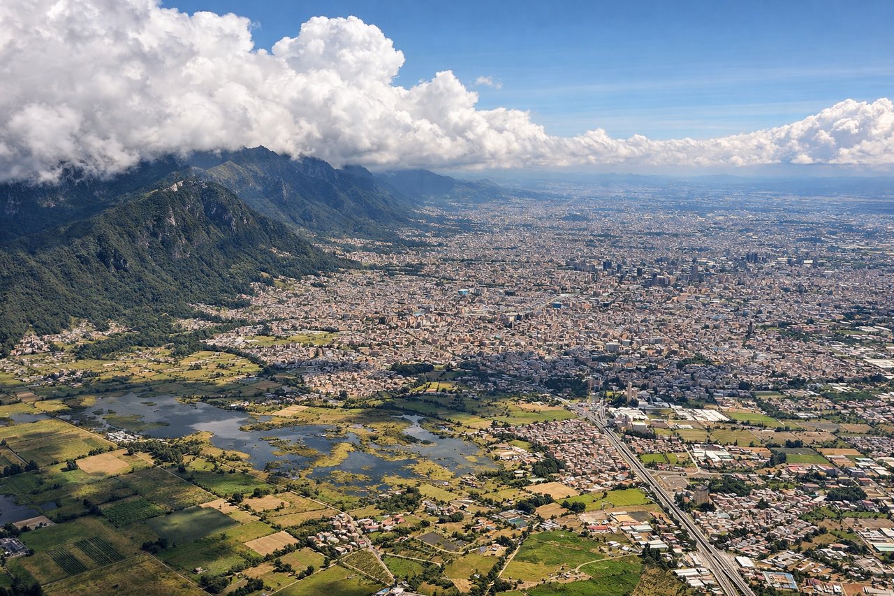
Landing at BOG
LEFTLeft-side seats provide excellent views of the Cordillera Central and the high Andean valleys surrounding Bogotá during descent. The approach path brings aircraft over the eastern range, with the city nestled in a high plateau visible from the left side as you descend into the valley.
Will your flight be in sunlight?
Pick a date and time in the Sun Map to watch the sun move across your whole flight.
About This Route
Which side of the plane should I sit on flying from El Salvador International (SAL) to Eldorado International (BOG)?
Sit on the Left side of the plane for the best views on flights from San Salvador to Bogota. While takeoff offers good volcanic scenery on the right, the landing approach into Bogotá provides more dramatic and sustained views of high-altitude Andean terrain on the left side. The descent into the Colombian highlands offers more visually distinctive geography than the El Salvador departure.
What can I see during takeoff from El Salvador International in San Salvador?
During takeoff from El Salvador International (SAL), sit on the Right side for the best views. Right-side seats offer views of the Pacific coastal plain and the volcanic highlands of El Salvador during the initial climb. The terrain rises dramatically southward from San Salvador toward the Central American volcanic belt, creating strong visual contrast. Notable sights include: Lake Ilopango (large crater lake east of San Salvador), Pacific coastal plain to the south, volcanic ridge of the Central American cordillera, San Salvador city sprawl below.
What can I see when landing at Eldorado International in Bogota?
When landing at Eldorado International (BOG), sit on the Left side for the best views. Left-side seats provide excellent views of the Cordillera Central and the high Andean valleys surrounding Bogotá during descent. The approach path brings aircraft over the eastern range, with the city nestled in a high plateau visible from the left side as you descend into the valley. Notable sights include: Cordillera Central (eastern range of Colombian Andes), Bogotá high plateau at 2,640 meters elevation, Río Magdalena valley to the west, surrounding forested mountain slopes.
How long is the flight from San Salvador to Bogota?
The flight from El Salvador International (SAL) to Eldorado International (BOG) takes about 2 hours 15 minutes. The shortest flight path between them is 1,182 miles (1,902 km); winds and air traffic control usually add a few percent.
What does the San Salvador to Bogota flight path pass over?
The flight path crosses the Caribbean coast of Central America (Nicaragua/Honduras border region), passes over the Mosquito Coast lowlands, crosses the Caribbean Sea, then approaches the Colombian Pacific coast before turning inland toward the Andes. Notable features include the Yucatán Peninsula's limestone platform to the north (visible on left during cruise), the Caribbean coastline of Central America, and the transition from tropical lowlands to the high Andean plateau as you approach Bogotá.