Right side scores higher (3.0 vs 2.5) due to superior landing scenery. The approach into Belize City over the Caribbean reef system, cayes, and mangrove lagoons provides dramatic visual variety and recognizable landmarks. While takeoff from San Salvador is comparable on both sides, the landing experience on the right significantly outweighs the left side's flat jungle approach. The reef and coastal geography create a memorable finale to an otherwise modest scenic flight.
Flown SAL to BZE? Did we get it right?
Flight Path
San Salvador to Belize City is 287 miles (462 km), a flight of about 50 minutes.
The flight path crosses the Petén region of Guatemala (flat jungle canopy), the Guatemala-Belize border, and approaches the Caribbean coast. Notable features include the Río Usumacinta valley (Guatemala-Mexico border region, visible as a linear depression in the jungle), the flat limestone plain of northern Belize, and the Caribbean coastal lagoon system. No major mountains or dramatic terrain interrupts the route; the landscape is predominantly low-lying tropical forest with scattered rivers and wetlands.
Great circle distance and headings ›Phase by phase
Takeoff from SAL
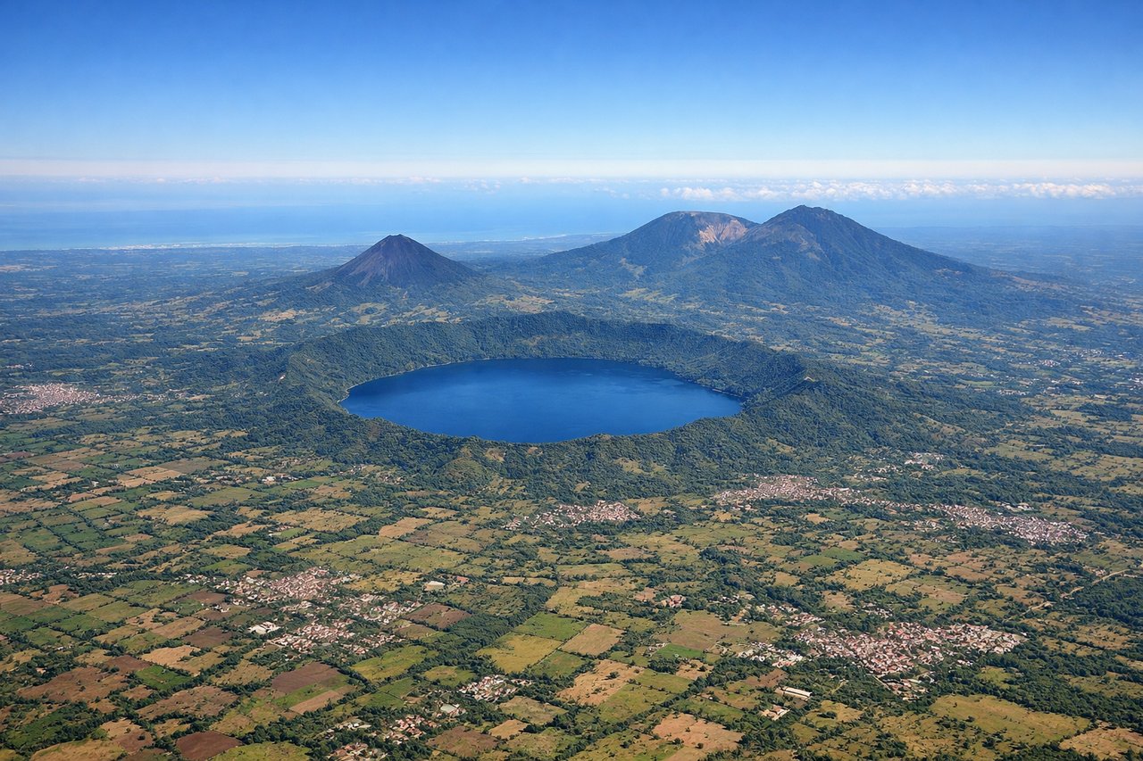
RIGHTRight side captures San Salvador's urban sprawl and the Pacific coastal plain during climb-out. Depending on runway use (typically 25 heading southwest), the right side faces toward the coast and volcanic terrain inland, offering immediate visual interest. Left side departs over inland hills with less dramatic relief.
Landing at BZE
RIGHTRight side offers superior approach scenery into Belize City. The typical eastbound approach (runway 07) brings aircraft over the Caribbean Sea and coastal lagoons, with mangrove forests, cayes, and the Belize Barrier Reef visible on descent. Right-side passengers see the reef system and coastal geography. Left side faces inland over flat jungle with minimal visual distinction.
Will your flight be in sunlight?
Pick a date and time in the Sun Map to watch the sun move across your whole flight.
About This Route
Which side of the plane should I sit on flying from El Salvador International (SAL) to Philip S W Goldson International (BZE)?
Sit on the Right side of the plane for the best views on flights from San Salvador to Belize City. Right side scores higher (3.0 vs 2.5) due to superior landing scenery. The approach into Belize City over the Caribbean reef system, cayes, and mangrove lagoons provides dramatic visual variety and recognizable landmarks. While takeoff from San Salvador is comparable on both sides, the landing experience on the right significantly outweighs the left side's flat jungle approach. The reef and coastal geography create a memorable finale to an otherwise modest scenic flight.
What can I see during takeoff from El Salvador International in San Salvador?
During takeoff from El Salvador International (SAL), sit on the Right side for the best views. Right side captures San Salvador's urban sprawl and the Pacific coastal plain during climb-out. Depending on runway use (typically 25 heading southwest), the right side faces toward the coast and volcanic terrain inland, offering immediate visual interest. Left side departs over inland hills with less dramatic relief. Notable sights include: San Salvador city grid, Lake Ilopango (volcanic crater lake visible inland), Pacific coastal plain to the southwest, volcanic highlands of central El Salvador.
What can I see when landing at Philip S W Goldson International in Belize City?
When landing at Philip S W Goldson International (BZE), sit on the Right side for the best views. Right side offers superior approach scenery into Belize City. The typical eastbound approach (runway 07) brings aircraft over the Caribbean Sea and coastal lagoons, with mangrove forests, cayes, and the Belize Barrier Reef visible on descent. Right-side passengers see the reef system and coastal geography. Left side faces inland over flat jungle with minimal visual distinction. Notable sights include: Belize Barrier Reef (world's second-longest reef system, visible as turquoise water and white breakers), Half Moon Caye and nearby cayes, mangrove lagoons and coastal wetlands, Belize City harbor and urban waterfront.
How long is the flight from San Salvador to Belize City?
The flight from El Salvador International (SAL) to Philip S W Goldson International (BZE) takes about 50 minutes. The shortest flight path between them is 287 miles (462 km); winds and air traffic control usually add a few percent.
What does the San Salvador to Belize City flight path pass over?
The flight path crosses the Petén region of Guatemala (flat jungle canopy), the Guatemala-Belize border, and approaches the Caribbean coast. Notable features include the Río Usumacinta valley (Guatemala-Mexico border region, visible as a linear depression in the jungle), the flat limestone plain of northern Belize, and the Caribbean coastal lagoon system. No major mountains or dramatic terrain interrupts the route; the landscape is predominantly low-lying tropical forest with scattered rivers and wetlands.