While takeoff favors the right for volcanic views around San Salvador, the landing approach into PTY is significantly more visually rewarding on the left, offering views of the Panama Canal, Gatun Lake, and the approach to Panama City. The landing experience outweighs the takeoff advantage.
Flown SAL to PTY? Did we get it right?
Flight Path
San Salvador to Panama City is 722 miles (1,161 km), a flight of about 2 hours 10 minutes.
The flight path crosses the Pacific coastal plain of El Salvador and Guatemala, then transitions over the mountainous terrain of Honduras and Nicaragua. The Mosquitia region's Caribbean-facing slopes and the volcanic highlands of central Nicaragua are visible at cruise altitude. The Caribbean Sea and the approach to the Panama Canal zone dominate the final descent phase.
Great circle distance and headings ›Phase by phase
Takeoff from SAL
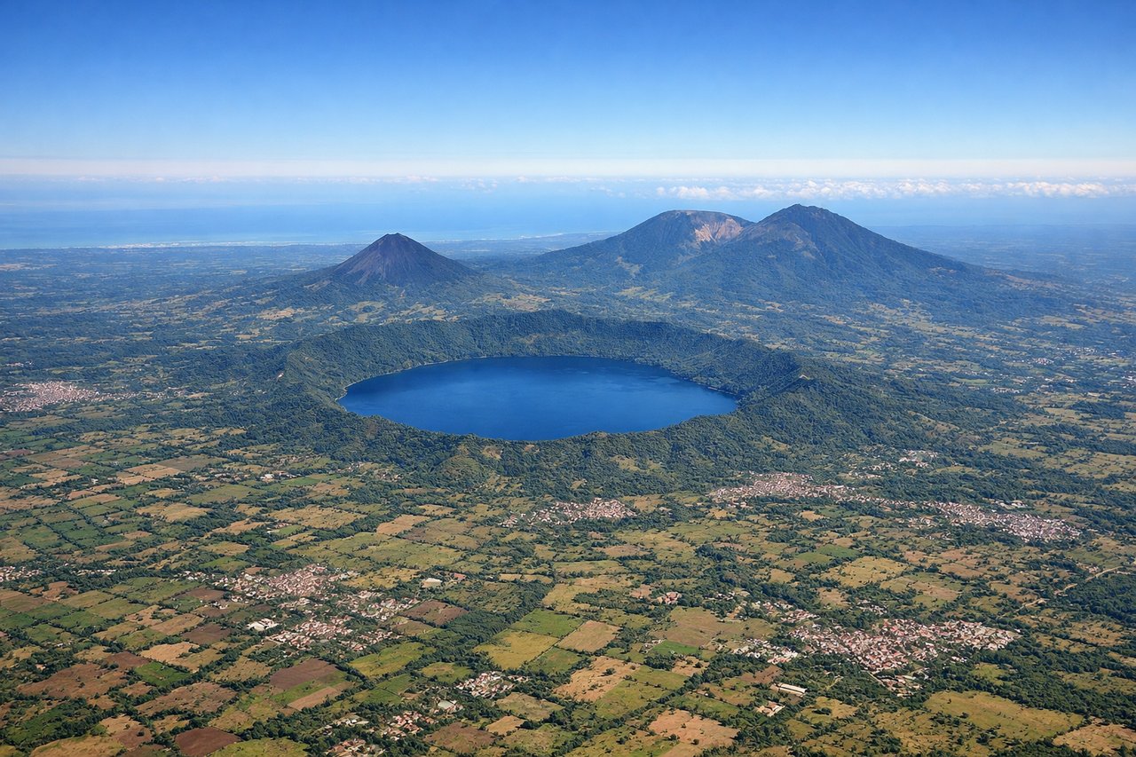
RIGHTSAL typically departs eastbound (Runway 10) or westbound (Runway 28). Right-side seats offer the best view of the volcanic landscape immediately surrounding San Salvador. You'll see the Central American highlands rising sharply from the coastal plain, with the city sprawling below.
Landing at PTY
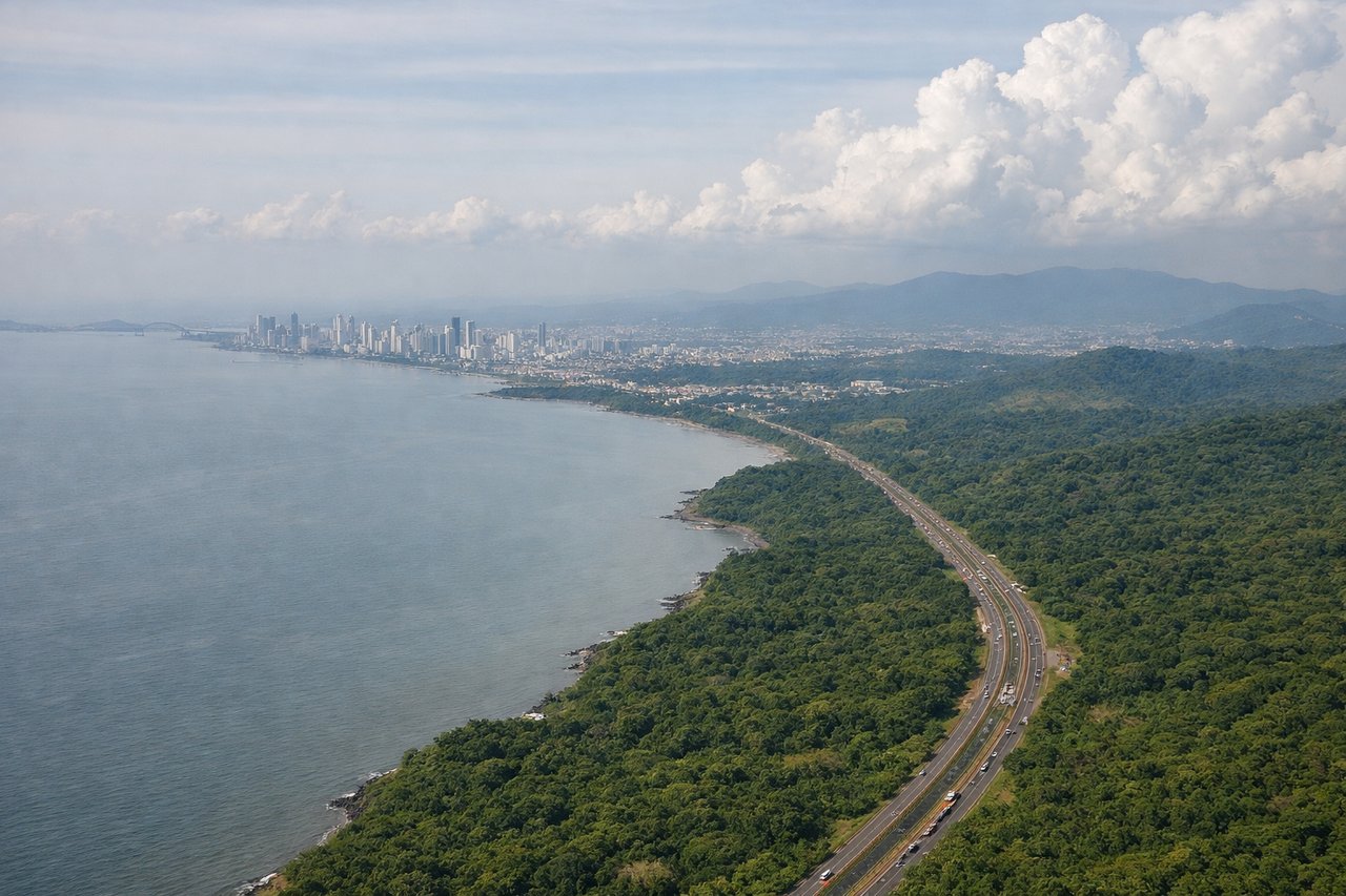
LEFTPTY's primary runway is 03/21. On approach from the northwest (typical for flights from El Salvador), left-side seats provide excellent views of the Panama Canal approach corridor and the Gatun Lake system. You'll see the canal's locks and the surrounding rainforest landscape as you descend into Tocumen.
Will your flight be in sunlight?
Pick a date and time in the Sun Map to watch the sun move across your whole flight.
About This Route
Which side of the plane should I sit on flying from El Salvador International (SAL) to Tocumen International (PTY)?
Sit on the Left side of the plane for the best views on flights from San Salvador to Panama City. While takeoff favors the right for volcanic views around San Salvador, the landing approach into PTY is significantly more visually rewarding on the left, offering views of the Panama Canal, Gatun Lake, and the approach to Panama City. The landing experience outweighs the takeoff advantage.
What can I see during takeoff from El Salvador International in San Salvador?
During takeoff from El Salvador International (SAL), sit on the Right side for the best views. SAL typically departs eastbound (Runway 10) or westbound (Runway 28). Right-side seats offer the best view of the volcanic landscape immediately surrounding San Salvador. You'll see the Central American highlands rising sharply from the coastal plain, with the city sprawling below. Notable sights include: San Salvador city grid, Lake Ilopango (crater lake east of the city), Volcán San Salvador (Santa Ana volcano complex to the west), Sierra Madre mountain range forming the eastern horizon.
What can I see when landing at Tocumen International in Panama City?
When landing at Tocumen International (PTY), sit on the Left side for the best views. PTY's primary runway is 03/21. On approach from the northwest (typical for flights from El Salvador), left-side seats provide excellent views of the Panama Canal approach corridor and the Gatun Lake system. You'll see the canal's locks and the surrounding rainforest landscape as you descend into Tocumen. Notable sights include: Gatun Lake (massive artificial reservoir), Panama Canal locks and cut, Soberanía National Park rainforest, Panama City skyline and Casco Viejo district.
How long is the flight from San Salvador to Panama City?
The flight from El Salvador International (SAL) to Tocumen International (PTY) takes about 2 hours 10 minutes. The shortest flight path between them is 722 miles (1,161 km); winds and air traffic control usually add a few percent.
What does the San Salvador to Panama City flight path pass over?
The flight path crosses the Pacific coastal plain of El Salvador and Guatemala, then transitions over the mountainous terrain of Honduras and Nicaragua. The Mosquitia region's Caribbean-facing slopes and the volcanic highlands of central Nicaragua are visible at cruise altitude. The Caribbean Sea and the approach to the Panama Canal zone dominate the final descent phase.