The right side captures the Marmara coastline at departure, likely brushes the Zagros foothills and Persian Gulf/Arabian Sea coastlines during cruise, and ends with a scenic river-delta approach into Bangkok, giving it more consistent visual variety than the left side's largely flat continental interior views.
Flown SAW to BKK? Did we get it right?
Flight Path
Pendik, Istanbul to Bangkok is 4,638 miles (7,464 km), a flight of about 8 hours 55 minutes.
Route crosses the Zagros Mountains of western Iran, the Persian Gulf or northern Arabian Sea, southern Pakistan and India, and the Bay of Bengal before reaching Myanmar's Andaman coast en route to Thailand.
Great circle distance and headings ›


Phase by phase
Takeoff from SAW
RIGHTDeparting SAW toward the southwest, the right side offers views over the Sea of Marmara with the Princes' Islands and Istanbul's skyline receding behind, while the left side mostly shows the flatter Anatolian hinterland.
Landing at BKK
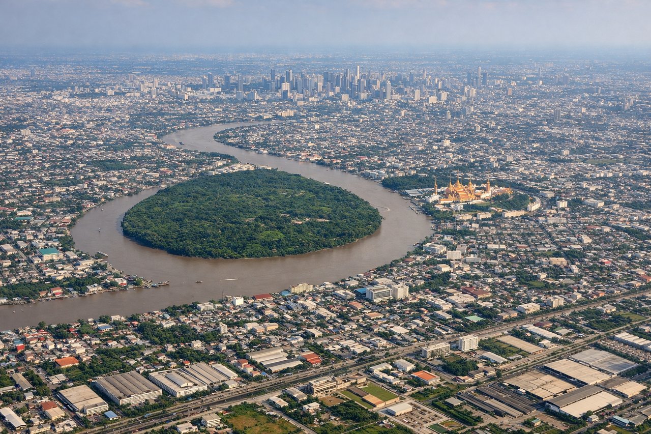
RIGHTOn approach into BKK, the right side typically reveals the sprawling Chao Phraya River delta and Bangkok's dense urban grid, with glimpses of the Gulf of Thailand's coastline further south, offering more visual interest than the flatter agricultural plains on the left.
Will your flight be in sunlight?
Pick a date and time in the Sun Map to watch the sun move across your whole flight.
About This Route
Which side of the plane should I sit on flying from Istanbul Sabiha Gökçen International Airport (SAW) to Suvarnabhumi Airport (BKK)?
Sit on the Right side of the plane for the best views on flights from Pendik, Istanbul to Bangkok. The right side captures the Marmara coastline at departure, likely brushes the Zagros foothills and Persian Gulf/Arabian Sea coastlines during cruise, and ends with a scenic river-delta approach into Bangkok, giving it more consistent visual variety than the left side's largely flat continental interior views.
What can I see during takeoff from Istanbul Sabiha Gökçen International Airport in Pendik, Istanbul?
During takeoff from Istanbul Sabiha Gökçen International Airport (SAW), sit on the Right side for the best views. Departing SAW toward the southwest, the right side offers views over the Sea of Marmara with the Princes' Islands and Istanbul's skyline receding behind, while the left side mostly shows the flatter Anatolian hinterland. Notable sights include: Princes' Islands, Sea of Marmara, Istanbul skyline, Bosphorus mouth.
What can I see when landing at Suvarnabhumi Airport in Bangkok?
When landing at Suvarnabhumi Airport (BKK), sit on the Right side for the best views. On approach into BKK, the right side typically reveals the sprawling Chao Phraya River delta and Bangkok's dense urban grid, with glimpses of the Gulf of Thailand's coastline further south, offering more visual interest than the flatter agricultural plains on the left. Notable sights include: Chao Phraya River, Bangkok skyline, Gulf of Thailand coastline, rice paddy patchwork.
How long is the flight from Pendik, Istanbul to Bangkok?
The flight from Istanbul Sabiha Gökçen International Airport (SAW) to Suvarnabhumi Airport (BKK) takes about 8 hours 55 minutes. The shortest flight path between them is 4,638 miles (7,464 km); winds and air traffic control usually add a few percent.
What does the Pendik, Istanbul to Bangkok flight path pass over?
Route crosses the Zagros Mountains of western Iran, the Persian Gulf or northern Arabian Sea, southern Pakistan and India, and the Bay of Bengal before reaching Myanmar's Andaman coast en route to Thailand.