The right side scores higher (3.0 vs 2.5) because it captures more visually distinctive geography across the full flight. Takeoff offers the Sea of Marmara and Bosphorus strait, while the landing provides the Red River delta's intricate agricultural patchwork and Hanoi's urban density. The left side, by contrast, offers primarily open water during cruise and less dramatic approach scenery. The right side's combination of coastal departure drama and delta landing detail outweighs the left's more monotonous ocean crossing.
Flown SAW to HAN? Did we get it right?
Flight Path
Pendik, Istanbul to Hanoi is 4,583 miles (7,375 km), a flight of about 9 hours 5 minutes.
Aegean Sea (Greece), eastern Mediterranean coastline, Syria-Turkey border region, Euphrates River valley, Iraq-Syria border, Persian Gulf approaches, Arabian Sea, Indian Ocean crossing, Bay of Bengal, Andaman Sea, Thailand-Myanmar border region, Mekong River delta approaches
Great circle distance and headings ›


Phase by phase
Takeoff from SAW
RIGHTRight side captures Istanbul's urban sprawl and the Sea of Marmara immediately after departure. Depending on runway use (24L/24R southwesterly), the right side offers views of the Bosphorus strait, the European shore, and the city's waterfront development as the aircraft climbs.
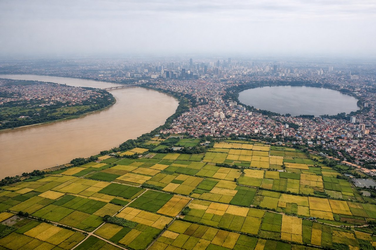
Landing at HAN
RIGHTRight side provides superior approach views into Hanoi. During typical winter (northeast monsoon) runway 29 operations or summer runway 11 operations, the right side captures the Red River delta, Hanoi's urban core, and the approach path over the densely populated river valley with its distinctive patchwork of rice paddies and waterways.
Will your flight be in sunlight?
Pick a date and time in the Sun Map to watch the sun move across your whole flight.
About This Route
Which side of the plane should I sit on flying from Istanbul Sabiha Gökçen International Airport (SAW) to Noibai International (HAN)?
Sit on the Right side of the plane for the best views on flights from Pendik, Istanbul to Hanoi. The right side scores higher (3.0 vs 2.5) because it captures more visually distinctive geography across the full flight. Takeoff offers the Sea of Marmara and Bosphorus strait, while the landing provides the Red River delta's intricate agricultural patchwork and Hanoi's urban density. The left side, by contrast, offers primarily open water during cruise and less dramatic approach scenery. The right side's combination of coastal departure drama and delta landing detail outweighs the left's more monotonous ocean crossing.
What can I see during takeoff from Istanbul Sabiha Gökçen International Airport in Pendik, Istanbul?
During takeoff from Istanbul Sabiha Gökçen International Airport (SAW), sit on the Right side for the best views. Right side captures Istanbul's urban sprawl and the Sea of Marmara immediately after departure. Depending on runway use (24L/24R southwesterly), the right side offers views of the Bosphorus strait, the European shore, and the city's waterfront development as the aircraft climbs. Notable sights include: Sea of Marmara, Bosphorus strait, Istanbul urban districts (Pendik, Tuzla), European coastline to the northwest.
What can I see when landing at Noibai International in Hanoi?
When landing at Noibai International (HAN), sit on the Right side for the best views. Right side provides superior approach views into Hanoi. During typical winter (northeast monsoon) runway 29 operations or summer runway 11 operations, the right side captures the Red River delta, Hanoi's urban core, and the approach path over the densely populated river valley with its distinctive patchwork of rice paddies and waterways. Notable sights include: Red River delta, Hanoi city center, Tay Ho (West Lake), approach corridor over the Red River valley.
How long is the flight from Pendik, Istanbul to Hanoi?
The flight from Istanbul Sabiha Gökçen International Airport (SAW) to Noibai International (HAN) takes about 9 hours 5 minutes. The shortest flight path between them is 4,583 miles (7,375 km); winds and air traffic control usually add a few percent.
What does the Pendik, Istanbul to Hanoi flight path pass over?
Aegean Sea (Greece), eastern Mediterranean coastline, Syria-Turkey border region, Euphrates River valley, Iraq-Syria border, Persian Gulf approaches, Arabian Sea, Indian Ocean crossing, Bay of Bengal, Andaman Sea, Thailand-Myanmar border region, Mekong River delta approaches