While both directions offer distinct advantages, right-side seats provide more consistent scenic value across the flight. The takeoff over the Sea of Marmara and Asian coastline is visually superior to the landing approach, and right-side seats during the long cruise over the Black Sea region, Caucasus, and Central Asia offer mountain ranges and varied terrain that left-side views do not capture as effectively on this eastbound routing.
Flown SAW to HND? Did we get it right?
Flight Path
Pendik, Istanbul to Tokyo is 5,560 miles (8,948 km), a flight of about 11 hours 20 minutes.
Black Sea coastline (Georgia and Russia), Caucasus Mountains (Greater Caucasus range visible as a dramatic north-south ridge), Caspian Sea (visible as a vast inland water body), Turkmenistan and Kazakhstan steppes, Aral Sea region, Tian Shan Mountains (western ranges visible during approach to Central Asia), and the transition into the Gobi Desert as the flight approaches Mongolia and China before turning south toward Japan
Great circle distance and headings ›


Phase by phase
Takeoff from SAW
RIGHTRight-side seats offer views of the Sea of Marmara and the Asian coastline as the aircraft climbs eastward from Sabiha Gökçen. The water body and Istanbul's eastern suburbs are clearly visible during the initial climb phase.
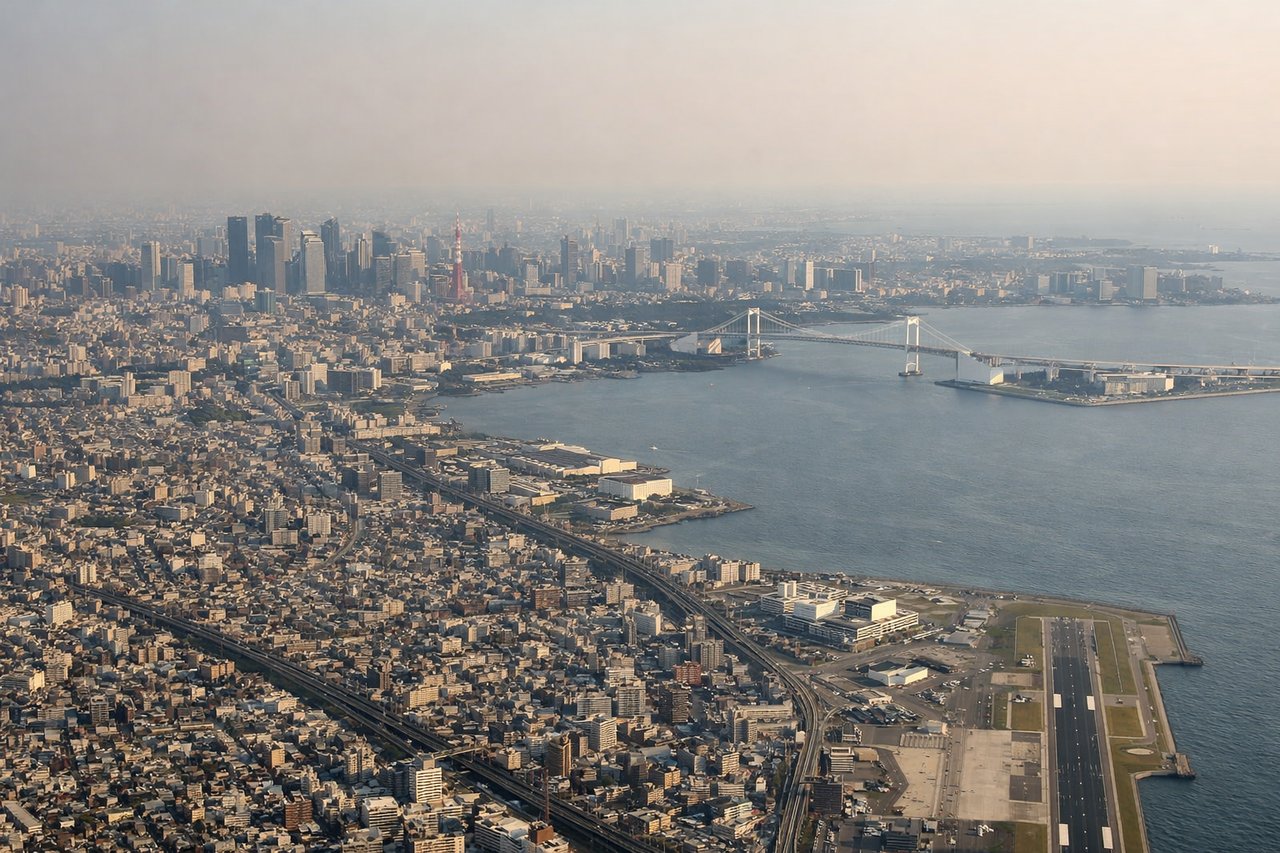
Landing at HND
LEFTLeft-side seats provide excellent views during descent into Haneda as the aircraft approaches from the east over Tokyo Bay. Mount Fuji is often visible on clear days to the west-southwest, and the bay's complex geography with multiple islands and the Tokyo waterfront is striking.
Will your flight be in sunlight?
Pick a date and time in the Sun Map to watch the sun move across your whole flight.
About This Route
Which side of the plane should I sit on flying from Istanbul Sabiha Gökçen International Airport (SAW) to Tokyo International (HND)?
Sit on the Right side of the plane for the best views on flights from Pendik, Istanbul to Tokyo. While both directions offer distinct advantages, right-side seats provide more consistent scenic value across the flight. The takeoff over the Sea of Marmara and Asian coastline is visually superior to the landing approach, and right-side seats during the long cruise over the Black Sea region, Caucasus, and Central Asia offer mountain ranges and varied terrain that left-side views do not capture as effectively on this eastbound routing.
What can I see during takeoff from Istanbul Sabiha Gökçen International Airport in Pendik, Istanbul?
During takeoff from Istanbul Sabiha Gökçen International Airport (SAW), sit on the Right side for the best views. Right-side seats offer views of the Sea of Marmara and the Asian coastline as the aircraft climbs eastward from Sabiha Gökçen. The water body and Istanbul's eastern suburbs are clearly visible during the initial climb phase. Notable sights include: Sea of Marmara, Princes' Islands (visible as small landmasses in the water), Asian Istanbul coastline, Kocaeli Peninsula to the east.
What can I see when landing at Tokyo International in Tokyo?
When landing at Tokyo International (HND), sit on the Left side for the best views. Left-side seats provide excellent views during descent into Haneda as the aircraft approaches from the east over Tokyo Bay. Mount Fuji is often visible on clear days to the west-southwest, and the bay's complex geography with multiple islands and the Tokyo waterfront is striking. Notable sights include: Tokyo Bay, Mount Fuji (on clear days, visible as a distant cone to the southwest), Chiba Peninsula, Tokyo's urban waterfront and harbor districts.
How long is the flight from Pendik, Istanbul to Tokyo?
The flight from Istanbul Sabiha Gökçen International Airport (SAW) to Tokyo International (HND) takes about 11 hours 20 minutes. The shortest flight path between them is 5,560 miles (8,948 km); winds and air traffic control usually add a few percent.
What does the Pendik, Istanbul to Tokyo flight path pass over?
Black Sea coastline (Georgia and Russia), Caucasus Mountains (Greater Caucasus range visible as a dramatic north-south ridge), Caspian Sea (visible as a vast inland water body), Turkmenistan and Kazakhstan steppes, Aral Sea region, Tian Shan Mountains (western ranges visible during approach to Central Asia), and the transition into the Gobi Desert as the flight approaches Mongolia and China before turning south toward Japan