While takeoff offers brief coastal views from the right, the landing approach into Kathmandu Valley from the left provides sustained, dramatic mountain scenery that dominates the final 90 minutes of flight. The Himalayan foothills and valley basin are far more visually striking than Istanbul's urban sprawl.
Flown SAW to KTM? Did we get it right?
Flight Path
Pendik, Istanbul to Kathmandu is 3,269 miles (5,260 km), a flight of about 5 hours 30 minutes.
The flight path crosses the Anatolian Plateau (central Turkey), the Taurus Mountains (southern Turkey), the Mediterranean coast near southern Turkey, then proceeds southeast over the Levant region, Iraq, and Iran. Passengers may glimpse the Zagros Mountains (western Iran) during the mid-flight segment if conditions permit. The route then crosses into Pakistan and approaches the Hindu Kush foothills before descending into Nepal. Most of the mid-flight segment occurs over arid and semi-arid terrain with limited dramatic landmarks visible from cruising altitude.
Great circle distance and headings ›


Phase by phase
Takeoff from SAW
RIGHTRight-side seats offer views of the Sea of Marmara and the Asian side of Istanbul's urban sprawl during the initial climb-out. The aircraft typically departs eastward from Sabiha Gökçen, so right-side passengers see the water body and coastal development immediately after takeoff.
Landing at KTM
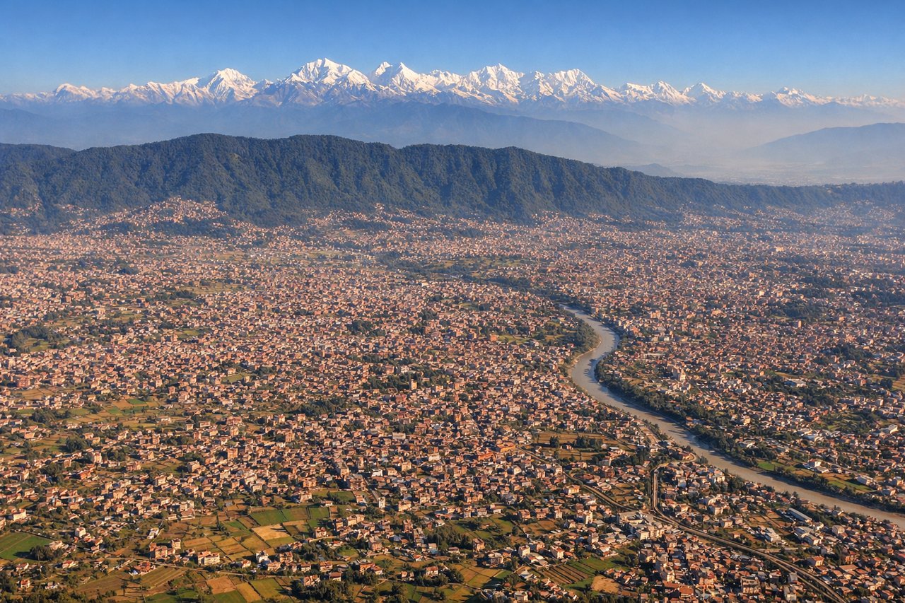
LEFTLeft-side seats provide the best views during descent into Kathmandu. The aircraft approaches from the south, and left-side passengers see the Himalayan foothills and the Kathmandu Valley's distinctive geography as the plane descends. The Mahabharata Range and surrounding peaks frame the approach.
Will your flight be in sunlight?
Pick a date and time in the Sun Map to watch the sun move across your whole flight.
About This Route
Which side of the plane should I sit on flying from Istanbul Sabiha Gökçen International Airport (SAW) to Tribhuvan International (KTM)?
Sit on the Left side of the plane for the best views on flights from Pendik, Istanbul to Kathmandu. While takeoff offers brief coastal views from the right, the landing approach into Kathmandu Valley from the left provides sustained, dramatic mountain scenery that dominates the final 90 minutes of flight. The Himalayan foothills and valley basin are far more visually striking than Istanbul's urban sprawl.
What can I see during takeoff from Istanbul Sabiha Gökçen International Airport in Pendik, Istanbul?
During takeoff from Istanbul Sabiha Gökçen International Airport (SAW), sit on the Right side for the best views. Right-side seats offer views of the Sea of Marmara and the Asian side of Istanbul's urban sprawl during the initial climb-out. The aircraft typically departs eastward from Sabiha Gökçen, so right-side passengers see the water body and coastal development immediately after takeoff. Notable sights include: Sea of Marmara, Asian Istanbul urban districts (Pendik, Tuzla), Bosphorus strait (distant), Prince Islands archipelago.
What can I see when landing at Tribhuvan International in Kathmandu?
When landing at Tribhuvan International (KTM), sit on the Left side for the best views. Left-side seats provide the best views during descent into Kathmandu. The aircraft approaches from the south, and left-side passengers see the Himalayan foothills and the Kathmandu Valley's distinctive geography as the plane descends. The Mahabharata Range and surrounding peaks frame the approach. Notable sights include: Kathmandu Valley basin, Mahabharata Range (southern rim), Shivapuri and Nagarjun peaks (northern valley rim), Bagmati River valley.
How long is the flight from Pendik, Istanbul to Kathmandu?
The flight from Istanbul Sabiha Gökçen International Airport (SAW) to Tribhuvan International (KTM) takes about 5 hours 30 minutes. The shortest flight path between them is 3,269 miles (5,260 km); winds and air traffic control usually add a few percent.
What does the Pendik, Istanbul to Kathmandu flight path pass over?
The flight path crosses the Anatolian Plateau (central Turkey), the Taurus Mountains (southern Turkey), the Mediterranean coast near southern Turkey, then proceeds southeast over the Levant region, Iraq, and Iran. Passengers may glimpse the Zagros Mountains (western Iran) during the mid-flight segment if conditions permit. The route then crosses into Pakistan and approaches the Hindu Kush foothills before descending into Nepal. Most of the mid-flight segment occurs over arid and semi-arid terrain with limited dramatic landmarks visible from cruising altitude.