Both sides score equally on the cruise phase (5+ hours over the Balkans, Greece, and Mediterranean—mostly open water and distant mountains on the horizon, capped at 2.0 per constraints). However, the right side gains a slight edge from the superior takeoff experience: the Sea of Marmara, Bosphorus geography, and Princes' Islands provide immediate, recognizable scenic interest during climb-out. The landing is comparable (both sides see London's urban approach), but the takeoff advantage tips the overall recommendation to the right.
Flown SAW to LCY? Did we get it right?
Flight Path
Pendik, Istanbul to London is 1,565 miles (2,518 km), a flight of about 3 hours 40 minutes.
Balkans (mountains visible on horizon during cruise over Greece and Albania), Ionian Sea, Adriatic coastline (Albania, Greece), Aegean islands (Corfu, Cephalonia visible as small landmasses during southbound routing), Mediterranean open water, English Channel approach with Kent and Sussex coastlines visible during descent
Great circle distance and headings ›Phase by phase
Takeoff from SAW
RIGHTRunway 24L/24R departures head southwest over the Sea of Marmara and the Bosphorus region, offering immediate water and coastal views. Right-side passengers see the Marmara coastline, islands, and the strait's geography during initial climb. Left-side departures see inland Anatolia—flat to gently rolling terrain with less visual drama.
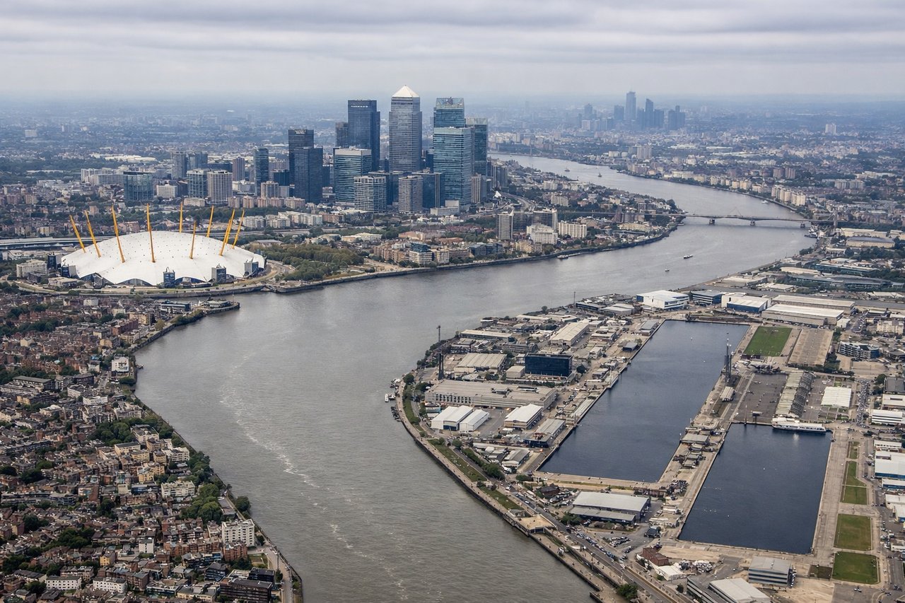
Landing at LCY
LEFTRunway 27 arrivals (prevailing westerly winds) descend over the Thames estuary and Docklands, giving left-side passengers direct views of London's river, urban sprawl, and iconic landmarks. Right-side passengers see suburban Essex and open countryside—less dramatic. Runway 09 arrivals (easterly winds, less common) reverse this, but runway 27 dominates.
Will your flight be in sunlight?
Pick a date and time in the Sun Map to watch the sun move across your whole flight.
About This Route
Which side of the plane should I sit on flying from Istanbul Sabiha Gökçen International Airport (SAW) to City (LCY)?
Sit on the Right side of the plane for the best views on flights from Pendik, Istanbul to London. Both sides score equally on the cruise phase (5+ hours over the Balkans, Greece, and Mediterranean—mostly open water and distant mountains on the horizon, capped at 2.0 per constraints). However, the right side gains a slight edge from the superior takeoff experience: the Sea of Marmara, Bosphorus geography, and Princes' Islands provide immediate, recognizable scenic interest during climb-out. The landing is comparable (both sides see London's urban approach), but the takeoff advantage tips the overall recommendation to the right.
What can I see during takeoff from Istanbul Sabiha Gökçen International Airport in Pendik, Istanbul?
During takeoff from Istanbul Sabiha Gökçen International Airport (SAW), sit on the Right side for the best views. Runway 24L/24R departures head southwest over the Sea of Marmara and the Bosphorus region, offering immediate water and coastal views. Right-side passengers see the Marmara coastline, islands, and the strait's geography during initial climb. Left-side departures see inland Anatolia—flat to gently rolling terrain with less visual drama. Notable sights include: Sea of Marmara, Bosphorus Strait, Princes' Islands (Kınalıada, Burgazada), Istanbul's Asian shore.
What can I see when landing at City in London?
When landing at City (LCY), sit on the Left side for the best views. Runway 27 arrivals (prevailing westerly winds) descend over the Thames estuary and Docklands, giving left-side passengers direct views of London's river, urban sprawl, and iconic landmarks. Right-side passengers see suburban Essex and open countryside—less dramatic. Runway 09 arrivals (easterly winds, less common) reverse this, but runway 27 dominates. Notable sights include: River Thames, Docklands skyline, Isle of Dogs, Greenwich Peninsula.
How long is the flight from Pendik, Istanbul to London?
The flight from Istanbul Sabiha Gökçen International Airport (SAW) to City (LCY) takes about 3 hours 40 minutes. The shortest flight path between them is 1,565 miles (2,518 km); winds and air traffic control usually add a few percent.
What does the Pendik, Istanbul to London flight path pass over?
Balkans (mountains visible on horizon during cruise over Greece and Albania), Ionian Sea, Adriatic coastline (Albania, Greece), Aegean islands (Corfu, Cephalonia visible as small landmasses during southbound routing), Mediterranean open water, English Channel approach with Kent and Sussex coastlines visible during descent