While takeoff offers brief but striking views of Istanbul's Sea of Marmara, the landing approach into Vienna provides more sustained and varied scenery—the Danube's dramatic meanders, Vienna's urban expanse, and the Alpine foothills create a more rewarding visual experience over a longer duration.
Flown SAW to VIE? Did we get it right?
Flight Path
Pendik, Istanbul to Vienna is 800 miles (1,287 km), a flight of about 2 hours 15 minutes.
The flight path crosses the Carpathian Mountains and their foothills in southern Slovakia and northern Hungary. The Danube River valley becomes visible as the aircraft descends toward Vienna, with the river's course through the Vienna Basin particularly distinctive. The Great Hungarian Plain extends across much of the midpoint, appearing as flat, patchwork agricultural land with scattered towns.
Great circle distance and headings ›

Phase by phase
Takeoff from SAW
RIGHTRight-side seats capture the Sea of Marmara and the Asian coastline of Istanbul during the initial climb-out. The aircraft departs eastbound from SAW, so the right wing offers immediate views of the water body and Pendik district before turning northwest toward Vienna.
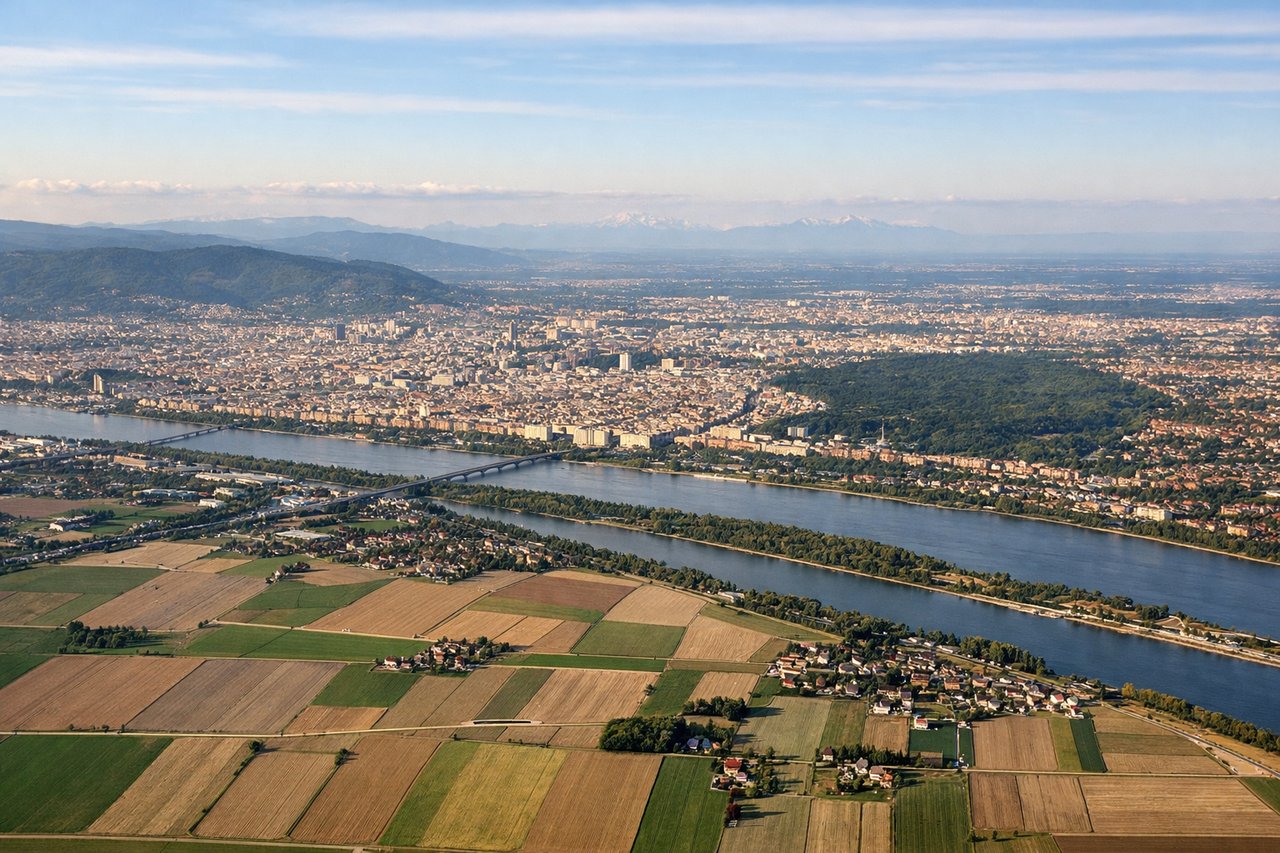
Landing at VIE
LEFTLeft-side seats provide excellent views during the descent into Vienna. The aircraft approaches from the southeast, and left-side windows frame the Danube River, the Vienna Basin, and the city's urban sprawl as the plane descends toward Schwechat Airport on the eastern outskirts.
Will your flight be in sunlight?
Pick a date and time in the Sun Map to watch the sun move across your whole flight.
About This Route
Which side of the plane should I sit on flying from Istanbul Sabiha Gökçen International Airport (SAW) to Schwechat (VIE)?
Sit on the Left side of the plane for the best views on flights from Pendik, Istanbul to Vienna. While takeoff offers brief but striking views of Istanbul's Sea of Marmara, the landing approach into Vienna provides more sustained and varied scenery—the Danube's dramatic meanders, Vienna's urban expanse, and the Alpine foothills create a more rewarding visual experience over a longer duration.
What can I see during takeoff from Istanbul Sabiha Gökçen International Airport in Pendik, Istanbul?
During takeoff from Istanbul Sabiha Gökçen International Airport (SAW), sit on the Right side for the best views. Right-side seats capture the Sea of Marmara and the Asian coastline of Istanbul during the initial climb-out. The aircraft departs eastbound from SAW, so the right wing offers immediate views of the water body and Pendik district before turning northwest toward Vienna. Notable sights include: Sea of Marmara, Pendik waterfront and residential areas, Princes' Islands (visible as small landmasses in the sea), Asian side of Istanbul coastline.
What can I see when landing at Schwechat in Vienna?
When landing at Schwechat (VIE), sit on the Left side for the best views. Left-side seats provide excellent views during the descent into Vienna. The aircraft approaches from the southeast, and left-side windows frame the Danube River, the Vienna Basin, and the city's urban sprawl as the plane descends toward Schwechat Airport on the eastern outskirts. Notable sights include: Danube River and its meanders, Vienna city center and urban districts, Eastern Alps foothills to the south and west, Vienna Basin agricultural plains.
How long is the flight from Pendik, Istanbul to Vienna?
The flight from Istanbul Sabiha Gökçen International Airport (SAW) to Schwechat (VIE) takes about 2 hours 15 minutes. The shortest flight path between them is 800 miles (1,287 km); winds and air traffic control usually add a few percent.
What does the Pendik, Istanbul to Vienna flight path pass over?
The flight path crosses the Carpathian Mountains and their foothills in southern Slovakia and northern Hungary. The Danube River valley becomes visible as the aircraft descends toward Vienna, with the river's course through the Vienna Basin particularly distinctive. The Great Hungarian Plain extends across much of the midpoint, appearing as flat, patchwork agricultural land with scattered towns.