Right-side seats capture the more dramatic departure scenery over Istanbul's Sea of Marmara and coastal geography. While the landing approach over Toronto offers urban views, the takeoff experience from SAW provides more distinctive natural water features and geographic contrast.
Flown SAW to YYZ? Did we get it right?
Flight Path
Pendik, Istanbul to Toronto is 5,117 miles (8,235 km), a flight of about 11 hours.
The flight path crosses the Atlantic Ocean for roughly 8 hours. Notable geographic checkpoints include: the Carpathian Mountains (visible during the first 2 hours heading northwest over Romania and Hungary), the North Atlantic basin (featureless ocean for the majority of the crossing), Greenland's ice sheet and coastline (visible on northerly routing, appearing as white terrain on the horizon during mid-flight), and the Canadian Arctic archipelago and Hudson Bay region (visible during the final 2-3 hours of descent into Ontario). The actual routing depends on jet stream positioning and weather, but typically follows a great-circle path that passes over or near Iceland and Labrador.
Great circle distance and headings ›


Phase by phase
Takeoff from SAW
RIGHTRight-side seats offer views of the Sea of Marmara and the Asian side of Istanbul's urban sprawl during the initial climb-out. The aircraft departs eastbound from Sabiha Gökçen, so right-side passengers see the water body and coastal development immediately after takeoff.
Landing at YYZ
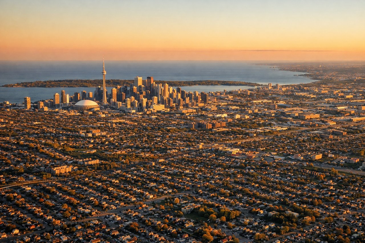
LEFTLeft-side seats provide views of the Canadian Shield, the Greater Toronto Area's urban expanse, and Lake Ontario during descent into Pearson. The aircraft approaches from the east, so left-side passengers see the lake and the city's western approach corridor.
Will your flight be in sunlight?
Pick a date and time in the Sun Map to watch the sun move across your whole flight.
About This Route
Which side of the plane should I sit on flying from Istanbul Sabiha Gökçen International Airport (SAW) to Lester B Pearson International (YYZ)?
Sit on the Right side of the plane for the best views on flights from Pendik, Istanbul to Toronto. Right-side seats capture the more dramatic departure scenery over Istanbul's Sea of Marmara and coastal geography. While the landing approach over Toronto offers urban views, the takeoff experience from SAW provides more distinctive natural water features and geographic contrast.
What can I see during takeoff from Istanbul Sabiha Gökçen International Airport in Pendik, Istanbul?
During takeoff from Istanbul Sabiha Gökçen International Airport (SAW), sit on the Right side for the best views. Right-side seats offer views of the Sea of Marmara and the Asian side of Istanbul's urban sprawl during the initial climb-out. The aircraft departs eastbound from Sabiha Gökçen, so right-side passengers see the water body and coastal development immediately after takeoff. Notable sights include: Sea of Marmara, Pendik district waterfront, Asian Istanbul urban grid, Bosphorus strait (distant, northern horizon).
What can I see when landing at Lester B Pearson International in Toronto?
When landing at Lester B Pearson International (YYZ), sit on the Left side for the best views. Left-side seats provide views of the Canadian Shield, the Greater Toronto Area's urban expanse, and Lake Ontario during descent into Pearson. The aircraft approaches from the east, so left-side passengers see the lake and the city's western approach corridor. Notable sights include: Lake Ontario, Greater Toronto Area skyline (downtown core visible on clear days), Niagara Escarpment (distant southern horizon), suburban sprawl of Mississauga and Brampton.
How long is the flight from Pendik, Istanbul to Toronto?
The flight from Istanbul Sabiha Gökçen International Airport (SAW) to Lester B Pearson International (YYZ) takes about 11 hours. The shortest flight path between them is 5,117 miles (8,235 km); winds and air traffic control usually add a few percent.
What does the Pendik, Istanbul to Toronto flight path pass over?
The flight path crosses the Atlantic Ocean for roughly 8 hours. Notable geographic checkpoints include: the Carpathian Mountains (visible during the first 2 hours heading northwest over Romania and Hungary), the North Atlantic basin (featureless ocean for the majority of the crossing), Greenland's ice sheet and coastline (visible on northerly routing, appearing as white terrain on the horizon during mid-flight), and the Canadian Arctic archipelago and Hudson Bay region (visible during the final 2-3 hours of descent into Ontario). The actual routing depends on jet stream positioning and weather, but typically follows a great-circle path that passes over or near Iceland and Labrador.