While the takeoff offers dramatic mountain scenery on the left, the landing approach on the right provides more sustained and varied visual interest as you descend through the urban corridor. The right side captures the geographic transition from high desert to developed metropolis, which is the defining feature of this route.
Flown SBO to DFW? Did we get it right?
Flight Path
Salina to Dallas-Fort Worth is 928 miles (1,494 km), a flight of about 2 hours 15 minutes.
The flight path crosses from the Colorado Plateau through the high desert of central Utah and New Mexico, then transitions into the Texas Panhandle and North Texas prairie. Notable midpoint features include the San Juan Mountains (visible to the east as you leave Utah), the Llano Estacado (Staked Plains) of the Texas Panhandle, and the gradual descent from 12,000+ feet cruising altitude into the rolling prairie of north-central Texas. The landscape transitions from mountainous terrain to increasingly flat, open grassland with scattered ranch lands and small towns.
Great circle distance and headings ›

Phase by phase
Takeoff from SBO
LEFTLeft side offers immediate views of the Wasatch Range and surrounding high desert terrain as you climb out from Salina-Gunnison. The airport sits at 4,900 feet elevation in a valley, so the mountains rise dramatically to the west and north.
Landing at DFW
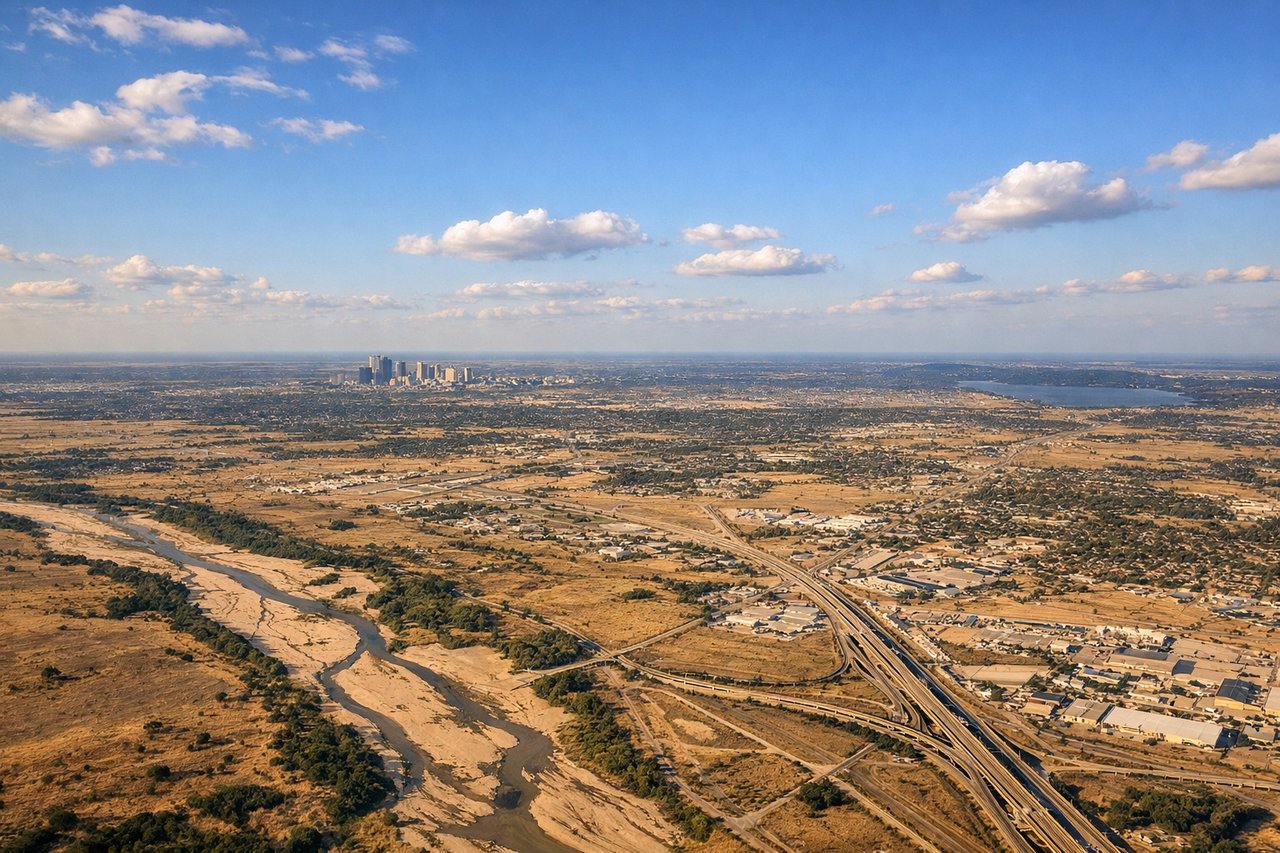
RIGHTRight side provides the best views during descent into DFW. As you approach from the northwest, the right wing shows the Trinity River system, Fort Worth's urban sprawl, and the transition from prairie to developed areas. You'll see the Dallas-Fort Worth metropolis spreading across the landscape.
Will your flight be in sunlight?
Pick a date and time in the Sun Map to watch the sun move across your whole flight.
About This Route
Which side of the plane should I sit on flying from Salina-Gunnison Airport (SBO) to Dallas Fort Worth International (DFW)?
Sit on the Right side of the plane for the best views on flights from Salina to Dallas-Fort Worth. While the takeoff offers dramatic mountain scenery on the left, the landing approach on the right provides more sustained and varied visual interest as you descend through the urban corridor. The right side captures the geographic transition from high desert to developed metropolis, which is the defining feature of this route.
What can I see during takeoff from Salina-Gunnison Airport in Salina?
During takeoff from Salina-Gunnison Airport (SBO), sit on the Left side for the best views. Left side offers immediate views of the Wasatch Range and surrounding high desert terrain as you climb out from Salina-Gunnison. The airport sits at 4,900 feet elevation in a valley, so the mountains rise dramatically to the west and north. Notable sights include: Wasatch Range (west), Sevier Plateau (north), San Pitch Mountains (southwest), high desert scrubland of central Utah.
What can I see when landing at Dallas Fort Worth International in Dallas-Fort Worth?
When landing at Dallas Fort Worth International (DFW), sit on the Right side for the best views. Right side provides the best views during descent into DFW. As you approach from the northwest, the right wing shows the Trinity River system, Fort Worth's urban sprawl, and the transition from prairie to developed areas. You'll see the Dallas-Fort Worth metropolis spreading across the landscape. Notable sights include: Trinity River (main channel and forks), Fort Worth downtown district, Dallas-Fort Worth urban corridor, Lake Worth and Eagle Mountain Lake.
How long is the flight from Salina to Dallas-Fort Worth?
The flight from Salina-Gunnison Airport (SBO) to Dallas Fort Worth International (DFW) takes about 2 hours 15 minutes. The shortest flight path between them is 928 miles (1,494 km); winds and air traffic control usually add a few percent.
What does the Salina to Dallas-Fort Worth flight path pass over?
The flight path crosses from the Colorado Plateau through the high desert of central Utah and New Mexico, then transitions into the Texas Panhandle and North Texas prairie. Notable midpoint features include the San Juan Mountains (visible to the east as you leave Utah), the Llano Estacado (Staked Plains) of the Texas Panhandle, and the gradual descent from 12,000+ feet cruising altitude into the rolling prairie of north-central Texas. The landscape transitions from mountainous terrain to increasingly flat, open grassland with scattered ranch lands and small towns.