Santiago to Lappeenranta is 8,497 miles (13,675 km), a flight of about 16 hours 10 minutes.
While the takeoff offers dramatic Andean views on the left, the landing approach over Lake Saimaa on the right is more visually distinctive and sustained. The lake's scale and the contrast between water and boreal forest provide stronger scenic value than the urban sprawl visible during departure.
Flight Path
This route crosses the Atlantic, the Iberian Peninsula (if routed via southern Europe), the Alps or Central European highlands, and the North European Plain. Notable features include the Pyrenees (if visible during European transit), the Rhine valley, and the transition from temperate to boreal forest as the aircraft approaches Scandinavia. The flight typically passes over the North Sea or Baltic approaches before final descent into Finland.
Great circle distance and headings ›


Phase by phase
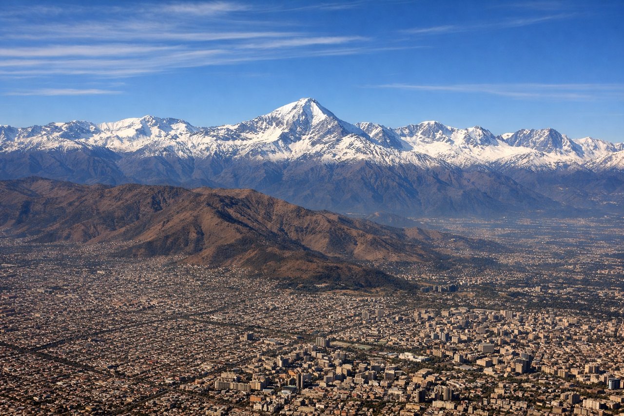
Takeoff from SCL
LEFTLeft side offers views of the Andes Mountains immediately after departure. Santiago climbs southeastward, and the western slopes of the Andes dominate the left window during the initial climb-out phase.
Landing at LPP
RIGHTRight side provides views of Lake Saimaa and the Finnish lake district during approach to Lappeenranta. The descent path brings the aircraft over the eastern shore of Saimaa, Finland's largest lake, which dominates the right window in the final approach phase.
Landmarks on this routeAll landmarks →
Will your flight be in sunlight?
Pick a date and time in the Sun Map to watch the sun move across your whole flight.
About This Route
Which side of the plane should I sit on flying from Arturo Merino Benitez International (SCL) to Lappeenranta (LPP)?
Sit on the Right side of the plane for the best views on flights from Santiago to Lappeenranta. While the takeoff offers dramatic Andean views on the left, the landing approach over Lake Saimaa on the right is more visually distinctive and sustained. The lake's scale and the contrast between water and boreal forest provide stronger scenic value than the urban sprawl visible during departure.
What can I see during takeoff from Arturo Merino Benitez International in Santiago?
During takeoff from Arturo Merino Benitez International (SCL), sit on the Left side for the best views. Left side offers views of the Andes Mountains immediately after departure. Santiago climbs southeastward, and the western slopes of the Andes dominate the left window during the initial climb-out phase. Notable sights include: Andes Mountains (western face), Santiago urban sprawl to the west, Maipo River valley, Cerro San Cristóbal.
What can I see when landing at Lappeenranta in Lappeenranta?
When landing at Lappeenranta (LPP), sit on the Right side for the best views. Right side provides views of Lake Saimaa and the Finnish lake district during approach to Lappeenranta. The descent path brings the aircraft over the eastern shore of Saimaa, Finland's largest lake, which dominates the right window in the final approach phase. Notable sights include: Lake Saimaa (eastern basin), Lappeenranta city and harbor, Finnish boreal forest, Vuoksi River outlet.
How long is the flight from Santiago to Lappeenranta?
The flight from Arturo Merino Benitez International (SCL) to Lappeenranta (LPP) takes about 16 hours 10 minutes. The shortest flight path between them is 8,497 miles (13,675 km); winds and air traffic control usually add a few percent.
What does the Santiago to Lappeenranta flight path pass over?
This route crosses the Atlantic, the Iberian Peninsula (if routed via southern Europe), the Alps or Central European highlands, and the North European Plain. Notable features include the Pyrenees (if visible during European transit), the Rhine valley, and the transition from temperate to boreal forest as the aircraft approaches Scandinavia. The flight typically passes over the North Sea or Baltic approaches before final descent into Finland.